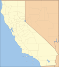
 | Markleeville (formerly, Markleville) is a census-designated place (CDP) and the county seat of Alpine County, California, United States. The population... 15 KB (1,375 words) - 05:43, 12 July 2023 |
 | and largest community is Markleeville. The Washoe people, a Great Basin tribe, inhabited the Sierra Nevada on the California–Nevada boundary, with the... 44 KB (2,596 words) - 15:12, 23 April 2024 |
 | Old Webster Schoolhouse (redirect from Webster School (Markleeville, California)) Schoolhouse, also known as Markleeville Schoolhouse is located at 135 School St., Markleeville, in Alpine County, California. It was a meeting hall and... 2 KB (124 words) - 01:53, 8 August 2023 |
 | Monitor Pass (category Landforms of Alpine County, California) Crossing the pass allows for a more direct route between U.S. 395 and Markleeville, California, at the expense of some additional elevation. Monitor Pass is part... 3 KB (321 words) - 02:52, 2 January 2023 |
 | Citizenship and character Hypothetical polling Alpine (largest municipality: Markleeville) Contra Costa (largest municipality: Concord) Del Norte (largest municipality:... 55 KB (1,413 words) - 17:34, 14 April 2024 |
 | Alpine County Courthouse is a building built in 1928 in Markleeville, California. It was listed on the National Register of Historic Places in 2004. The... 2 KB (156 words) - 17:58, 5 August 2023 |
 | did not approve of his job performance. Alpine (largest municipality: Markleeville) Amador (largest municipality: Ione) Del Norte (largest municipality:... 48 KB (1,264 words) - 21:06, 13 February 2024 |
 | p. 561. ISBN 1-884995-14-4. United States Geological Survey (1955). Markleeville Sheet (JPEG) (Topographic map). 1:125,000. Reston VA: US Geological Survey... 8 KB (699 words) - 23:55, 6 September 2022 |
 | Humboldt–Toiyabe National Forest (category Protected areas of California articles without parameters) south. About 11% of the forest is in eastern California, in the areas around Bridgeport and Markleeville, and other areas east of the Sierra Nevada. The... 12 KB (847 words) - 18:11, 11 April 2024 |
 | The U.S. state of California is divided into 58 counties. The state was first divided into 27 counties on February 18, 1850. These were further sub-divided... 25 KB (861 words) - 00:29, 21 March 2024 |
This is a list of airports in California (a U.S. state), grouped by type and sorted by location. It contains all public-use and military airports in the... 57 KB (648 words) - 07:26, 25 April 2024 |
 | Republican — +7.5−10% County flips Legend Alpine (largest municipality: Markleeville) Mono (largest municipality: Mammoth Lakes) Kerry won 31 of 53 congressional... 54 KB (1,457 words) - 19:50, 22 January 2024 |
Missouri – Gen. Francis Marion Marklee Village, California – Jacob Marklee (early settler) Markleeville, California – Jacob Marklee (early settler) Marlboro... 363 KB (31,755 words) - 02:30, 12 April 2024 |
Markleville may refer to: Markleville, former name of Markleeville, California Markleville, Indiana This disambiguation page lists articles about distinct... 126 bytes (46 words) - 09:09, 29 December 2019 |
 | known as Rooptown) is a city in and is the county seat of Lassen County, California, United States. Susanville is located on the Susan River in the southern... 28 KB (2,417 words) - 22:43, 19 April 2024 |
 | Numbered Highway, stretching from Hesperia, California to the Canadian border in Laurier, Washington. The California portion of US 395 is a 557-mile (896 km)... 53 KB (4,632 words) - 12:52, 21 January 2024 |
 | Blackwood Creek Ward Creek Carson River (in Nevada) East Fork Carson River Markleeville Creek Hot Springs Creek Pleasant Valley Creek Monitor Creek Silver Creek... 69 KB (5,980 words) - 23:42, 17 February 2024 |
California, near Markleeville. For census purposes, it is included in Alpine Village. It is located 6 miles (9.7 km) north-northwest of Markleeville,... 6 KB (419 words) - 05:59, 30 July 2023 |
Dublin Bear Valley High School, Bear Valley Woodfords High School, Markleeville Amador County Unified School District Amador High School, Sutter Creek... 91 KB (6,662 words) - 16:41, 21 March 2024 |
 | the U.S. state of California that have existed since the 1964 renumbering. It includes routes that were defined by the California State Legislature but... 106 KB (856 words) - 12:44, 28 February 2024 |
 | several volcanic peaks that surround Markleeville. It is a possible flank vent of the Round Top (Alpine County, California) volcano. Northwest aspect of Hawkins... 6 KB (515 words) - 21:02, 7 July 2023 |
 | towns of Murphys, California & Stockton, California to gold and silver mining towns/mines near Markleeville in eastern California and western Nevada... 214 KB (31,614 words) - 19:32, 14 March 2024 |
 | East Fork Carson River (category Rivers of Alpine County, California) Between here and Markleeville, California the river canyon is followed by parts of SR 4 and SR 89, the Alpine State Highway. At Markleeville it receives a... 6 KB (471 words) - 17:05, 5 August 2022 |
The following is a list of California locations by income. California had a per capita income of $29,906 during the five-year period comprising years 2010... 223 KB (903 words) - 21:38, 1 September 2023 |
 | to non-Native farmers. The only community in California, Woodfords Community is located near Markleeville. Its Washoe name is "Hung A Lei Ti." It includes... 11 KB (1,131 words) - 08:39, 30 September 2023 |
 | Area code 530 (category Area codes in California) Woodland, Yuba City, and South Lake Tahoe. Alpine Village Bear Valley Markleeville Mesa Vista Woodfords Bangor Berry Creek Biggs Brush Creek Butte Meadows... 17 KB (772 words) - 02:32, 9 April 2024 |
 | Mokelumne Wilderness (category Wilderness areas of California) (9,590 ft) Elephants Back (9,585 ft) Fourth of July Peak (9,537 ft) Markleeville Peak (9,415 ft) The Nipple (9,342 ft) Mokelumne Peak (9,334 ft) Da-ek... 13 KB (819 words) - 22:49, 16 March 2024 |
highway in Alpine County, California, United States. It runs from Grover Hot Springs State Park to State Route 89 in Markleeville. It is the only signed... 45 KB (2,559 words) - 01:21, 30 March 2024 |
 | (formerly Fresno Flats) is a census-designated place (CDP) in Madera County, California, United States, 14 miles (23 km) south of the entrance to Yosemite National... 29 KB (2,862 words) - 10:34, 28 April 2024 |
 | Spring, and Botellas) is a city in and the county seat of Amador County, California. Its population was 4,651 at the 2010 census, up from 3,989 at the 2000... 19 KB (1,738 words) - 04:35, 9 January 2024 |