 | Jean-Gabriel Charvet (redirect from Sauvages de la Mer du Pacifique) Exposition des produits de I’industrie francaise in 1806. Charvet died in Tournon-sur-Rhône, France in 1829. Les Sauvages de la Mer Pacifique (Les Sauvages)... 29 KB (3,856 words) - 09:24, 30 November 2023 |
 | Tyrrhenian Sea (redirect from Mer Tyrrhénienne) -RAY-; Italian: Mar Tirreno [mar tirˈrɛːno] or [-ˈreː-], French: Mer Tyrrhénienne [mɛʁ tiʁenjɛn]) is part of the Mediterranean Sea off the western coast... 12 KB (1,036 words) - 00:27, 28 March 2024 |
 | Nukumanu Islands (redirect from Tasman Islands) 52500°S 159.40000°E / -4.52500; 159.40000 The Nukumanu Islands, formerly the Tasman Islands, is an atoll of Papua New Guinea, located in the south-western Pacific... 6 KB (641 words) - 14:13, 12 January 2023 |
Cie produced a twenty-panel set of scenic wallpaper entitled Sauvages de la Mer du Pacifique ('Savages of the Pacific'), which became the biggest success... 11 KB (1,500 words) - 14:34, 23 January 2024 |
 | Salish Sea (redirect from Mer des Salish) British Columbia Geographical Names Office in February 2010. The French name Mer des Salish is also official in Canada. In a 2019 survey of residents in the... 33 KB (3,062 words) - 04:57, 18 April 2024 |
 | Celtic Sea (redirect from Mer celtique) ˈkɛltək]; Breton: Ar Mor Keltiek [ar mo:r kɛl'ti:ɛk]; French: La mer Celtique [la mɛʁ sɛltik] C. Michael Hogan. 2011. Celtic Sea. eds. P. Saundry & C.... 11 KB (1,132 words) - 13:27, 8 May 2024 |
 | (primary coordinates) GPX (secondary coordinates) The Coral Sea (French: Mer de Corail) is a marginal sea of the South Pacific off the northeast coast of... 59 KB (5,934 words) - 22:07, 14 April 2024 |
 | East China Sea (redirect from Mer de Corée) Inland Sea Shantar Sea Sibuyan Sea Solomon Sea South China Sea Sulu Sea Tasman Sea Visayan Sea Yellow Sea Endorheic basins Aral Sea Caspian Sea Dead Sea... 26 KB (2,895 words) - 02:15, 3 May 2024 |
 | Rochefort: Imprimerie de Henry Loustau. (in French) Vergniol, Camille (1930). Dumont d'Urville. La grande légende de la mer. (in French) "Jules-Sebastien-Cesar... 11 KB (992 words) - 13:50, 6 January 2024 |
 | Kerguelen Islands (redirect from Grande Terre de Kerguelen) is possible this early name was after Abel Tasman's ship De Zeeuwsche Nachtegaal. On the Buache map, "Ile de Nachtegal" is located at 43°S, 72°E, about... 47 KB (4,907 words) - 02:47, 17 April 2024 |
International reactions to the Israel–Hamas war (category CS1 German-language sources (de)) with Israel. Tasmania: Premier Jeremy Rockliff condemned the attacks. The Tasman Bridge in Hobart was lit up in blue and white for three nights in solidarity... 465 KB (42,586 words) - 08:44, 7 May 2024 |
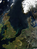 | North Sea (redirect from Mer du Nord) Nordsøen [ˈnoɐ̯ˌsøˀn̩], Dutch: Noordzee, Dutch Low Saxon: Noordzee, French: Mer du Nord, West Frisian: Noardsee, German: Nordsee, Low German: Noordsee, Northern... 135 KB (11,996 words) - 21:20, 5 May 2024 |
 | Accuratissima Terrarum Orbis Tabula, incorporating the discoveries of Abel Tasman, was published in 1648. This map was revolutionary in that it "depicts the... 6 KB (727 words) - 15:52, 7 December 2023 |
 | are Auckland Council, Nelson City Council, the Gisborne, Marlborough and Tasman district councils, and Chatham Islands Council. Regional council areas are... 87 KB (10,199 words) - 14:58, 7 May 2024 |
List of solved missing person cases: pre-2000 (category Articles with German-language sources (de)) January 21, 2008 (in Russian) Clements, Graham (1996). "Donoghue, Raymond Tasman (1920–1960)". Australian Dictionary of Biography. National Centre of Biography... 568 KB (16,154 words) - 11:00, 6 May 2024 |
 | which he ascends as far as the tree line. 1642–43 – Dutch explorer Abel Tasman discovers "Anthony van Diemenslandt" (Tasmania) and "Staten Landt" (New... 108 KB (10,891 words) - 10:29, 19 April 2024 |
 | Abel Tasman's voyages The Abel Tasman map 1644. The first European impression of Māori, at Murderers' Bay. Drawing by Isaack Gilsemans in Abel Tasman's travel... 95 KB (10,909 words) - 20:09, 24 April 2024 |
 | confins de l'Europe: un éclairage historique", in Stella Ghervas et François Rosset (ed), Lieux d'Europe. Mythes et limites (Paris: Editions de la Maison... 116 KB (11,620 words) - 09:31, 7 May 2024 |
 | English Channel (category Landforms of Hauts-de-France) Morieux, Renaud (2008). Une mer pour deux royaumes : La Manche, une mer franco-anglaise (in French). Presses Universitaires de Rennes. Laurentin, Emmanuel... 88 KB (8,410 words) - 15:03, 25 April 2024 |
 | Labrador Sea (redirect from Mer du Labrador) The Labrador Sea (French: mer du Labrador; Danish: Labradorhavet) is an arm of the North Atlantic Ocean between the Labrador Peninsula and Greenland.... 17 KB (1,916 words) - 10:48, 16 April 2024 |
 | The Ligurian Sea (Italian: Mar Ligure; French: Mer Ligurienne; Ligurian: Mâ Ligure; Corsican: Mari Liguru) is an arm of the Mediterranean Sea. It lies... 6 KB (623 words) - 18:53, 3 September 2023 |
Tashkent Aircraft Production Corporation CORTAS Uzbekistan HJ TMN Tasman Cargo Airlines TASMAN Australia [citation needed] SF DTH Tassili Airlines TASSILI AIR... 3 KB (815 words) - 17:49, 3 March 2024 |
 | Caribbean Sea (redirect from Mer des Caraïbes) Territorial evolution of the Caribbean West Indies (Spanish: Mar Caribe; French: Mer des Caraïbes; Haitian Creole: Lanmè Karayib; Jamaican Patois: Kiaribiyan... 43 KB (4,513 words) - 21:54, 25 April 2024 |
 | N254F - Departure From Controlled Flight- 31 Km South-West Of Raglan - Tasman Sea - 30 March 2013 (PDF) (Report). Civil Aviation Authority of New Zealand... 158 KB (2,539 words) - 13:37, 27 April 2024 |
un marin malouin à la découvertes des mers australes, traduction française de Maryse Duyker (avec l'assistance de Maurice Recq et l'auteur), Les Portes... 17 KB (2,138 words) - 21:30, 3 May 2024 |
Matthijs Quast and Abel Tasman searched the empty ocean east of Japan looking for two islands called 'Rica de Oro' and 'Rica de Plata'. In 1643 Maarten... 41 KB (5,553 words) - 10:27, 19 April 2024 |
 | tient en occident au destroict de Magaillan, et en orient à la terre Australle ... J'estime que cest coste de la mer Occéane qu'est dicte coste Australle... 21 KB (3,072 words) - 07:07, 8 July 2023 |
 | been depleted and apart from the occasional visit from whalers and bêche-de-mer traders, the island received little further attention until 1840, when a... 14 KB (1,542 words) - 19:32, 3 May 2024 |
 | Eastern Australia/New Zealand population – This stock may reside in the Tasman Sea and the Lau Basin in winter and feed mostly in the South Taranaki Bight... 94 KB (10,271 words) - 11:34, 2 May 2024 |
ocean and islands, (2006), 1,516,557 km2 (585,546 sq mi) Parc Naturel de la Mer de Corail, (2014), 1,291,643 km2 (498,706 sq mi) Pacific Remote Islands... 25 KB (3,634 words) - 16:29, 17 August 2023 |