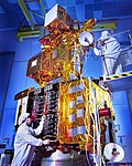
National Authority for Remote Sensing and Space Sciences (NARSS) is the pioneering Egyptian institution in the field of satellite remote sensing and space... 5 KB (611 words) - 21:12, 22 April 2024 |
 | EgyptSat 1 (section Achievements and future plans) first Earth remote sensing satellite. This satellite was jointly built by Egypt's National Authority for Remote Sensing and Space Sciences together with... 12 KB (790 words) - 06:51, 27 February 2023 |
and Mapping. Mapy.cz, by Seznam.cz; uses OpenStreetMap for other countries "NARSS Geoportal", by the National Authority for Remote Sensing and Space Sciences... 8 KB (889 words) - 18:04, 31 March 2024 |
EgyptSat 2 (section Assumed lost and end of mission) citing a source in the RSC Energia. While the National Authority for Remote Sensing and Space Sciences (NARSS) insisted that EgyptSat 2 is still recoverable... 15 KB (1,240 words) - 06:13, 28 February 2024 |
launched in 2007 and EgyptSat 2 launched in 2014. This satellite was built by the Egyptian National Authority for Remote Sensing and Space Sciences Jointly with... 4 KB (173 words) - 05:09, 28 February 2023 |
 | ISRO (redirect from Indian Space Research Organisation) "The Indian remote sensing satellite: a programme overview". Proceedings of the Indian Academy of Sciences Section C: Engineering Sciences. 6 (4): 313–336... 234 KB (17,952 words) - 22:07, 24 April 2024 |
 | NASA (redirect from National Aeronautics and Space Agency) National Aeronautics and Space Administration (NASA /ˈnæsə/) is an independent agency of the U.S. federal government responsible for the civil space program... 217 KB (20,333 words) - 16:38, 4 April 2024 |
The Institute for Astronomy, Astrophysics, Space Applications, and Remote Sensing (IAASARS/NOA; Greek: Ινστιτούτο Αστρονομίας, Αστροφυσικής, Διαστημικών... 15 KB (1,794 words) - 05:23, 18 February 2023 |
 | Egyptian Air Force (category Military units and formations established in 1937) Enlisted List of air forces National Authority for Remote Sensing and Space Sciences Atef Sadat International Institute for Strategic Studies (15 February... 96 KB (8,897 words) - 11:17, 14 April 2024 |
 | Landsat program (redirect from Land remote-sensing satellite) a new age of remote sensing of land from space. The Hughes Aircraft Company from Santa Barbara Research Center initiated, designed, and fabricated the... 41 KB (3,813 words) - 21:11, 5 January 2024 |
everyday services for terrestrial use such as weather forecasting, remote sensing, satellite navigation systems, satellite television, and some long-distance... 7 KB (924 words) - 10:10, 25 April 2024 |
of the African continent. Ground stations for satellite tracking, remote sensing, and more recently, for space weather forecasting, have also been established... 66 KB (7,473 words) - 06:06, 25 April 2024 |
 | Sarah Parcak (category Remote sensing archaeologists) space and protect them from looting and illegal house construction and other encroachments.". The Egyptian National Authority for Remote Sensing and Space... 17 KB (1,609 words) - 19:04, 20 November 2023 |
 | Outline of astronomy (redirect from Astronomy and Astrophysics basic topics) Outline of space exploration Space agencies Algerian Space Agency National Authority for Remote Sensing and Space Sciences Egypt Remote Sensing Center Royal... 42 KB (3,389 words) - 04:49, 3 April 2024 |
2010 by the National Space Agency Act. Currently, SANSA's main focusses include using data obtained from remote sensing through satellites and other projects... 9 KB (761 words) - 10:27, 11 March 2024 |
the Suparco and to meet the national and international user requirements in the field of satellite imagery. There are six remote sensing satellites expected... 12 KB (988 words) - 10:37, 21 April 2024 |
Space Centre (SDSC-SHAR), Sriharikota. ISRO Satellite Centre (ISAC), Bangalore. Space Applications Centre (SAC), Ahmedabad. National Remote Sensing Centre... 51 KB (4,622 words) - 08:42, 18 April 2024 |
 | Paul Scully-Power (category Space Shuttle program) in the 2004 Australia Day Honours "for service to science in the fields of oceanography and space remote sensing, and to the community through contributions... 16 KB (1,764 words) - 01:58, 20 March 2024 |
in space. The US National Lab conducts research in life sciences, physical sciences, technology development and remote sensing for a wide variety of... 11 KB (1,292 words) - 13:19, 21 September 2023 |
 | Geomatics (redirect from Spatial sciences) computer hardware, computer science, and software engineering, as well as by airborne and space observation remote-sensing technologies. Geomatics engineering... 16 KB (1,574 words) - 03:54, 9 April 2024 |
space applications, space communications and related matters; Earth remote sensing policy; civil aviation research, development, and demonstration; research... 6 KB (235 words) - 23:03, 24 March 2024 |
 | Topography (section Remote sensing) relief, but identification of landmark features and vegetative land cover. Remote sensing is a general term for geodata collection at a distance from the subject... 16 KB (1,956 words) - 22:26, 7 April 2024 |
research and development, initiates research and development in space and remote sensing, and acts as the Swedish contact in international cooperative efforts... 12 KB (1,318 words) - 21:45, 8 August 2023 |
 | basis for the sciences and technologies of Geoinformatics, including cartography, geographic information systems, surveying, remote sensing, and civil... 15 KB (1,546 words) - 22:10, 9 April 2024 |
 | Field of view (category Science of photography) the spatial resolution of a remote sensing imaging system, it is often expressed as dimensions of visible ground area, for some known sensor altitude.... 12 KB (1,565 words) - 09:33, 25 April 2024 |


