National Remote Sensing Centre (Hindi: राष्ट्रीय सुदूर संवेदन केन्द्र), or NRSC, located in Hyderabad, Telangana is one of the centres of the Indian Space... 2 KB (99 words) - 09:38, 30 September 2023 |
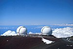
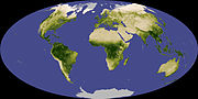
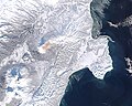
 | Remote sensing is the acquisition of information about an object or phenomenon without making physical contact with the object, in contrast to in situ... 62 KB (7,676 words) - 14:49, 11 April 2024 |
India's remote sensing program was developed with the idea of applying space technologies for the benefit of humankind and the development of the country... 12 KB (910 words) - 22:03, 10 April 2024 |
 | The Remote Sensing Center (RSC) at the Naval Postgraduate School was established to bring together a range of capabilities and expertise to address problems... 8 KB (1,046 words) - 23:38, 2 August 2021 |
Remote sensing techniques in archaeology are an increasingly important component of the technical and methodological tool set available in archaeological... 16 KB (2,072 words) - 03:19, 24 November 2023 |
38166 National Authority for Remote Sensing and Space Sciences (NARSS) is the pioneering Egyptian institution in the field of satellite remote sensing and... 5 KB (611 words) - 21:12, 22 April 2024 |
 | Baitarni Basin (PDF). Version 2.0. Central Water Commission, National Remote Sensing Center. p. 12. "Imperial Gazetteer2 of India, Volume 9, page 10 --... 7 KB (585 words) - 14:39, 26 February 2024 |
The Pakistan Remote Sensing Satellite (PRSS), is an earth observation optical satellite launched from China's Jiuquan Satellite Centre on 9 July 2018.... 6 KB (404 words) - 14:16, 22 April 2024 |
 | List of government space agencies (redirect from National space agencies) organizations are established with objectives that include national prestige, exploitation of remote sensing information, communications, education, and economic... 98 KB (4,027 words) - 22:45, 27 March 2024 |
 | The Land Remote-Sensing Commercialization Act of 1984 is a United States statute establishing a system to further the utilization of satellite imagery... 8 KB (456 words) - 14:06, 17 February 2024 |
Collocation is a procedure used in remote sensing to match measurements from two or more different instruments. This is done for two main reasons: for... 16 KB (2,105 words) - 23:56, 24 July 2023 |
 | National Authority for Remote Sensing and Space Sciences Egypt Remote Sensing Center Royal Centre for Remote Sensing National Remote Sensing Center... 42 KB (3,389 words) - 04:49, 3 April 2024 |
/ 25.6137°N 80.384°W / 25.6137; -80.384 The Center for Southeastern Tropical Advanced Remote Sensing (CSTARS) is a ground station owned by the University... 8 KB (817 words) - 05:18, 2 March 2024 |
 | The Bangladesh Space Research and Remote Sensing Organization (Bengali: বাংলাদেশ মহাকাশ গবেষণা ও দূর অনুধাবন প্রতিষ্ঠান, romanized: Bangladesh mohakash... 5 KB (442 words) - 09:46, 14 April 2024 |
 | geosciences. He is a member of the American Society for Photogrammetry and Remote Sensing (ASPRS). Ralph Bernstein was born in Zweibrücken, Germany, and immigrated... 8 KB (591 words) - 15:34, 21 April 2024 |
 | Landsat program (redirect from Land remote-sensing satellite) launched, heralding a new age of remote sensing of land from space. The Hughes Aircraft Company from Santa Barbara Research Center initiated, designed, and fabricated... 41 KB (3,813 words) - 21:11, 5 January 2024 |
Committee on Earth Observation Satellites (category Remote sensing organizations) (CAST); China Center for Resources Satellite Data and Applications (CRESDA); National Remote Sensing Center of China (NRSCC); National Satellite Meteorological... 6 KB (523 words) - 05:49, 31 July 2023 |
 | Seyed Kazem Alavipanah (category Remote sensing professionals) professor of Remote Sensing and Geographic Information System (GIS) at University of Tehran, and current Head of Department of Remote Sensing and GIS of... 7 KB (518 words) - 00:58, 27 September 2023 |
a set of techniques that do remote sensing looking away from the earth (contrasted with how MASINT employs remote sensing looking toward the earth). Astronomers... 38 KB (4,922 words) - 16:21, 9 January 2024 |
Ground-based, flight-based, or satellite-based remote sensing instruments can be used to measure properties of the planetary boundary layer, including... 13 KB (1,755 words) - 03:50, 28 January 2024 |
 | George Joseph (scientist) (category Remote sensing professionals) space scientist, best known for his contributions to the development of remote sensing technology in India, especially in the field of Earth observation sensors... 15 KB (1,488 words) - 18:28, 16 December 2023 |
 | Management. Each college houses numerous research centers, such as the Center for Space & Remote Sensing Research, Hazard Mitigation & Prevention, Taiwan... 11 KB (959 words) - 08:09, 5 February 2024 |
Computational geophysics (section Remote sensing) and geological modelling. In addition to modelling, some problems in remote sensing fall within the scope of computational geophysics such as tomography... 7 KB (767 words) - 13:07, 3 March 2024 |
 | Normalized difference vegetation index (category Remote sensing) in 1973 by Rouse et al. (Dr. John Rouse was the Director of the Remote Sensing Center of Texas A&M University where the Great Plains study was conducted)... 27 KB (3,621 words) - 11:39, 31 December 2023 |
needed] Oberpfaffenhofen Applied Remote Sensing Cluster Space Operations and Astronaut Training German Remote Sensing Data Center (DFD) Flight Operations Institute... 57 KB (5,440 words) - 20:03, 13 April 2024 |
 | Atmospheric physics (section Remote sensing) Remote sensing is the small or large-scale acquisition of information of an object or phenomenon, by the use of either recording or real-time sensing... 16 KB (1,848 words) - 07:10, 7 April 2024 |
engineer with expertise in microwave remote sensing and spaceflight engineering. He had been the director of the Center for Space Science and Applied Research... 4 KB (230 words) - 15:58, 30 October 2023 |
 | in the United States. The United States Forest Service's Remote Sensing Applications Center analyzes MODIS imagery on a continuous basis to provide information... 16 KB (1,093 words) - 00:59, 9 February 2024 |
 | Topography (section Remote sensing) Giovanni Domenico Cassini, the great Italian astronomer. Even though remote sensing has greatly sped up the process of gathering information, and has allowed... 16 KB (1,956 words) - 22:26, 7 April 2024 |
 | remote sensing scientist. He has been a Chair Professor at the Hong Kong Polytechnic University since July 2021, and was the Director of the Center for... 29 KB (3,147 words) - 11:43, 9 December 2023 |