
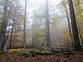
The Bavarian Rhön Nature Park (Naturpark Bayerische Rhön) straddles the junction of the German states of Bavaria, Hesse and Thuringia. 70 km2 of the total...
2 KB (167 words) - 15:51, 8 October 2021

Rhön. page 10. Naturpark und Biosphärenreservat Bayerische Rhön e. V. (pub.): Naturlehrpfad Schwarzes Moor. 2003. Zweckverband Naturpark Bayerische Rhön...
35 KB (788 words) - 14:44, 24 November 2021

the Wayback Machine, Sandachse Franken, retrieved 23 May 2014 Naturpark Bayerische Rhön Archived 2016-07-29 at the Wayback Machine, retrieved 2 Jun 2014...
123 KB (13,455 words) - 15:32, 11 May 2024
Spessart (redirect from Naturpark Bayerischer Spessart)
Spessart Nature Park (Naturpark Bayerischer Spessart) measures 171,000 hectares in area and includes part of the southern Rhön (north of Gemünden and...
41 KB (4,739 words) - 18:24, 25 April 2024

2021-01-31. The website of the Rhön Biosphere Reserve Board of trustees for the Naturpark and Biosphere Reserve Bayerische Rhön e.V. Thuringian Environment...
7 KB (702 words) - 13:57, 4 February 2023
Baumarchiv (in German). BLV Verlag. p. 264. ISBN 978-3-8354-0376-5. Naturpark Bayerische Rhön: Die amtliche Umgebungskarte 1:50.000 (in German). Münich: Landesamt...
39 KB (4,940 words) - 23:56, 25 August 2023

Kreuzberg ski area (category Buildings and structures in Rhön-Grabfeld)
of 103 meters. Naturpark Bayerische Rhön. In: Topographische Sonderkarten Bayern /Topographische Umgebungskarten 1:50000. Bayerisches Landesvermessungsamt...
22 KB (2,607 words) - 15:43, 29 February 2024

under A 7 E45 Bavaria Bad Kissingen district (KG number plates) Naturpark Bayerische Rhön Motten Motten-Kothen (94) Bad Brückenau-Volkers A 7 E45 Bad Brückenau...
2 KB (133 words) - 11:51, 25 February 2024