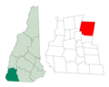
 | New Hampshire Route 123 (abbreviated NH 123) is a 63.055-mile-long (101.477 km) secondary north–south state highway in southwestern New Hampshire. The... 13 KB (640 words) - 07:29, 19 March 2024 |
 | census-designated place (CDP), and is located at the junction of New Hampshire routes 123 and 137. Hancock started as an unidentified settlement on the Contoocook... 15 KB (1,307 words) - 14:29, 3 May 2024 |
 | New Hampshire Route 101 (NH 101) is a state-maintained highway in southern New Hampshire extending from Keene to Hampton Beach. It is the major east–west... 37 KB (3,339 words) - 10:33, 29 December 2023 |
 | New Hampshire Route 12 is a 62.773-mile (101.023 km) long north–south state highway in southwestern New Hampshire. Its southern terminus is at the Massachusetts... 18 KB (1,312 words) - 08:15, 16 April 2024 |
 | New Hampshire Route 9 (abbreviated NH 9 and also known as the Franklin Pierce Highway) is a 109.910-mile-long (176.883 km) state highway located in southern... 24 KB (1,535 words) - 15:20, 22 April 2024 |
Route 123 M-123 (Michigan highway) Minnesota State Highway 123 Missouri Route 123 New Hampshire Route 123 New Hampshire Route 123A County Route 123 (Bergen... 4 KB (328 words) - 15:14, 9 April 2024 |
 | The western terminus is in Peterborough at U.S. Route 202 and New Hampshire Route 123. The entire route is in Hillsborough County. Bureau of Planning &... 4 KB (171 words) - 03:08, 25 March 2023 |
 | at the 2010 census. It is located at the junctions of New Hampshire routes 31, 45, and 123. Once a part of Mason called "Mason Village", Greenville is... 18 KB (1,156 words) - 12:30, 21 March 2024 |
 | New Hampshire Route 10 is a 122.25-mile-long (196.74 km) north–south state highway in western New Hampshire, United States. Its southern terminus is in... 18 KB (1,257 words) - 02:38, 25 March 2023 |
NH 123 may refer to: National Highway 123 (India) New Hampshire Route 123, United States This disambiguation page lists articles associated with the title... 146 bytes (47 words) - 00:22, 25 January 2020 |
 | the north, east, and west. To the south, the CDP border follows New Hampshire Route 123 (River Street, Pleasant Street, and Mason Road) and Darling Hill... 9 KB (696 words) - 16:54, 5 March 2024 |
 | sea level). The town is crossed by New Hampshire Route 9 from northeast to southwest, and by New Hampshire Route 123, which passes through the town center... 15 KB (1,446 words) - 17:07, 3 May 2024 |
 | diagonal routes). The Massachusetts Highway Commission convinced the rest of southern New England and New York to use this system in 1915 (New Hampshire and... 158 KB (6,445 words) - 17:10, 1 February 2024 |
 | New Hampshire Route 45 is a 5.981-mile-long (9.625 km) north–south state highway in southern New Hampshire. It runs from Greenville to Temple. NH 45 begins... 3 KB (201 words) - 02:45, 25 March 2023 |
 | Interstate 89 (redirect from New Hampshire Route 89) capital of New Hampshire; Montpelier, the state capital of Vermont; and Burlington, Vermont. I-89 is one of three main Interstate highways whose route is located... 38 KB (2,896 words) - 15:25, 22 April 2024 |
 | city in southern New Hampshire, United States. As of the 2020 census, it had a population of 91,322, the second-largest in northern New England after nearby... 48 KB (4,402 words) - 01:50, 3 May 2024 |
 | U.S. Route 4 (US 4) in the state of New Hampshire runs for 106.834 miles (171.933 km) across the central and southern part of the state, stretching from... 21 KB (1,155 words) - 14:48, 17 February 2024 |
 | Schoolhouse is a historic one-room schoolhouse at 432 New Hampshire Route 123 in Sharon, New Hampshire. Built in 1832, it is the only of the town's three... 4 KB (358 words) - 16:09, 14 July 2023 |
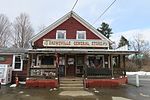 | of Walpole, just south of the valley of the Cold River. New Hampshire Route 123 passes through the village, connecting it with Alstead to the east and... 3 KB (99 words) - 20:23, 28 September 2023 |
| state routes in the U.S. state of New Hampshire. All routes in the state are maintained by the New Hampshire Department of Transportation. New Hampshire route... 49 KB (75 words) - 19:33, 4 May 2024 |
 | New Hampshire Route 31 (abbreviated NH 31) is a 56.148-mile-long (90.361 km) north–south state highway in southern New Hampshire. It runs from Mason on... 12 KB (827 words) - 02:43, 25 March 2023 |
 | traveling through the states of Pennsylvania, New Jersey, New York, Connecticut, Massachusetts, and New Hampshire. The highway has borne the number 202 since... 57 KB (3,240 words) - 14:20, 17 February 2024 |
 | West Alton. New Hampshire Route 106 runs north-south through downtown, leading south to Concord and north to Meredith. New Hampshire Route 107 leads southeast... 35 KB (2,741 words) - 07:52, 21 March 2024 |
 | New Hampshire Route 122 (abbreviated NH 122) is a 12.614-mile-long (20.300 km) north–south highway in Hillsborough County in southeastern New Hampshire... 4 KB (179 words) - 03:05, 25 March 2023 |
 | New Hampshire Route 124 (abbreviated NH 124) is a 28.083-mile-long (45.195 km) east–west highway in southern New Hampshire, United States. It runs from... 5 KB (259 words) - 03:05, 25 March 2023 |
 | Marlow is a town in Cheshire County, New Hampshire, United States. The population was 749 at the 2020 census. Marlow is home to Honey Brook State Forest... 10 KB (810 words) - 14:33, 3 May 2024 |
 | defined as the Walpole census-designated place (CDP) and is east of New Hampshire Route 12. The town also includes the villages of North Walpole and Drewsville... 15 KB (1,300 words) - 00:14, 18 March 2024 |
 | Strafford County, New Hampshire, United States. The population was 32,741 at the 2020 census, making it the most populous city in the New Hampshire Seacoast region... 35 KB (3,001 words) - 12:55, 25 March 2024 |
 | New Hampshire Route 137 (abbreviated NH 137) is a 16.583-mile-long (26.688 km) secondary north–south state highway in southern New Hampshire. The road... 4 KB (179 words) - 03:08, 25 March 2023 |
 | while to the south it leads 17 miles (27 km) to Keene. New Hampshire Route 123 leaves Route 12 just west of the town center and leads west across the... 8 KB (643 words) - 13:31, 5 March 2024 |