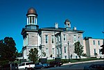
 | New York State Route 481 (NY 481) is a state highway in Central New York in the United States. The southern terminus of the route is at an interchange... 19 KB (1,962 words) - 02:06, 9 February 2024 |
 | crossing I-81 in North Syracuse, I-481 continues northwest to Fulton and Oswego as New York State Route 481 (NY 481). I-481 is part of the Veterans Memorial... 15 KB (1,450 words) - 21:59, 13 January 2024 |
 | New York State Route 5 (NY 5) is a state highway that extends for 370.80 miles (596.74 km) across the state of New York in the United States. It begins... 91 KB (7,590 words) - 01:29, 13 May 2024 |
 | New York State Route 57 (NY 57) was a north–south state highway in the central portion of New York in the United States. It extended for 33.45 miles (53... 19 KB (1,821 words) - 18:22, 16 February 2024 |
 | (917.05 km) within the U.S. state of New York. It is operated by the New York State Thruway Authority (NYSTA), a New York State public-benefit corporation... 115 KB (8,829 words) - 03:32, 13 May 2024 |
route, County Route 91 (CR 91), has route markers posted along its length; however, the signs display the number "57" for New York State Route 57 (NY 57)... 76 KB (163 words) - 21:57, 13 October 2023 |
 | New York State Route 48 (NY 48) is a 28.20-mile (45.38 km) north–south state highway in Central New York in the United States. The southern terminus of... 17 KB (1,648 words) - 10:28, 8 January 2023 |
 | New York State Route 31 (NY 31) is a state highway that extends for 208.74 miles (335.93 km) across western and central New York in the United States.... 69 KB (6,619 words) - 15:06, 18 November 2022 |
 | numbered state highways in the U.S. state of New York. Signed state highways in New York, referred to as "touring routes" by the New York State Department... 167 KB (908 words) - 11:59, 30 April 2024 |
 | New York State Route 69 New York State Route 104 New York State Route 104B New York State Route 481 (Veterans Memorial Highway) As of the census of 2000... 29 KB (2,373 words) - 01:16, 4 May 2024 |
 | A reference route is an unsigned highway assigned by the New York State Department of Transportation (NYSDOT) to roads that possess a signed name (mainly... 124 KB (1,299 words) - 17:56, 4 May 2024 |
numbered 481: Manitoba Provincial Road 481 Main road 481 (Hungary) Japan National Route 481 Interstate 481 Maryland Route 481 New York State Route 481 Pennsylvania... 821 bytes (75 words) - 22:28, 4 April 2024 |
 | New York State Route 31 New York State Route 41 New York State Route 92 New York State Route 481 (Veterans Memorial Highway) New York State Route 690 As... 37 KB (2,820 words) - 16:33, 5 May 2024 |
 | New York State Route 481 travels from NY 104 in Oswego to the terminus of Interstate 481 north of Syracuse. New York State Route 690 was built as an extension... 129 KB (11,572 words) - 04:10, 19 April 2024 |
 | New York State Route 104 (NY 104) is a 182.41-mile-long (293.56 km) east–west state highway in Upstate New York in the United States. It spans six counties... 59 KB (5,328 words) - 18:16, 22 January 2024 |
 | rivers around the border of Clay. New York State Route 31 is an east–west highway through the town. New York State Route 481 intersects NY-31 west of Euclid... 12 KB (1,198 words) - 17:27, 4 May 2024 |
 | New York State Route 92 (NY 92) is a state highway located in central New York in the United States. The western terminus of the route is at an intersection... 16 KB (1,492 words) - 10:17, 8 January 2023 |
 | New York State Route 3 (NY 3) is a major east–west state highway in New York, in the United States, that connects central New York to the North Country... 45 KB (4,010 words) - 02:20, 18 March 2023 |
 | New York State Route 80 (NY 80) is a 127.32-mile-long (204.90 km) west–east New York State Route located within Onondaga, Madison, Chenango, Otsego, Herkimer... 25 KB (1,987 words) - 03:48, 1 May 2024 |
 | Robert F. Kennedy Bridge (redirect from New York State Route 900G) carries Interstate 278 (I-278) as well as the unsigned highway New York State Route 900G. It connects with the FDR Drive and the Harlem River Drive in... 239 KB (22,190 words) - 21:20, 6 May 2024 |
 | heavy snowfall. New York State Route 481 (from Interstate 81) runs north/south to Oswego from Syracuse and Fulton. New York State Route 104 runs east/west... 38 KB (3,441 words) - 03:33, 24 March 2024 |
 | Interstate 690 (redirect from Interstate 690 (New York)) northwest of the thruway as New York State Route 690 (NY 690). I-690 begins at a double trumpet interchange with the New York State Thruway (I-90) in the town... 16 KB (1,625 words) - 14:29, 12 May 2024 |
 | New York State Route 264 (NY 264) is a north–south state highway located within Oswego County, New York, in the United States. It runs for 8.65 miles... 9 KB (1,004 words) - 03:39, 31 January 2023 |
 | Designations in New York State (PDF). Archived from the original (PDF) on July 29, 2013. Retrieved August 5, 2015. "Route Changes in State Listed". New York Post... 98 KB (469 words) - 21:42, 4 January 2024 |
 | replacing New York State Route 2 (NY 2), a route assigned three years earlier as part of the creation of the modern New York state route system. The... 57 KB (4,498 words) - 21:38, 3 May 2024 |
 | second-longest highway in the state after New York State Route 17 (NY 17). Although most of the route is part of the tolled New York State Thruway, two non-tolled... 44 KB (2,831 words) - 02:15, 13 May 2024 |
 | hamlet (and census-designated place) in Ulster County, New York, United States. The population was 481 at the 2020 census. Rifton is home to the Woodcrest... 8 KB (645 words) - 04:19, 29 January 2024 |
 | riverbank to the outskirts of Binghamton, where I-81 merges with New York State Route 17 (NY 17; Future I-86) in an industrial area east of the city. I-81... 58 KB (4,880 words) - 01:37, 6 May 2024 |
 | Interstate 90 (New York State Thruway) in the northern part of the town. New York State Route 92 conjoined with New York State Route 5 intersects I-481 in the... 21 KB (1,906 words) - 17:44, 4 May 2024 |
 | New York State Route 298 (NY 298) is an east–west state highway located entirely within Onondaga County, New York, in the United States. It runs in a... 12 KB (1,297 words) - 00:07, 13 May 2024 |