 | 10°20′N 61°00′W / 10.333°N 61.000°W / 10.333; -61.000 The Ortoire River is a river in Trinidad and Tobago. It forms the boundary between Nariva County... 1 KB (148 words) - 19:47, 24 March 2024 |
Claro Regional Corporation Ortoire River, a river on Trinidad and Tobago Ortoire syncline, a geologic feature in Ortoire Block, an oil and gas exploration... 653 bytes (121 words) - 16:12, 22 December 2020 |
Ortoire, in Trinidad, is the archaeological type site for the Ortoiroid people, immigrants to the Antilles around 2000 BCE. It is a shell midden site... 3 KB (364 words) - 10:30, 5 May 2024 |
Ortoire is a village in Mayaro County on Trinidad Island. It is named after the adjacent Ortoire River. The village dates to at least the 1880s or a few... 6 KB (223 words) - 11:03, 23 January 2021 |
 | has been farmed out to small independent oil producers. Mayaro Bay Ortoire River Anthony, Michael. 2002. Where's Mayaro? Sunday Express, 14 July 2002... 3 KB (289 words) - 04:20, 4 August 2021 |
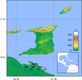 | (1,001 ft). There are numerous rivers and streams on the island of Trinidad; the most significant are the Ortoire River, 50 kilometres (31.1 mi) long,... 19 KB (1,507 words) - 23:06, 28 March 2024 |
River Pool may refer to: River Pool, Cumbria River Pool (London) Poole River, a tributary of the Ortoire River in Trinidad. This disambiguation page lists... 185 bytes (53 words) - 22:46, 29 December 2019 |
 | the Caroni and Naparima Plains. Major river systems include the Caroni, North and South Oropouche and Ortoire Rivers. There are many other natural landforms... 20 KB (1,776 words) - 13:59, 26 April 2024 |
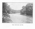
will get the opportunity to see the splendor of the mouth of the Ortoire River. This river is fifty (50) km long and extends into the Atlantic Ocean. Fishes... 5 KB (576 words) - 09:49, 22 April 2023 |
| Saint George County. The southern boundary of the county lies along the Ortoire River and the western boundary is Cocos Bay (more commonly referred to as... 2 KB (171 words) - 19:16, 14 December 2020 |
 | with the Forestry Division on the potential of the mouth of the Nariva River and its eastern bank for tourism. Six years later in 1974, the Tourist Board... 14 KB (1,944 words) - 16:26, 2 September 2022 |
is a village in Mayaro County, Trinidad and Tobago, located on the Ortoire River. Mafeking has historically had problems with water drainage and stagnant... 790 bytes (74 words) - 04:55, 15 December 2022 |
 | a swampy area, on the Gulf of Paria coast, whereas the 31-mile long Ortoire River flows through the Nariva Plain and drains into the Nariva Swamp on the... 3 KB (337 words) - 13:44, 23 February 2023 |
| the island is not as thickly settled as the western. The 35-mile long Ortoire River flows eastward through the Nariva Plain and drains in the Nariva Swamp... 1 KB (146 words) - 03:47, 6 April 2022 |
Guaracara Guayaguayare Icacos Iere Macoya Mayaro Naparima Nariva Oropuche Ortoire (disambiguation) Paria Salybia Siparia Tamana Tumpuna Tunapuna Yarra List... 25 KB (2,118 words) - 10:39, 18 April 2024 |
belong to the Ortoiroid Series, which gets its name from the type site of Ortoire in Trinidad. 5645 La Brea Pitch Lake La Brea, Siparia Trinidad and Tobago... 52 KB (1,200 words) - 22:04, 1 February 2024 |
Newtown Girls' RC School North Oropouche R.C School, Toco Main Rd Ortoire RC School, Ortoire Village, Mayaro Paramin RC School Petit Valley Boys' R.C School... 23 KB (2,579 words) - 23:48, 29 April 2024 |
 | archaeological tradition, named after the similar but much more recent Ortoire site in Mayaro, Trinidad.[citation needed] Scholars have attempted to classify... 88 KB (11,044 words) - 11:53, 18 April 2024 |