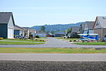
Pine Ridge Airport (IATA: XPR, ICAO: KIEN, FAA LID: IEN) is a public use airport located two nautical miles (3.7 km) east of the central business district... 4 KB (345 words) - 08:00, 9 January 2024 |
 | The Pine Ridge Indian Reservation (Lakota: Wazí Aháŋhaŋ Oyáŋke), also called Pine Ridge Agency, is an Oglala Lakota Indian reservation located in the... 127 KB (14,742 words) - 09:29, 19 April 2024 |
Kien (album), a 2008 album by the Japanese group Bleach Pine Ridge Airport (ICAO: KIEN), Pine Ridge, South Dakota , US Kiens, a comune in South Tyrol, Italy... 577 bytes (98 words) - 00:59, 30 December 2022 |
List of airports by IATA airport code: A - B - C - D - E - F - G - H - I - J - K - L - M - N - O - P - Q - R - S - T - U - V - W - X - Y - Z XA XB XC XD... 17 KB (133 words) - 07:50, 5 February 2024 |
Wood Elementary School, R.H. Fulmer Middle School, and Pine Ridge Middle School. Airport's Golden Talon Drill Team is a drill team that consistently... 5 KB (369 words) - 16:35, 23 September 2022 |
 | Springdale, Pine Ridge, and South Congaree. The airport is a regional cargo hub for UPS Airlines. The airport was built in 1940 as Lexington County Airport. In... 25 KB (2,138 words) - 21:22, 14 April 2024 |
a list of airports in South Dakota (a U.S. state), grouped by type and sorted by location. It contains all public-use and military airports in the state... 21 KB (567 words) - 17:10, 27 January 2023 |
 | Walnut Ridge Regional Airport (IATA: ARG, ICAO: KARG, FAA LID: ARG) is a city-owned public-use airport located four nautical miles (7 km) northeast of... 6 KB (569 words) - 01:34, 30 January 2024 |
 | through Burnt Pine as the island's sole thoroughfare runs through the town's centre. The town is located on a roughly east–west-aligned ridge of volcanic... 8 KB (982 words) - 13:58, 12 February 2024 |
XPR or xpr may refer to: XPR, the IATA code for Pine Ridge Airport, South Dakota, United States xpr, the ISO 639-3 code for Parthian language, an extinct... 218 bytes (63 words) - 11:05, 4 July 2023 |
Municipal Airport – Indianola, Mississippi KIDP – Independence Municipal Airport – Independence, Kansas KIEN - Pine Ridge Airport - Pine Ridge, South Dakota... 177 KB (15,587 words) - 16:50, 1 March 2024 |
Orange Walk Airport (now officially Alfredo Martinez Chan Pine Ridge Airstrip) (IATA: ORZ, ICAO: MZTH) is a public use airport 3 kilometres (2 mi) southwest... 3 KB (207 words) - 15:02, 24 April 2023 |
 | East Fork Ridge and Pine Ridge), Bear Creek Valley (between Pine Ridge and Chestnut), and Bethel Valley (between Chestnut and Haw). These ridges and valleys... 76 KB (7,773 words) - 19:46, 10 April 2024 |
 | Airpark (redirect from Airport community) Lake Airport (Groveland, California) Ridge Landing Airpark (Frostproof, Florida) Spruce Creek Airport (Port Orange, Florida) Greystone Airport / Jumbolair... 4 KB (399 words) - 16:32, 17 January 2024 |
 | list of airports in North Carolina (a U.S. state), grouped by type and sorted by location. It contains all public-use and military airports in the state... 29 KB (562 words) - 04:38, 16 June 2023 |
 | settlements studded amongst forests of deodar that tower above pine trees on the lower rocky ridges. Together with the river Beas running through the valley... 14 KB (1,493 words) - 15:43, 22 March 2024 |
 | Flora also includes grass, shrubs, hemlock and mixed-oak pine forests. While the Blue Ridge range includes the highest summits in the eastern United States... 18 KB (1,549 words) - 01:12, 24 February 2024 |
 | County, 3 miles (5 km) east of Pine Knot. McCreary County Airport is located in the county, 3 miles (5 km) northeast of Pine Knot. "2022 U.S. Gazetteer Files:... 8 KB (702 words) - 01:17, 16 July 2023 |
 | Petawawa (redirect from Pine Ridge, Renfrew County, Ontario) Kramer Subdivision, Laurentian View, McGuire, Petawawa Point, Pine Meadows, Pine Ridge, Pinehurst Estates and Riverview. Petawawa has a humid continental... 16 KB (867 words) - 08:34, 9 February 2024 |
a list of airports in California (a U.S. state), grouped by type and sorted by location. It contains all public-use and military airports in the state... 57 KB (648 words) - 05:13, 12 April 2024 |
(Apple Valley, Bridlewood, Echo Highlands, Pine Knoll Vista, Sun Valley) Ensley (Dolomite, West Ensley, Oak Ridge, Sherman Heights, Tuxedo, Wylam) Five Points... 4 KB (389 words) - 15:54, 30 May 2022 |
 | city of Laurel was incorporated in 1882, with timber as the impetus. Yellow pine forests in the region fueled the industry. The city was named for thickets... 29 KB (2,191 words) - 04:28, 7 February 2024 |
 | Kedron to Bracken Ridge that will generally follow Gympie Road.[citation needed] Gympie Road has the following interfaces with the Airport Link tunnel: Northbound... 16 KB (826 words) - 09:47, 23 January 2024 |
Mena Intermountain Municipal Airport (IATA: UMZ, ICAO: KMEZ, FAA LID: MEZ) is a city-owned, public-use airport located two nautical miles (4 km) southeast... 8 KB (703 words) - 18:42, 21 December 2023 |
 | and consists primarily of hardy grasses. Alpine species such as juniper, pine, fir, cypress, and rhododendron can be found at elevations between 3,500... 16 KB (1,241 words) - 15:54, 18 January 2024 |
 | The Castle Pines North Metropolitan District maintains most trails in Castle Pines. Castle Pines parks and natural areas include: Elk Ridge Park Retreat... 19 KB (1,484 words) - 15:14, 5 April 2024 |
 | valleys. When the British established the town, big invasive species of pine, wattle and eucalyptus were planted and they became the dominant species... 38 KB (3,480 words) - 15:14, 18 April 2024 |
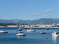 | slope of the ridge, halfway to the old fishery village of Golfe-Juan (where Napoleon landed in 1815), it had been an area with many stone pine trees (pins... 7 KB (653 words) - 08:02, 28 July 2023 |
 | Aviation Airport. As canals were constructed in the 1900s, and especially the 1960s, the slough was drained and became a low valley in the limestone ridge. Roadways... 29 KB (2,210 words) - 02:58, 12 April 2024 |
 | (Statue), Jakhu Temple, Viceregal Lodge, Christ Church, Mall Road, The Ridge and Annadale. The city centre's northernmost point is Jakhoo and the southernmost... 80 KB (8,156 words) - 14:47, 4 April 2024 |