 | A projected coordinate system – also called a projected coordinate reference system, planar coordinate system, or grid reference system – is a type of... 21 KB (2,802 words) - 02:18, 12 April 2024 |
 | be aligned with a standard projected coordinate system. Local tangent plane coordinates are a type of local coordinate system used in aviation and marine... 15 KB (1,546 words) - 22:10, 9 April 2024 |
 | In geometry, a coordinate system is a system that uses one or more numbers, or coordinates, to uniquely determine the position of the points or other... 19 KB (2,265 words) - 23:43, 7 January 2024 |
 | In geometry, a Cartesian coordinate system (UK: /kɑːrˈtiːzjən/, US: /kɑːrˈtiːʒən/) in a plane is a coordinate system that specifies each point uniquely... 40 KB (5,501 words) - 11:14, 16 April 2024 |
 | trivial. Spherical coordinates, projected on the celestial sphere, are analogous to the geographic coordinate system used on the surface of Earth. These... 28 KB (3,948 words) - 03:55, 7 April 2024 |
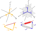
 | In geometry, a barycentric coordinate system is a coordinate system in which the location of a point is specified by reference to a simplex (a triangle... 44 KB (8,017 words) - 20:34, 18 April 2024 |
 | Homogeneous coordinates (redirect from Homogeneous coordinate system) Cartesian coordinate system is somewhat arbitrary, the selection of a single system of homogeneous coordinates out of all possible systems is somewhat... 25 KB (3,343 words) - 06:21, 17 December 2023 |
| A geographic coordinate system (GCS) is a spherical or geodetic coordinate system for measuring and communicating positions directly on the Earth as latitude... 21 KB (2,380 words) - 18:12, 4 April 2024 |
 | map, is a graphical depiction of a coordinate system as a grid of lines, each line representing a constant coordinate value. It is thus a form of isoline... 6 KB (713 words) - 10:28, 22 March 2024 |
 | In geometry, the elliptic coordinate system is a two-dimensional orthogonal coordinate system in which the coordinate lines are confocal ellipses and... 9 KB (1,599 words) - 16:25, 17 November 2023 |
| zones and projects each to the plane as a basis for its coordinates. Specifying a location means specifying the zone and the x, y coordinate in that plane... 17 KB (2,610 words) - 23:05, 29 February 2024 |
The State Plane Coordinate System (SPCS) is a set of 125 geographic zones or coordinate systems designed for specific regions of the United States. Each... 7 KB (965 words) - 15:06, 26 February 2024 |
 | Earth. Like the UTM coordinate system, the UPS coordinate system uses a metric-based cartesian grid laid out on a conformally projected surface. UPS covers... 4 KB (490 words) - 07:35, 21 October 2023 |
list below is a collection of available official national projected Coordinate Reference Systems. Links to the relevant unique identification codes of the... 5 KB (271 words) - 22:13, 18 March 2024 |
 | Geographic coordinate system – System to specify locations on Earth Geohash – Public domain geocoding invented in 2008 Projected coordinate system – Cartesian... 29 KB (2,649 words) - 11:23, 28 April 2024 |
 | Invariant (mathematics) (redirect from Coordinate system invariant) principal invariants of tensors do not change with rotation of the coordinate system (see Invariants of tensors). The singular values of a matrix are invariant... 23 KB (2,729 words) - 17:54, 23 March 2024 |
 | displacement from a reference position in a three-dimensional Cartesian coordinate system (i.e., with XYZ axes). In addition to moving the probe along the X... 19 KB (2,612 words) - 13:28, 28 March 2024 |
 | Transverse Mercator projection (redirect from Gauss–Krüger coordinate system) is oriented with north up. In most applications the Gauss–Krüger coordinate system is applied to a narrow strip near the central meridians where the... 37 KB (4,481 words) - 08:45, 7 November 2023 |
Orthogonal coordinates (redirect from Orthogonal coordinate system) three-dimensional Cartesian coordinates (x, y, z) is an orthogonal coordinate system, since its coordinate surfaces x = constant, y = constant, and z = constant are... 30 KB (3,322 words) - 09:34, 22 April 2024 |
System, a Geocode system used by radio amateurs worldwide A 1 km2 square defined by a National grid reference system, see Projected coordinate system#Grid... 376 bytes (82 words) - 11:56, 19 December 2023 |
geographic coordinate reference systems, but also geocentric, projected, vertical, temporal and engineering ones (for example a coordinate reference system attached... 10 KB (1,044 words) - 01:05, 26 September 2022 |
 | Coordinated Universal Time or UTC is the primary time standard globally used to regulate clocks and time. It establishes a reference for the current time... 52 KB (5,997 words) - 07:53, 18 April 2024 |
The object locative environment coordinate system, known as OLE coordinate system, is a coordinate system used for virtual environments in which movement... 1 KB (148 words) - 08:40, 23 September 2019 |
 | three-dimensional orthogonal coordinate system that results from projecting the two-dimensional parabolic coordinate system in the perpendicular z{\displaystyle... 10 KB (1,411 words) - 14:32, 7 August 2022 |
 | Spherinder (redirect from Spherindrical coordinate system) that a tesseract (cubic prism) can be projected as two concentric cubes, and how a circular cylinder can be projected into 2-dimensional space as two concentric... 7 KB (1,004 words) - 20:03, 28 March 2024 |
In geographic information systems, this can be easily calculated from locations in a cartesian Projected coordinate system using the Pythagorean theorem... 7 KB (819 words) - 15:13, 19 December 2023 |
 | Azimuth (category Horizontal coordinate system) a point of interest is projected perpendicularly onto a reference plane (the horizontal plane); the angle between the projected vector and a reference... 14 KB (1,767 words) - 08:13, 27 March 2024 |
 | orthogonal coordinate system with its origin at O. This is also where the camera aperture is located. The three axes of the coordinate system are referred... 11 KB (1,599 words) - 09:41, 9 April 2024 |
 | important for understanding how the coordinate description of a vector changes by passing from one coordinate system to another. Tensors are objects in... 35 KB (5,574 words) - 16:34, 17 March 2024 |
moisture and soil nutrients. false origin A selected point in a projected coordinate system from which the position of any place can be expressed in terms... 259 KB (26,647 words) - 05:12, 24 January 2024 |