 | located in Washington County and southern Kent County, Rhode Island, United States. The route is a major north–south freeway in the southern Providence... 23 KB (2,431 words) - 22:01, 29 January 2024 |
 | Island. The route is about 4.6 miles (7.4 km) long and begins at Connecticut Route 2 in Stonington, crossing into Rhode Island at the Pawcatuck River, where... 9 KB (859 words) - 02:35, 27 April 2024 |
 | Route 1A, largely signed as Scenic 1A, is a 33.3-mile (53.6 km) long numbered state highway located in Washington County, Rhode Island, United States.... 16 KB (1,453 words) - 01:02, 6 March 2023 |
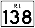 | Route 138 is a numbered State Highway running 48.3 miles (77.7 km) in Rhode Island. It is the longest state numbered route in Rhode Island, and the second... 15 KB (828 words) - 01:28, 27 March 2024 |
 | Route 24 is a freeway in the U.S. state of Rhode Island. It runs approximately 8 miles (13 km) from Route 114 in Portsmouth to Massachusetts Route 24 in... 6 KB (283 words) - 01:35, 27 March 2024 |
 | Route 102 is a 44.4-mile-long (71.5 km) numbered state highway in the U.S. state of Rhode Island. Route 102 serves as a non-freeway beltway around the... 8 KB (333 words) - 00:37, 30 December 2023 |
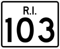 | Route 103 is a numbered state highway running 11.8 miles (19.0 km) in Rhode Island, United States. It runs from Interstate 195 (I-195) in East Providence... 8 KB (566 words) - 22:35, 27 January 2024 |
 | Route 99, also known as the Woonsocket Industrial Highway, is a 2.9-mile-long (4.7 km) freeway in Providence County, Rhode Island, United States. Route... 16 KB (1,557 words) - 19:27, 17 April 2024 |
 | Route 10 is a numbered state highway connector in the U.S. state of Rhode Island, traveling along the Huntington Expressway, the first freeway in the state... 17 KB (1,569 words) - 00:41, 20 March 2024 |
 | Route 146 is a 16.24-mile (26.14 km) north-south expressway in the U.S. state of Rhode Island, maintained by the Rhode Island Department of Transportation... 16 KB (1,090 words) - 22:07, 2 February 2024 |
 | Route 104 is a 13.4-mile-long (21.6 km) numbered state highway in the U.S. state of Rhode Island. It runs from US 44 in North Providence to Worrall Street... 6 KB (443 words) - 20:27, 4 June 2023 |
 | Route 2 is a 33.6-mile (54.1 km) state highway in Rhode Island, that runs from U.S. Route 1 in Charlestown to US 1 in Providence. Route 2 starts at US 1... 9 KB (286 words) - 06:31, 13 July 2022 |
 | Route 3 is a 30.1-mile-long (48.4 km) state highway in the U.S. state of Rhode Island. Route 3 serves as a local alternative to Interstate 95 (I-95) as... 12 KB (956 words) - 01:03, 6 March 2023 |
city and town in Rhode Island, except for New Shoreham (Block Island), has at least one numbered route. State highways in Rhode Island are signed with... 34 KB (179 words) - 21:33, 6 March 2024 |
 | Route 14 is a numbered state highway in the U.S. state of Rhode Island. It runs approximately 23 miles (37 km) from Connecticut routes 14 and 14A at the... 6 KB (329 words) - 01:06, 6 March 2023 |
 | Route 98 is a numbered state highway running 6.1 miles (9.8 km) in Rhode Island. Route 98's southern terminus is at Route 100 in Chepachet and the northern... 3 KB (153 words) - 01:11, 6 March 2023 |
 | Route 37 is a state highway running 3.47 miles (5.58 km) in Providence County and Kent County, Rhode Island, United States. A freeway for its entire length... 19 KB (1,968 words) - 07:17, 10 February 2024 |
 | Route 51 is a state highway in the U.S. state of Rhode Island. It runs approximately 5.4 miles (8.7 km) from Route 115 in West Warwick to Route 12 in... 5 KB (343 words) - 01:08, 6 March 2023 |
 | Providence, Rhode Island. Average daily ridership as of the fourth quarter of 2023 is 41,800. The agency operates 59 fixed-route bus routes and 7 demand-responsive... 17 KB (798 words) - 23:31, 21 November 2023 |
 | Route 117 is a 28.4-mile-long (45.7 km) state route in the U.S. state of Rhode Island. Its western terminus is at Route 14 in Coventry, and its eastern... 8 KB (366 words) - 01:17, 6 March 2023 |
 | Route 77 is a state highway in the U.S. state of Rhode Island. It runs approximately 14 miles (23 km) from Rhode Island Road in Little Compton to Route... 4 KB (179 words) - 00:56, 17 February 2024 |
 | Route 94 is a numbered state highway running 12.7 miles (20.4 km) in Rhode Island. Route 94's southern terminus is at Route 14 and Route 102 in Foster... 3 KB (138 words) - 01:10, 6 March 2023 |
 | Route 81 is a numbered state highway running 8.0 miles (12.9 km) in Rhode Island. Route 81's southern terminus is at Rhode Island Route 179 in Little... 2 KB (90 words) - 01:09, 6 March 2023 |
 | Route 5 is a state highway in the U.S. state of Rhode Island. It runs approximately 26 miles (42 km) from US 1 in Warwick to the Massachusetts state line... 6 KB (217 words) - 10:09, 8 March 2024 |
 | Route 108 is a 8.6-mile-long (13.8 km) state highway in Washington County, Rhode Island. The route begins at an intersection with Ocean Road in the village... 8 KB (808 words) - 01:13, 6 March 2023 |
 | Route 33 is a state highway in the U.S. state of Rhode Island. It runs approximately 6.8 miles (10.9 km) from Route 3 in Coventry to Route 2 in Cranston... 4 KB (222 words) - 22:23, 24 April 2023 |
 | Route 7 is a numbered state highway in Rhode Island, United States. It runs approximately 16 miles (26 km) from Route 246 in Providence to Joslin Road... 5 KB (336 words) - 01:04, 6 March 2023 |
 | Route 15 is a state highway in the U.S. states of Rhode Island and Massachusetts. The highway runs 8.3 miles (13.4 km) from U.S. Route 44 (US 44) in North... 9 KB (681 words) - 20:28, 13 February 2024 |
 | Route 121 is a numbered state highway running 1.0 mile (1.6 km) in Rhode Island and 4.4 miles (7.1 km) in Massachusetts. It is part of the route connecting... 6 KB (384 words) - 01:05, 6 March 2023 |
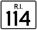 | Route 114 is a 45.7-mile-long (73.5 km) numbered state highway in the U.S. state of Rhode Island. It connects the city of Newport to the city of Woonsocket... 22 KB (1,510 words) - 07:09, 10 February 2024 |