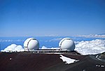
History of space in Africa (section Earth observation, remote sensing and communications activities ) facilities; including astronomical observatories, ground stations for remote sensing and communications, and rocket launch capabilities. At present, 20... 66 KB (7,473 words) - 06:15, 30 March 2024 |
 | National Authority for Remote Sensing and Space Sciences Egypt Remote Sensing Center Royal Centre for Remote Sensing National Remote Sensing Center National... 42 KB (3,389 words) - 04:49, 3 April 2024 |
 | Geomatics includes the tools and techniques used in land surveying, remote sensing, cartography, geographic information systems (GIS), global navigation... 16 KB (1,574 words) - 03:54, 9 April 2024 |
 | technology for geopositioning and remote sensing. A major Image Analysis Laboratory was installed in 1977 and the Centre for Remote Sensing (later known... 14 KB (1,687 words) - 16:14, 17 March 2024 |
 | Willem Schermerhorn (category Members of the Royal Netherlands Academy of Arts and Sciences) of the International Training Centre for Aerial Survey. The International Society for Photogrammetry and Remote Sensing has offers an award in memory... 10 KB (562 words) - 17:04, 18 March 2024 |
 | Geoinformation and Earth Observation Sciences were awarded. In the field of remote sensing, the university landed among the top ten universities in the world.... 21 KB (1,477 words) - 08:11, 24 January 2024 |
 | form of active remote sensing – the antenna transmits radiation that is reflected from the image area, as opposed to passive sensing, where the reflection... 34 KB (4,256 words) - 14:59, 19 April 2024 |
Lawrence Morley (category Royal Canadian Navy personnel of World War II) remote sensing pioneer. He was best known for his studies on the magnetic properties of the oceanic crust and their effect on plate tectonics and for... 5 KB (372 words) - 15:36, 6 January 2024 |
 | reporting. Space Intelligence, based in Edinburgh, uses machine learning on remote sensing satellite data to classify landscapes, especially around deforestation... 17 KB (1,582 words) - 22:07, 23 February 2024 |
2007). "ARRSI: Automatic Registration of Remote-Sensing Images". IEEE Transactions on Geoscience and Remote Sensing. 45 (5): 1483–1493. Bibcode:2007ITGRS... 7 KB (646 words) - 16:31, 6 March 2024 |
Met Office (redirect from Met Office Operations Centre) of mesoscale weather systems; Boundary layer and turbulence studies; Remote sensing: verification of ground-based instruments; Satellite ground truth: radiometric... 34 KB (3,304 words) - 19:18, 23 April 2024 |
Survey of Pakistan (category All articles with bare URLs for citations) of Printing & Geodesy, Rawalpindi. Directorate of Photogrammetry and Remote Sensing, Rawalpindi. Directorate of Cartography & GIS, Rawalpindi. Survey Training... 5 KB (429 words) - 13:13, 2 September 2023 |
 | flows. Dhawan carried out pioneering experiments in rural education, remote sensing and satellite communications. His efforts led to operational systems... 12 KB (1,099 words) - 12:02, 15 April 2024 |
Emirates and adjoining regions from geostationary satellite data". Remote Sensing of Environment. 228: 90–104. Bibcode:2019RSEnv.228...90K. doi:10.1016/j... 19 KB (2,423 words) - 16:17, 23 April 2024 |
 | Hydrology (section Remote sensing) balance, for example surface water storage, soil moisture, precipitation, evapotranspiration, and snow and ice, are measurable using remote sensing at various... 40 KB (4,050 words) - 10:08, 28 June 2023 |
 | August 2017). "Satellite remote sensing of ecosystem functions: opportunities, challenges and way forward". Remote Sensing in Ecology and Conservation... 6 KB (736 words) - 00:17, 16 April 2024 |
 | conjunction with Antarctica New Zealand) a suite of atmospheric in situ and remote sensing instruments at Arrival Heights, Ross Island, Antarctica. The NIWA Lauder... 26 KB (2,612 words) - 13:23, 10 April 2024 |
NextSense, formally the Royal Institute for Deaf & Blind Children (RIDBC), in Sydney provides a range of educational services for students with vision... 7 KB (812 words) - 03:45, 4 April 2024 |
 | University of Hertfordshire's astronomical and atmospheric physics remote sensing observatory, and one of the largest teaching observatories in the UK... 7 KB (592 words) - 15:19, 21 November 2023 |
 | spacecraft provides a stable platform to accommodate the combination of remote-sensing and in situ instrumentation in an electromagnetically clean environment... 38 KB (3,064 words) - 18:07, 15 April 2024 |
commencing postgraduate work at Imperial on the potential applications of remote sensing for geological exploration, in anticipation of the launch of the first... 8 KB (1,019 words) - 15:32, 8 January 2024 |
(ANGKASA) was merged with the Malaysian Remote Sensing Agency (MRSA) and renamed the Malaysian Space Agency (MYSA) for greater synergy. The Angkasawan program... 13 KB (1,281 words) - 02:07, 2 March 2024 |
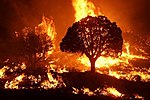 | Wildfire (redirect from Remote sensing of wildfires) of Remote Sensing, GIS, and Information Distribution for Wildfire Detection and Management" (PDF). Photogrammetric Engineering and Remote Sensing. 64... 187 KB (19,244 words) - 13:21, 18 April 2024 |
 | a remote sensing satellite with charge-coupled device cameras. In early 2006, Sheikh Muszaphar Shukor and three other finalists were selected for the... 9 KB (975 words) - 01:20, 29 November 2023 |
 | Princess Helen of Waldeck and Pyrmont (category Ladies of the Royal Order of Victoria and Albert) strong sense of duty, and a genuine love of welfare work. Queen Victoria, initially worried that Helen might turn out to be a stereotypically remote German... 12 KB (888 words) - 12:30, 19 April 2024 |
 | Paul Curran (geographer) (category Fellows of the Royal Geographical Society) Patron's Medal of the Royal Geographical Society for his 'international development of geographical science through remote sensing and Earth observation'... 9 KB (799 words) - 20:56, 25 January 2024 |
 | Rossby Centre (Regional and Global Climate Modelling) Atmospheric Remote Sensing The regional and global climate modelling is at the Rossby Centre, which... 8 KB (641 words) - 13:47, 12 November 2023 |
 | National Remots Sensing Center (NRSC)". Asia-Pacific Regional Space Agency Forum. Retrieved 19 February 2023. "Royal Center for Remote Sensing". crts.gov.ma... 98 KB (4,027 words) - 22:45, 27 March 2024 |
 | EVALUATION FOR THE PROJECT ON THE USE OF REMOTE SENSING TECHNOLOGIES FOR ECOSYSTEM MANAGEMENT TREATIES" (PDF). Remote Sensing Technologies for Ecosystem... 9 KB (733 words) - 16:49, 4 January 2024 |
 | Thorne, British climatologist with the Nansen Environmental and Remote Sensing Centre, Bergen, Norway Liz Thomas, British palaeoclimatologist, ice cores... 31 KB (3,616 words) - 18:56, 26 March 2024 |