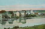
 | Sebec is a town in Piscataquis County, Maine, United States. The population was 665 at the 2020 census. According to the United States Census Bureau, the... 11 KB (737 words) - 02:47, 18 January 2024 |
up Sebec or sebec in Wiktionary, the free dictionary. Sebec may refer to: Sebec, Maine, United States; a town located in Piscataquis County Sebec River... 1 KB (193 words) - 14:41, 25 July 2023 |
 | The Sebec River is a tributary of the Piscataquis River in Piscataquis County, Maine. From the outflow of Sebec Lake (45°16′13″N 69°06′54″W / 45.2704°N... 8 KB (567 words) - 15:48, 12 January 2022 |
House is a historic house on Burgess Road, just east of Austin Road in Sebec, Maine, United States. The oldest portion of this wood-frame house dates to... 4 KB (426 words) - 17:19, 30 May 2022 |
 | Maine is a state located in the Northeastern United States. According to the 2020 United States census, Maine is the 9th least populous state, with 1... 79 KB (253 words) - 20:16, 28 March 2024 |
 | includes the village of Derby. The town sits in the valley of the Piscataquis, Sebec and Pleasant Rivers in the foothills of the Longfellow Mountains and is... 18 KB (1,996 words) - 21:58, 17 March 2024 |
 | David Mallett (category People from Piscataquis County, Maine) when he went to help his father plant the garden at his homestead in Sebec, Maine. With "music in his head and work at his hands," the first verse came... 6 KB (579 words) - 23:52, 11 January 2024 |
residential-scale solar thermal systems are in place on Nutting Hall and Sebec House. The University of Maine composts food scraps from dining facilities, and York Dining... 53 KB (5,170 words) - 02:22, 22 April 2024 |
Grand Forks, North Dakota Harriman School, a one-room schoolhouse in Sebec, Maine, U.S. Harriman, New York, U.S. Harriman, Tennessee, U.S. Harriman station... 1 KB (205 words) - 14:44, 23 May 2023 |
of important prehistoric archaeological sites in Milo, Maine. Located near the mouth of the Sebec River where it meets the Piscataquis River, these sites... 4 KB (404 words) - 07:08, 31 March 2024 |
 | a county located in the U.S. state of Maine. As of the 2020 census, its population was 16,800, making it Maine's least-populous county. Its county seat... 42 KB (2,775 words) - 02:44, 25 April 2024 |
Harriman School (category School buildings on the National Register of Historic Places in Maine) Harriman School is a historic one-room schoolhouse on North Road in rural Sebec, Maine. Built in 1860, it is the oldest of two surviving 19th-century district... 3 KB (337 words) - 12:15, 5 January 2022 |
 | SeDoMoCha Middle School (named for four of the communities that attend: Sebec, Dover-Foxcroft, Monson and Charleston) provides for grades 5–8. Foxcroft... 21 KB (1,731 words) - 18:43, 24 March 2024 |
 | USS Sebec (AO-87) was a Escambia-class fleet oiler acquired by the United States Navy for use during World War II. She had the dangerous but necessary... 9 KB (996 words) - 23:29, 20 April 2024 |
 | Cotton Brook Road south of Sebec Lake. The entire route is in Dover-Foxcroft, Piscataquis County. Maine DOT Map Viewer (Map). Maine Office of GIS. Retrieved... 2 KB (166 words) - 05:18, 6 April 2023 |
River Little Saco River Sebago: (Abnaki) "big lake" Sebago Lake Sebec Sebec River Sebec Lake Seboeis Seboeis River Little Seboeis River West Seboeis Stream... 12 KB (1,078 words) - 01:06, 1 April 2024 |
Macomber Corner, Maine, listed on the National Register of Historic Places in Piscataquis County, Maine Burgess House (Sebec, Maine), listed on the National... 1 KB (161 words) - 01:27, 12 October 2018 |
 | Willimantic near Sebec Lake. Maine DOT Map Viewer (Map). Maine Office of GIS. Retrieved October 14, 2017. Google (October 14, 2017). "Maine State Route 150"... 4 KB (110 words) - 05:17, 6 April 2023 |
Regional School Unit 68 (redirect from Maine School Administrative District 68) Dover-Foxcroft, Maine. The district serves the towns of Dover-Foxcroft, Monson, Sebec, Charleston, and smaller communities. Students are often bussed in from... 6 KB (493 words) - 04:38, 28 July 2023 |
Piscataquis River East Branch Piscataquis River West Branch Piscataquis River Sebec River Pleasant River East Branch Pleasant River Middle Branch Pleasant River... 12 KB (1,000 words) - 00:36, 3 January 2024 |
 | Robbinston Rome Rumford Saco Sanford Sangerville Scarborough Searsmont Sebec Sedgwick Shapleigh Sidney Solon South Berwick St. Albans St. George Standish... 117 KB (1,071 words) - 16:06, 29 February 2024 |
 | The qualifications for this list of Maine lakes is that the lake is located partially or entirely in Maine, named, and has a surface area of more than... 130 KB (269 words) - 14:20, 14 August 2023 |
Upper and Lower Wilson Ponds, Eagle Stream, Big Wilson Stream, Sebec Lake, and the Sebec River, another tributary of the Piscataquis River. The northwest... 3 KB (261 words) - 19:39, 4 April 2020 |
 | mile (0.6 km2) (3.12%) is water. Milo is located at the confluence of the Sebec River with the Piscataquis River. As of the census of 2000, there were 1... 7 KB (501 words) - 08:39, 24 May 2023 |
MSAD 68 (coextensive with RSU 68) – Charleston, Dover-Foxcroft, Monson, Sebec MSAD 70 (coextensive with RSU 70) – Amity, Haynesville, Hodgdon, Linneus... 9 KB (603 words) - 06:39, 27 September 2023 |
 | State routes in Maine are highways within the Maine State Highway System that are signed and maintained by the Maine Department of Transportation, and... 91 KB (221 words) - 11:10, 11 April 2024 |
 | New England road marking system (category State highways in Maine) system in 1915 (New Hampshire and Vermont already had their own schemes, and Maine also opted out), and it was the main system until 1922. The New England... 158 KB (6,445 words) - 17:10, 1 February 2024 |
thence into Upper Wilson Pond, Lower Wilson Pond, Big Wilson Stream, Sebec Lake, the Sebec River, and the Piscataquis River. The south and southeast faces... 3 KB (272 words) - 12:57, 16 November 2022 |
 | 04 km2) is land and 0.59 square miles (1.53 km2) is water. Situated between Sebec and Schoodic lakes, Brownville is drained by the Pleasant River. This climatic... 14 KB (1,377 words) - 07:50, 29 October 2023 |
reserved lands, and state historic sites in the U.S. state of Maine. They are operated by the Maine Department of Conservation, with the exceptions of Baxter... 28 KB (93 words) - 04:59, 29 December 2023 |