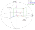
 | The North American Datum (NAD) is the horizontal datum now used to define the geodetic network in North America. A datum is a formal description of the... 13 KB (1,613 words) - 06:32, 16 April 2024 |
 | States of America based upon the General Adjustment of the North American Datum of 1988. It superseded the National Geodetic Vertical Datum of 1929 (NGVD... 7 KB (732 words) - 16:18, 31 January 2024 |
 | geodetic datum or geodetic system (also: geodetic reference datum, geodetic reference system, or geodetic reference frame) is a global datum reference... 29 KB (3,073 words) - 16:06, 31 December 2023 |
 | National Spatial Reference System (redirect from Datum of 2022) American Datum of 1983 (NAD 83) and the North American Vertical Datum of 1988 (NAVD 88) with a new geometric reference frame and geopotential datum.... 6 KB (555 words) - 16:13, 16 April 2024 |
 | ED50 (redirect from European Datum 1950) ED50 ("European Datum 1950", EPSG:4230) is a geodetic datum which was defined after World War II for the international connection of geodetic networks... 8 KB (928 words) - 18:08, 2 August 2023 |
 | Geographic coordinate system (section Geodetic datum) standards, also includes a choice of geodetic datum (including an Earth ellipsoid), as different datums will yield different latitude and longitude values... 21 KB (2,380 words) - 18:12, 4 April 2024 |
 | European Terrestrial Reference System 1989 (redirect from ETRS89 datum) geodetic datum to be used for mapping and surveying purposes in Europe. It plays the same role for Europe as NAD-83 for North America. (NAD-83 is a datum in... 6 KB (585 words) - 18:43, 20 March 2024 |
 | the large geodetic systems, such as European Datum (ED50), North American Datum (NAD), and Tokyo Datum (TD), to provide a worldwide geo-data basis Need... 24 KB (2,809 words) - 05:56, 18 March 2024 |
 | Earth-centered, Earth-fixed coordinate system (category Use American English from March 2021) 2010. ECEF datum transformation Archived March 22, 2007, at the Wayback Machine Notes on converting ECEF coordinates to WGS-84 datum Datum Transformations... 9 KB (904 words) - 13:39, 7 January 2024 |
 | up to 200 meters from the old. For different geographic regions, other datum systems can be used. Prior to the development of the Universal Transverse... 17 KB (2,610 words) - 23:05, 29 February 2024 |
 | Spatial reference system (section North America) include the World Geodetic System and the 1927 and 1983 North American Datum. A datum generally consists of an estimate of the shape of the Earth (usually... 15 KB (1,546 words) - 22:10, 9 April 2024 |
 | Parameter Dataset (also EPSG registry) is a public registry of geodetic datums, spatial reference systems, Earth ellipsoids, coordinate transformations... 5 KB (448 words) - 13:19, 16 January 2024 |
 | Geodesy (section Geodetic datums) (vertical). These regional geodetic datums, such as ED 50 (European Datum 1950) or NAD 27 (North American Datum 1927), have ellipsoids associated with... 37 KB (4,184 words) - 21:12, 12 April 2024 |
 | Level Datum 1929 OSGB36 Ordnance Survey Great Britain 1936 SK-42 Systema Koordinat 1942 goda ED50 European Datum 1950 SAD69 South American Datum 1969 GRS... 6 KB (624 words) - 03:28, 19 March 2024 |
 | datum and a projection system. In some documents it is called Greek Geodetic Reference System 1987 or GGRS87. HGRS87 specifies a non-geocentric datum... 7 KB (827 words) - 10:07, 15 December 2023 |
'Topographic map non-linear confidentiality algorithm') is a geodetic datum used by the Chinese State Bureau of Surveying and Mapping (Chinese: 国测局;... 28 KB (2,989 words) - 22:54, 4 March 2024 |
 | horizontal position coordinate (ϕ or y), such as latitude (negative number south of equator and positive north of equator) Second horizontal coordinate (λ... 9 KB (1,071 words) - 01:47, 1 June 2023 |


