
South Carolina Highway 544 (SC 544) is a 13.710-mile (22.064 km) major four-lane state highway in Horry County, South Carolina. It connects the Surfside...
13 KB (923 words) - 21:51, 10 May 2023
Killing of Ronald Eugene Woodham IV (redirect from Baby Boy Horry (South Carolina))
victim whose body was found off of South Carolina Highway 544, on the outskirts of Conway in Horry County, South Carolina on December 4, 2008. Known as "Baby...
13 KB (1,448 words) - 09:25, 10 April 2024

South Carolina Highway 31 (SC 31), also known as the Carolina Bays Parkway, is a 28.097-mile (45.218 km) six-lane, limited-access highway that parallels...
28 KB (2,959 words) - 12:01, 2 April 2024

U.S. Route 378 (redirect from South Carolina Highway 43)
(US 378) is a spur of US 78 in the U.S. states of Georgia and South Carolina. The U.S. Highway runs 234.30 miles (377.07 km) from US 78, Georgia State Route...
47 KB (3,284 words) - 01:36, 13 July 2023
South Carolina Highway 38 (SC 38) is a 43.694-mile (70.319 km) state highway that extends from Marlboro County near Hamlet, North Carolina to U.S. Route 501...
13 KB (1,109 words) - 17:36, 4 October 2023
South Carolina Highway 707 (SC 707) is a 12.645-mile (20.350 km) state highway in Georgetown and Horry counties, in the northeastern part of the U.S. state...
12 KB (1,289 words) - 17:43, 26 March 2024

South Carolina Highway 90 (SC 90) is a 23.110-mile (37.192 km) state highway in Horry County, within the northeastern part of the U.S. state of South...
13 KB (965 words) - 20:59, 10 May 2023

U.S. Route 501 (redirect from U.S. Highway 501 (South Carolina))
South Carolina KML is not from Wikidata US 501 in South Carolina is a north–south United States highway that traverses 73.8 miles (118.8 km); it is one...
46 KB (2,588 words) - 11:55, 27 March 2024

U.S. Highway 17 (US 17) is a 221.454-mile (356.396 km) north–south United States Numbered Highway in the U.S. state of South Carolina located near the...
28 KB (1,322 words) - 15:29, 22 April 2024
with Myrtle Beach, 12 miles (19 km) to the southeast. South Carolina Highway 544 runs north–south the length of Red Hill, connecting Conway with Socastee...
8 KB (619 words) - 21:13, 13 July 2023

South Carolina Highway 170 (SC 170) is a 49.010-mile (78.874 km) state highway, connecting northern Beaufort County with southern portions of Beaufort...
15 KB (1,158 words) - 11:08, 18 May 2022

state highways in South Carolina. These state highways are owned and maintained by the U.S. state of South Carolina, through the South Carolina Department...
317 KB (242 words) - 14:36, 26 April 2024

Special routes of U.S. Route 701 (redirect from U.S. Route 701 Business (Mount Pleasant, South Carolina))
The highway is entirely concurrent with US 378 Truck. It directs truck traffic onto US 501, South Carolina Highway 544 Connector (Red Hill 1) (SC 544 Conn...
16 KB (1,270 words) - 01:19, 28 February 2024
Conway. The highway begins in Red Hill, and utilizes a flyover with part of the northern terminus of South Carolina Highway 544 (SC 544). The former...
19 KB (1,613 words) - 01:20, 28 February 2024

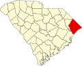
U.S. state of South Carolina. As of the 2020 census, its population was 351,029. It is the fourth-most populous county in South Carolina. The county seat...
41 KB (2,609 words) - 00:43, 4 May 2024

South Carolina Highway 541 (SC 541) is a 10.660-mile (17.156 km) state highway in the U.S. state of South Carolina. The highway connects Olanta with Coward...
3 KB (176 words) - 02:24, 16 February 2024

S. Highways that exist entirely or partially in the U.S. state of South Carolina. In South Carolina, all U.S. Highways are maintained by the South Carolina...
73 KB (178 words) - 18:05, 2 March 2022

Clover is a town in York County, South Carolina, United States. It is located in the greater Charlotte metropolitan area. As of 2020, the population was...
13 KB (1,083 words) - 00:17, 7 May 2024

States Numbered Highway System that runs from Globe, Arizona, to the Crystal Coast of the US state of North Carolina. In North Carolina, it is a major...
163 KB (12,521 words) - 17:25, 18 May 2024

South Carolina Highway 555 (SC 555) is a 14.900-mile (23.979 km) primary state highway in the U.S. state of South Carolina. It serves as an alternate route...
4 KB (235 words) - 02:22, 16 February 2024

of the state. The highway is a major east–west route through the central and eastern portion of the state. US 64 enters North Carolina in Cherokee County...
64 KB (3,963 words) - 15:59, 19 May 2024

Grand Strand (redirect from Grand Strand (South Carolina))
The Grand Strand is an arc of beach land on the Atlantic Ocean in South Carolina, United States, extending more than 60 miles (97 km) from Little River...
35 KB (3,944 words) - 03:20, 27 November 2023
The Carolina & Northwestern Railway (Ca&NW) was a railroad that served South Carolina and North Carolina from 1897 until January 1, 1974. The original...
7 KB (813 words) - 18:56, 17 March 2023
the National Register of Historic Places listings in Horry County, South Carolina. This is intended to be a complete list of the properties and districts...
15 KB (328 words) - 23:13, 10 December 2022

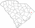
Surfside Beach is a town in Horry County, South Carolina, United States. Its nickname is "The Family Beach". The population was 3,837 at the 2010 census...
13 KB (1,397 words) - 00:43, 7 May 2024

Socastee Historic District (category Historic districts on the National Register of Historic Places in South Carolina)
by the Tidewater Construction Corporation. According to a 1981 South Carolina Highway Department Survey, however, the bridge contains a plate bearing...
6 KB (591 words) - 02:48, 10 December 2023

Jersey New Mexico New York North Carolina North Dakota Ohio Oklahoma Oregon Pennsylvania Rhode Island South Carolina South Dakota Tennessee Texas Utah Vermont...
195 KB (1,571 words) - 20:33, 13 May 2024
State Road 501 North Carolina Highway 501 (former) Ohio State Route 501 Oregon Route 501 Pennsylvania Route 501 South Carolina Highway 501 (former) Washington...
2 KB (118 words) - 23:12, 4 April 2024
North Carolina Highway 402 (former) Oregon Route 402 Pennsylvania Route 402 Puerto Rico Highway 402 Rhode Island Route 402 South Carolina Highway 402 Texas:...
2 KB (154 words) - 23:16, 4 April 2024
New York) North Carolina Highway 403 Pennsylvania Route 403 Puerto Rico Highway 403 Rhode Island Route 403 South Carolina Highway 403 Virginia State...
2 KB (136 words) - 22:25, 4 April 2024