
the 2000 census. For all practical purposes, South Oroville is tied to Oroville proper. South Oroville contains a negligible number of businesses, and...
10 KB (1,072 words) - 21:32, 20 December 2023
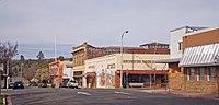
to the south.[citation needed] Oroville's nickname is the "City of Gold", which is essentially the Spanish name of the city in English. Oroville has also...
46 KB (4,419 words) - 19:04, 14 May 2024

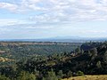
Lake Oroville is a reservoir formed by the Oroville Dam impounding the Feather River, located in Butte County, northern California. The lake is situated...
27 KB (3,085 words) - 20:20, 31 March 2024

Oroville is a city located in the northern bulk of the Okanogan Highlands in north-central Washington, United States. Oroville is a member municipality...
15 KB (1,377 words) - 01:17, 12 May 2024

Table Mountain (Butte County, California) (category Oroville, California)
Mountain and South Table Mountain are two prominent basaltic mesas overlooking the city of Oroville, California. They lie a few miles north of Oroville in Butte...
12 KB (1,521 words) - 17:13, 29 April 2024

Inskip Magalia Merrimac Nord Oregon City Oroville East Oroville Palermo Paradise Pulga Richvale South Oroville Stirling City Thermalito Yankee Hill Arbuckle...
17 KB (772 words) - 02:32, 9 April 2024
California. In the 2020 census, its population was 211,632. The county seat is Oroville. Butte County comprises the Chico, California, metropolitan statistical...
66 KB (2,987 words) - 12:49, 27 April 2024

The Oroville–Thermalito Complex is a group of reservoirs, structures, and facilities located in and around the city of Oroville in Butte County, California...
19 KB (2,361 words) - 16:20, 23 September 2023
for the Air1 Radio Network based in Chico, California and licensed to South Oroville, California. It is owned by Butte Broadcasting Company, Inc., which...
2 KB (104 words) - 18:39, 6 August 2023

In February 2017, heavy rainfall damaged Oroville Dam's main and emergency spillways, prompting the evacuation of more than 180,000 people living downstream...
42 KB (3,858 words) - 02:17, 11 May 2024
County South Main 1 Orange County 92707 South Modesto 1 Stanislaus County 95350 South Oceanside 1 San Diego County South Oroville 1 Butte County...
71 KB (77 words) - 00:51, 20 January 2024

The Oroville–Osoyoos Border Crossing connects the city of Oroville, Washington and the town of Osoyoos, British Columbia on the Canada–US border. U.S....
7 KB (637 words) - 07:12, 7 September 2023
7 Oildale CA Bakersfield K221GB 92.1 Barstow CA Barstow KYIX 104.9 South Oroville CA Chico KYLA 92.7 Fountain Valley CA Fountain Valley KAWF 88.5 Selma...
42 KB (62 words) - 13:59, 14 April 2024

It is located in the community of Oroville East, in suburban Oroville. Other nearby communities include South Oroville and Palermo. The tribe owns and operates...
3 KB (283 words) - 15:52, 30 July 2023
5 FM Nipomo Santa Maria Valley Media Ministry Silent KYIX 104.9 FM South Oroville Butte Broadcasting Company, Inc. Worship music (Air1) KYKL 90.7 FM Tracy...
109 KB (144 words) - 16:06, 13 May 2024

Oroville Municipal Airport (IATA: OVE, ICAO: KOVE) is a public airport located 3 miles (5 km) southwest of the city of Oroville in Butte County, California...
7 KB (902 words) - 12:37, 14 February 2024

Feather River (section South Fork)
The main stem Feather River begins in Lake Oroville, where its four long tributary forks join—the South Fork, Middle Fork, North Fork, and West Branch...
32 KB (3,938 words) - 05:26, 4 April 2024
through which it largely passes. It begins in the south at the international border crossing north of Oroville, and travels 4 km (2.5 mi) north to its junction...
32 KB (1,688 words) - 02:43, 17 May 2024
$57,329 South Oroville Butte 6,058 2,065.5 $10,946 $33,605 $33,978 South Pasadena Los Angeles 25,914 7,610.6 $46,649 $80,479 $107,015 South San Francisco...
223 KB (903 words) - 21:38, 1 September 2023
kilometres (5.0 mi) south-southeast of the town of Oroville, California and at a depth of about 5 kilometres (3.1 mi) below the Oroville Dam and the lake...
5 KB (566 words) - 19:38, 14 January 2024
Northeastern Maidu. They are a federally recognized Maidu tribe, headquartered in Oroville in Butte County. Their reservation is 65 acres (260,000 m2), located in...
4 KB (309 words) - 21:23, 10 November 2023
72694; -121.67917 Translator(s) 103.9 K280GL (Chico) Repeater(s) 104.9 KYIX-HD3 (South Oroville) Links Webcast Listen Live Website chicochristianradio.com...
3 KB (222 words) - 18:40, 6 August 2023

California State Route 149 (redirect from Oroville-Chico Highway)
north–south highway through the eastern Sacramento Valley, a Focus Route of the Interregional Road System. SR 149 was formerly part of the Oroville-Chico...
13 KB (1,604 words) - 06:03, 22 August 2023

heading north on a two-lane road. Another four-lane freeway begins south of SR 162 in Oroville, and ends at SR 149. SR 149 is a major connection northwest to...
32 KB (3,243 words) - 16:57, 17 March 2024
west because of the steeper and more rugged topography. The tallest is Oroville Dam in northern California, a 770.5-foot (234.8 m) embankment dam completed...
39 KB (423 words) - 21:58, 30 December 2023

Lake Oroville State Recreation Area (LOSRA) is a state park unit of California, United States, surrounding Lake Oroville, a reservoir on the Feather River...
4 KB (281 words) - 19:37, 2 June 2023
roads. An evacuation center was set up at the Church of the Nazarene in South Oroville. By Saturday, July 8, the fire was a reported 2,000 acres in size with...
6 KB (639 words) - 20:17, 27 March 2024
film called Why?, this film marks his acting debut. Filming took place in Oroville, California, just outside Sacramento. Burton and wife Elizabeth Taylor...
18 KB (2,267 words) - 00:38, 12 April 2024

on the lakeshore are the town of Osoyoos, British Columbia and city of Oroville, Washington. The lake's maximum elevation is 912.78 ft (278.22 m), while...
4 KB (294 words) - 02:39, 30 April 2024
74.3% South Oroville Butte 5,982 63.9% 7.8% 17.3% 8.3% 2.7% 15.2% South Pasadena Los Angeles 25,465 57.7% 9.0% 30.8% 2.0% 0.4% 21.0% South San Francisco...
236 KB (1,182 words) - 07:14, 17 May 2024