 | Terrain cartography or relief mapping is the depiction of the shape of the surface of the Earth on a map, using one or more of several techniques that... 25 KB (2,860 words) - 12:52, 28 March 2024 |
 | Cartography (/kɑːrˈtɒɡrəfi/; from Ancient Greek: χάρτης chartēs, 'papyrus, sheet of paper, map'; and γράφειν graphein, 'write') is the study and practice... 61 KB (7,307 words) - 04:01, 23 March 2024 |
 | Digital elevation model (redirect from Digital terrain model) gradient) Digital outcrop model Global Relief Model Physical terrain model Terrain cartography Terrain rendering Bathymetric Attributed Grid (BAG) DTED DIMAP... 30 KB (3,236 words) - 14:45, 26 February 2024 |
shadows Topographic map, a 2D depiction of terrestrial relief, using terrain cartography Relief (disambiguation) This disambiguation page lists articles associated... 363 bytes (75 words) - 00:08, 21 January 2018 |
Cartographic generalization Cartographic labeling Critical cartography Terrain cartography French cartography Geodesy Geomatics Topography Cartogram City map Contour... 5 KB (351 words) - 23:15, 26 March 2024 |
Relief (disambiguation) (section Terrain) relief, the variation in elevation of a landscape Shaded relief in terrain cartography Relief (feature selection), a feature selection algorithm Relief... 3 KB (341 words) - 07:22, 30 July 2021 |
 | Topography (redirect from Terrain topography) the graphic representation of the landform on a map by a variety of cartographic relief depiction techniques, including contour lines, hypsometric tints... 16 KB (1,956 words) - 22:26, 7 April 2024 |
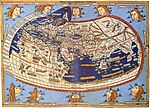
The history of cartography refers to the development and consequences of cartography, or mapmaking technology, throughout human history. Maps have been... 142 KB (17,588 words) - 11:31, 14 April 2024 |
 | Landform (redirect from Terrain feature) the Earth or other planetary body. Landforms together make up a given terrain, and their arrangement in the landscape is known as topography. Landforms... 9 KB (886 words) - 16:28, 24 April 2024 |
 | Fantasy cartography, fictional map-making, or geofiction is a type of map design that visually presents an imaginary world or concept, or represents a... 30 KB (2,835 words) - 16:14, 11 November 2023 |
 | Wright Mons (section Hummocky terrain) terrain, but the hummocky terrain is most apparent adjacent to and partially on Wright Mons's edifice, though it appears to fade to rougher terrain to... 15 KB (1,591 words) - 21:42, 24 April 2024 |
 | Raised-relief map (redirect from Terrain model) Wikimedia Commons has media related to Cartographic reliefs. Terrain Models, a website of the Institute of Cartography at ETH Zurich Library of Congress:... 13 KB (1,663 words) - 18:37, 7 October 2023 |
 | another value Terrain cartography, also known as Cartographic relief depiction – Representation of surface shape on maps Cartographic generalization –... 13 KB (1,601 words) - 19:00, 13 January 2024 |
 | Selenography (redirect from Cartography of the Moon) A. Whitaker (1999). Mapping and Naming the Moon: A History of Lunar Cartography and Nomenclature. Cambridge University Press. ISBN 0-521-62248-4. William... 25 KB (2,804 words) - 11:40, 2 March 2024 |
laser scanning, and terrain modelling. The Journal also publishes articles on social, political and historical aspects of cartography. Occasionally, Special... 3 KB (305 words) - 14:07, 8 August 2023 |
Tolkien's maps (redirect from Tolkien's cartography) and beauty", and in her view lie somewhere between illustration and cartography. Tolkien indeed wrote that "there should be picturesque maps, providing... 23 KB (2,837 words) - 14:37, 22 April 2024 |
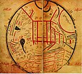
 | The cartography of Asia can refer to the representation of Asia on a map, or to depictions of the world by cartographers from Asia. Depictions of portions... 5 KB (601 words) - 16:52, 5 February 2024 |
DTED (redirect from Digital Terrain Elevation Data) DTED (or Digital Terrain Elevation Data) is a standard of digital datasets which consists of a matrix of terrain elevation values, i.e., a Digital Elevation... 3 KB (280 words) - 08:43, 22 April 2024 |
 | Contour line (category Cartography) connecting points where the function has the same particular value. In cartography, a contour line (often just called a "contour") joins points of equal... 36 KB (4,352 words) - 17:14, 17 April 2024 |
 | Web mapping (redirect from Web cartography) of web mapping can be regarded as a major new trend in cartography. Until recently, cartography was restricted to a few companies, institutes and mapping... 39 KB (4,675 words) - 14:42, 23 April 2024 |
 | Terra incognita (category Cartography) Latin, but with variation in pronunciation in English) is a term used in cartography for regions that have not been mapped or documented. The expression is... 5 KB (580 words) - 03:02, 8 April 2024 |
 | Map symbol (redirect from Cartographic symbol) A map symbol or cartographic symbol is a graphical device used to visually represent a real-world feature on a map, working in the same fashion as other... 19 KB (2,107 words) - 08:59, 22 December 2023 |
Planetary cartography, or cartography of extraterrestrial objects (CEO), is the cartography of solid objects outside of the Earth. Planetary maps can... 9 KB (1,051 words) - 12:09, 13 August 2023 |
 | inside the GIS allow for manipulation of data for spatial analysis or cartography. A topographical map is the main type of map used to depict elevation... 7 KB (573 words) - 07:27, 11 February 2024 |


