 | A tide gauge is a device for measuring the change in sea level relative to a vertical datum.[citation needed] It is also known as a mareograph, marigraph... 8 KB (789 words) - 08:24, 21 April 2024 |
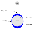 | lunitidal interval. To make accurate records, tide gauges at fixed stations measure water level over time. Gauges ignore variations caused by waves with periods... 109 KB (13,054 words) - 12:33, 17 February 2024 |
 | The Cascais tide gauge (Portuguese: Marégrafo de Cascais) was the first tide gauge (also known as a mareograph or marigraph, as well as a sea-level recorder)... 7 KB (789 words) - 10:58, 14 August 2023 |
 | Fort Denison (section Tide gauge) as Pinchgut Island. The site contains time gun, navigational aids and tide gauge facilities. Correctional and military facilities were designed by George... 31 KB (3,158 words) - 15:23, 11 February 2024 |
Historically, analysis of the annual cycle has been limited by locations with tide gauge records, i.e., coastlines and some islands in the deep ocean, and by sparse... 5 KB (653 words) - 19:31, 29 June 2021 |
 | straightforward mean sea-level standard is instead a long-term average of tide gauge readings at a particular reference location. Sea levels can be affected... 23 KB (4,395 words) - 03:20, 18 April 2024 |
Water level (redirect from Gauge height) horizontal plane of reference Flood stage Hydraulic head Stream gauge Water level gauges Tide gauge Level sensor Liquid level Reference water level Stage (hydrology)... 1 KB (80 words) - 23:06, 14 April 2024 |
 | the tide gauge was incomplete as it was one of several tide gauges across the peninsula that stopped receiving information shortly after. A tide gauge at... 238 KB (22,866 words) - 20:47, 24 April 2024 |
 | Sea level rise (section Tide gauges) climate change simulations. Regional differences are also visible in the tide gauge data. Some are caused by local sea level differences. Others are due to... 189 KB (21,140 words) - 17:18, 19 April 2024 |
 | Metres above the Adriatic (section Gauge) also refer to heights as 'metres above the Adriatic', but use a specific tide gauge in the port of Durrës. The individual countries using this datum abbreviate... 5 KB (556 words) - 07:18, 2 February 2024 |
 | North Sea (section Water circulation and tides) of the North Sea Tide table for Lerwick: tide-forecast Archived 26 April 2014 at the Wayback Machine Tide table for Aberdeen: tide-forecast Archived... 135 KB (11,993 words) - 13:09, 19 March 2024 |
 | The UK National Tide Gauge Network is part of the National Tidal and Sea Level Facility. It was set up in 1953 to record sea levels around the coast of... 1 KB (101 words) - 10:49, 14 August 2023 |
 | A stream gauge, streamgage or stream gauging station is a location used by hydrologists or environmental scientists to monitor and test terrestrial bodies... 14 KB (1,637 words) - 09:58, 5 February 2024 |
 | Slovenia with the elevation benchmark of 0 m has its origin at the Koper tide gauge station. Until then, it referred to the Sartorio mole in Trieste (see... 15 KB (1,046 words) - 00:30, 1 March 2024 |
 | was corrected to align with the mean sea level observations of thirty tide gauges positioned around the entire coastline. While it remains the published... 20 KB (2,277 words) - 14:15, 11 April 2024 |
 | archaeological sites and late Holocene tidal marsh sediments, combined with tide gauge and satellite records and geophysical modeling. For example, this research... 27 KB (3,306 words) - 10:47, 29 November 2023 |
 | warnings; then, data from observed sea level height (either shore-based tide gauges or DART buoys) are used to verify the existence of a tsunami. Other systems... 24 KB (2,545 words) - 00:57, 26 March 2024 |
Psychrometer Rain gauge Rain sensor Seismometer SNOTEL Snow gauge Soil moisture sensor Stream gauge Tide gauge Weather radar Air flow meter Anemometer Flow sensor... 12 KB (1,021 words) - 04:16, 7 March 2024 |
 | Tidal flooding (category Tides) mean sea level trends for some stations. During the king tides, the local Miami area tide gauge at Virginia Key shows levels running at times 1 foot (0... 14 KB (1,423 words) - 19:50, 28 October 2023 |
 | Tuvalu (section Cyclones and king tides) uncertainty as to the accuracy of the data from this tide gauge resulted in a modern Aquatrak acoustic gauge being installed in 1993 by the Australian National... 221 KB (22,332 words) - 22:47, 25 April 2024 |
 | Atlantic City's Steel Pier was also used to mount a measuring device (tide gauge) to monitor changes in the sea level of the Atlantic Ocean. However, changes... 6 KB (641 words) - 01:02, 25 February 2024 |
 | on Earth by suitable simple measurements from physical objects like a tide gauge. The geoid can, therefore, be considered a physical ("real") surface.... 37 KB (4,184 words) - 21:12, 12 April 2024 |
 | histories of tide-gauge observations, by harmonic analysis based on the principal tide-generating frequencies as shown by the global theory of tides and the... 26 KB (3,422 words) - 07:29, 26 February 2024 |
 | (2006). "The 2004 Indian tsunami in Thailand: Surveyed runup heights and tide gauge records" (PDF). Earth Planets Space. 58 (2): 223–232. Bibcode:2006EP&S... 172 KB (18,296 words) - 00:16, 26 March 2024 |
 | are used to determine the tidal harmonic constituents directly from tide gauge records. Tidal constituents combine to give an endlessly varying aggregate... 46 KB (4,237 words) - 17:32, 19 April 2024 |
 | the United States, and Mexico. It held fixed the height of the primary tide gauge benchmark, referenced to the International Great Lakes Datum of 1985 local... 7 KB (732 words) - 16:18, 31 January 2024 |
research conducted on the Dragon Hole, a multitude of data was collected. Tide gauge stations were temporarily deployed around the Dragon Hole as well as on... 9 KB (1,096 words) - 07:38, 27 October 2023 |
force Tidal power Tidal race Tidal range Tidal resonance Tide gauge Tideline Theory of tides Landforms Abyssal fan Abyssal plain Atoll Bathymetric chart... 1 KB (119 words) - 00:52, 23 May 2023 |
 | Storm surge (redirect from Storm Tide) includes images, video, and animations. UK storm surge model outputs and real-time tide gauge information from the National Tidal and Sea Level Facility... 43 KB (4,580 words) - 03:30, 11 April 2024 |
The Permanent Service for Mean Sea Level is a repository for tide gauge data used in the measurement of long-term sea level change. The PSMSL is based... 3 KB (310 words) - 08:46, 28 January 2024 |