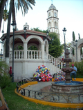
 | Tlaltenango de Sánchez Román is a municipality located in the southwestern portion of the Mexican state of Zacatecas. The average elevation of the municipality... 16 KB (1,303 words) - 23:11, 6 December 2023 |
Tlaltenango, Mexican toponym, may mean: Tlaltenango de Sánchez Román, Zacatecas Tlaltenango, Puebla Tlaltenango, Morelos This disambiguation page lists... 160 bytes (48 words) - 16:24, 30 December 2019 |
 | Zacatecas (redirect from Estado Libre y Soberano de Zacatecas) others in Tlaltenango, Juchipila and Teocaltiche. Chalchihuites Fresnillo Guadalupe Jalpa Jerez de García Salinas Juchipila Juan Aldama Moyahua de Estrada... 39 KB (3,451 words) - 02:56, 7 February 2024 |
 | it is bordered by the municipality of Tlaltenango de Sánchez Román, to the south by the municipality of Teúl de González Ortega, to the east by the municipalities... 7 KB (324 words) - 05:20, 6 December 2023 |
Tepechitlán Tepetongo Tlachichila Tlaltenango de Sánchez Román Tayahua Tenanguillo Trinidad Garcia De La Cadena Valparaíso Veinte de Noviembre Villanueva Villa... 3 KB (219 words) - 17:44, 10 May 2024 |
 | municipalities of Tepechitlán and Florencia de Benito Juárez. To the east it is bordered by Tlaltenango de Sánchez Román and to the north and west by the state... 7 KB (322 words) - 17:16, 3 December 2023 |
 | the Ultimate Fighting Championship (UFC). Quiñónez was born in Tlaltenango de Sánchez Román in the state of Zacatecas, Mexico. He was interested and involved... 26 KB (1,845 words) - 17:38, 3 December 2023 |
by the municipal divisions of Villanueva, Tabasco, Momax, and Tlaltenango de Sánchez Román. Population (1990): 1606. Elevation: 2800 m. 21°56′N 103°06′W... 843 bytes (74 words) - 16:47, 10 December 2017 |
 | representation. The current president of the municipality is Maria del Rocio Moreno Sánchez. In the 2020 Mexican Census, Juchipila recorded a population of 12,251... 20 KB (1,482 words) - 23:51, 4 December 2023 |
 | Cuernavaca (redirect from Museo Morelense de Arte Contemporáneo) de los Milagros de Tlaltenango, built in 1720-1730. Asunción de María y San José Parish, built in the 16th century. Museo Fotográfico de Cuernavaca (El... 159 KB (16,743 words) - 10:09, 26 February 2024 |
 | in the drainage basin of the Río Grande de Santiago. Most of the municipality is drained by the Tlaltenango River, a tributary of the Bolaños River,... 11 KB (766 words) - 05:16, 6 December 2023 |
Cuernavaca Municipality (section Tlaltenango) historia de Tlaltenango". Noticias de Morelos Habla (in Spanish). Retrieved July 16, 2020. "Capilla de San José Tlaltenango y Santuario de la Virgen de los... 70 KB (7,539 words) - 07:06, 5 February 2024 |
 | municipalities of Jalpa and on the west by the municipality of Tlaltenango De Sanchez Roman. Huanusco was founded shortly after the Mixtón War fought between... 9 KB (1,389 words) - 23:17, 6 November 2022 |
 | the northeast, Noria de Ángeles to the east, and Loreto to the southeast. It also borders the municipalities of Cosío, Rincón de Romos, and Tepezalá in... 14 KB (838 words) - 02:18, 16 May 2024 |
to 1793. After Mexican independence, it became part of the partido of Tlaltenango. The hacienda was expropriated by the state in 1869, and after a further... 15 KB (954 words) - 17:40, 15 January 2024 |
 | Hernández, Mireya; Vázquez Sánchez, Monserrat; López Acosta, Juan Carlos (2022). "Contribution to the floristic knowledge of the Sierra de los Cardos, Susticacán... 17 KB (1,121 words) - 13:48, 9 January 2024 |
| de los Municipios y Delegaciones de México (in Spanish). INAFED. Retrieved 16 June 2021. "Morelos". Enciclopedia de los Municipios y Delegaciones de México... 26 KB (750 words) - 15:53, 11 March 2024 |
 | municipalities of Trinidad García de la Cadena to the west, Teúl de González Ortega to the north, Juchipila to the northeast, and Moyahua de Estrada to the east. It... 14 KB (828 words) - 23:56, 4 December 2023 |
 | Salado. The highest point of the municipality is Cerro San Gil in the Sierra de Zacatecas southeast of the town of Hacienda Nueva, with an elevation of 2... 11 KB (785 words) - 22:42, 15 May 2024 |
 | Noria de Ángeles is a municipality in the Mexican state of Zacatecas, located approximately 75 kilometres (47 mi) southeast of the state capital of Zacatecas... 15 KB (984 words) - 17:58, 12 March 2024 |
and Guadalupe to the northwest. It also borders the municipality of Villa de Ramos in the state of San Luis Potosí to the northeast. The municipality covers... 10 KB (701 words) - 23:10, 4 March 2023 |
 | Enciclopedia de los Municipios y Delegaciones de México (in Spanish). INAFED. Retrieved 23 January 2021. Estado de Zacatecas. División Territorial de 1810 a... 11 KB (754 words) - 23:56, 4 December 2023 |
 | Colegio de Michoacán [es], El Colegio de San Luis [es]. p. 565. ISBN 970-679-031-4. Retrieved 21 June 2021. Estado de Zacatecas. División Territorial de 1810... 14 KB (805 words) - 21:15, 24 March 2024 |
 | Enciclopedia de los Municipios y Delegaciones de México (in Spanish). INAFED. Retrieved 22 January 2021. Inventario físico de recursos minerales de la carta... 14 KB (773 words) - 10:29, 24 March 2024 |
 | Noria de Ángeles to the south, Ojocaliente to the southwest, and General Pánfilo Natera to the northwest. It also borders the municipalities of Villa de Ramos... 15 KB (958 words) - 15:52, 21 January 2024 |
the east. It also borders the municipalities of Rincón de Romos to the southeast and San José de Gracia to the south, which are both in the state of Aguascalientes... 14 KB (835 words) - 02:22, 16 May 2024 |
registro de candidaturas a cargos de elección popular de los partidos políticos y coaliciones" (PDF) (in Spanish). Instituto Electoral del Estado de Zacatecas... 14 KB (814 words) - 13:05, 26 August 2023 |
 | Melchor Ocampo is situated in the drainage basin of the Laguna de Viesca [es] in the Bolsón de Mapimí. Melchor Ocampo's climate ranges from semiarid to arid... 10 KB (700 words) - 23:55, 4 December 2023 |
Miguel de Allende, Guanajuato to San Luis Potosí and rename FC Potosino. Mineros de Zacatecas Premier relocated from Tlaltenango de Sánchez Román, Zacatecas... 110 KB (1,985 words) - 17:34, 16 July 2023 |
 | List of canonically crowned images (category CS1 German-language sources (de)) granted on 8 February 1887 for the Archbishop of Mexico, Próspero Alarcón y Sánchez de la Barquera but the decree was initially withheld. The Sacred Congregation... 576 KB (19,676 words) - 07:15, 14 May 2024 |