
U.S. Route 340 (US 340) is a spur route of US 40, and runs from Greenville, Virginia, to Frederick, Maryland. In Virginia, it runs north–south, parallel...
61 KB (5,642 words) - 03:15, 29 August 2024

U.S. Route 211 (US 211) is a spur of US 11 in the U.S. state of Virginia. Known for most of its length as Lee Highway, the U.S. Highway runs 59.09 miles...
20 KB (1,477 words) - 14:16, 18 February 2024

U.S. Route 250 (US 250) is a route of the United States Numbered Highway System, and is a spur of U.S. Route 50. It currently runs for 514 miles (827 km)...
14 KB (1,373 words) - 03:35, 2 February 2024

Warren County, Virginia, United States. Bentonville is located along U.S. Route 340 8.9 miles (14.3 km) southwest of Front Royal. Bentonville has a post...
3 KB (136 words) - 17:50, 5 October 2023

U.S. Route 40 or U.S. Highway 40 (US 40), also known as the Main Street of America (a nickname shared with U.S. Route 66), is a major east–west United...
77 KB (8,335 words) - 01:42, 5 August 2024

U.S. Route 15 or U.S. Highway 15 (US 15) is a 791.71-mile-long (1,274.13 km) United States Numbered Highway, serving the states of South Carolina, North...
20 KB (1,850 words) - 14:54, 5 May 2024

SR 42 near Buffalo Gap east to U.S. Route 340 (US 340) in Waynesboro. SR 254 provides a northerly alternate route to US 250 between Waynesboro and Staunton...
8 KB (517 words) - 18:47, 16 February 2024

Route 340 between Manchester Road and the Interstate 64 / U.S. 40 / U.S. 61 interchange is known locally as Clarkson Road. The remainder of Route 340...
4 KB (208 words) - 04:30, 14 January 2024

U.S. Route 191 (US 191) is a north–south highway in the Western United States and a spur of parent route U.S. Route 91 that has two segments. The southern...
27 KB (3,071 words) - 21:06, 5 September 2024

Elkton, Virginia (category Pages using US Census population needing update)
the Shenandoah River at the intersections of east-west U.S. Route 33 and north-south U.S. Route 340. The town celebrated its 100th anniversary in 2008. One...
17 KB (1,878 words) - 19:53, 23 May 2024

U.S. Route 460 (US 460) is an auxiliary route of U.S. Route 60. It currently runs for 655 miles (1,054 km) from Norfolk, Virginia, at its parent route...
13 KB (1,254 words) - 22:23, 4 August 2024

U.S. Route 34 (US 34) is an east–west United States highway that runs for 1,122 miles (1,806 km) from north-central Colorado to the western suburbs of...
14 KB (1,252 words) - 12:51, 27 May 2024
also host an unsigned alternate route of U.S. Route 340, which follows Washington Street through Bolivar. "2019 U.S. Gazetteer Files". United States...
11 KB (1,011 words) - 15:36, 6 May 2024
09306°N 78.05917°W / 39.09306; -78.05917 (39.093118, −78.059190), along U.S. Route 340. It is 6 miles (10 km) southwest of Berryville, the county seat and...
18 KB (2,217 words) - 18:27, 6 May 2024

Virginia. Harpers Ferry and Bolivar host an unsigned alternate route of U.S. Route 340, which follows Washington Street, High Street, and Shenandoah Street...
80 KB (8,239 words) - 17:05, 27 August 2024

U.S. Route 522 (US 522) is a spur route of US 22 in the states of Virginia, West Virginia, Maryland, and Pennsylvania. The U.S. Highway travels in a north-south...
66 KB (5,529 words) - 19:27, 25 June 2024
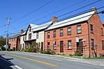
Clarke County, Virginia. Briggs is located on Lord Fairfax Highway (U.S. Route 340). According to the Geographic Names Information System, Briggs was formerly...
4 KB (94 words) - 20:34, 22 July 2023

U.S. Route 17 or U.S. Highway 17 (US 17), also known as the Coastal Highway, is a north–south United States Numbered Highway that spans in the Southeastern...
29 KB (2,697 words) - 19:31, 14 September 2024
U.S. Route 321 (US 321) is a spur of U.S. Route 21. It runs for 516.9 miles (831.9 km) from Hardeeville, South Carolina to Lenoir City, Tennessee; with...
62 KB (2,788 words) - 04:52, 8 September 2024
U.S. Route 501 (US 501) is a spur of U.S. Route 1. It runs 355 miles (571 km) from Buena Vista, Virginia at U.S. Route 60 to Myrtle Beach, South Carolina...
46 KB (2,573 words) - 18:17, 6 September 2024

U.S. Route 33 (US 33) is a United States Numbered Highway that runs northwest–southeast for 709 miles (1,141 km) from northern Indiana to Richmond, Virginia...
21 KB (2,001 words) - 18:35, 9 July 2024

U.S. Route 50 (US 50) is a part of the U.S. Highway System that travels from West Sacramento, California, to Ocean City, Maryland. In the U.S. state of...
26 KB (1,626 words) - 06:37, 30 August 2024

U.S. Route 209 (US 209) is a 211.74-mile (340.76 km) long U.S. Highway in the states of Pennsylvania and New York. Although the route is a spur of US 9...
63 KB (4,834 words) - 14:11, 10 September 2024

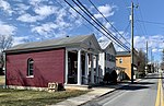
Stanley, Virginia (category Pages using US Census population needing update)
is U.S. Route 340 Business, which is the main road northeast and southwest out of Stanley. To the northeast, US 340 Bus travels to Luray, rejoins U.S. Route...
9 KB (675 words) - 05:38, 29 July 2024
Skyline Drive (section Route description)
is at an intersection with U.S. Route 340 (US 340) near Front Royal, and the southern terminus is at an interchange with US 250 near Interstate 64 (I-64)...
40 KB (3,583 words) - 01:34, 5 August 2024

over. Berryville is located at the intersection of U.S. Route 340 and Virginia State Route 7. US 340 passes through the center of town, extending southwest...
18 KB (1,479 words) - 18:40, 18 September 2024
U.S. Route 50 or U.S. Highway 50 (US 50) is a major east–west route of the U.S. Highway system, stretching 3,019 miles (4,859 km) from Interstate 80 (I-80)...
39 KB (3,845 words) - 02:43, 22 August 2024

main highways, U.S. Route 340 and West Virginia Route 9, which run concurrently for a short stretch in the vicinity of Charles Town. US 340 travels in a...
21 KB (2,253 words) - 14:15, 15 September 2024

U.S. Route 11 or U.S. Highway 11 (US 11) is a major north–south United States Numbered Highway extending 1,645 miles (2,647 km) across the eastern U.S...
40 KB (3,610 words) - 06:09, 14 April 2024
concurrency with US 340 and through Frederick, where the highway meets US 40 and Interstate 70 (I-70). US 15 has a business route through Emmitsburg. US 15 is the...
55 KB (6,294 words) - 13:46, 24 August 2024