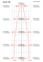
 | by a particular map projection. Each projected coordinate system, such as "Universal Transverse Mercator WGS 84 Zone 26N," is defined by a choice of map... 21 KB (2,802 words) - 02:18, 12 April 2024 |
modified transverse Mercator (MTM) coordinate system is a metric grid-based method of specifying locations, similar to the Universal Transverse Mercator coordinate... 471 bytes (50 words) - 13:52, 3 October 2019 |
the actual year of release. Public Land Survey System Universal Transverse Mercator coordinate system Doyle, David R. (January 2004). "NGS Geodetic Toolkit... 7 KB (965 words) - 15:06, 26 February 2024 |
 | Irish Transverse Mercator (ITM) is the geographic coordinate system for Ireland. It was implemented jointly by the Ordnance Survey Ireland (OSi) and the... 7 KB (696 words) - 22:44, 13 August 2023 |
Plane Coordinate System, in national (Great Britain, Ireland and many others) and also international mapping systems, including the Universal Transverse Mercator... 25 KB (4,237 words) - 10:02, 3 September 2023 |
 | The universal polar stereographic (UPS) coordinate system is used in conjunction with the universal transverse Mercator (UTM) coordinate system to locate... 4 KB (490 words) - 07:35, 21 October 2023 |
system Universal polar stereographic coordinate system Universal Transverse Mercator coordinate system Roger Foster; Dan Mullaney. "Basic Geodesy Article... 34 KB (4,417 words) - 23:49, 2 December 2023 |
 | Ordnance Survey National Grid (redirect from British national grid reference system) Ireland. The Universal Transverse Mercator coordinate system (UTM) is used to provide grid references for worldwide locations, and this is the system commonly... 19 KB (2,130 words) - 10:22, 14 April 2024 |
 | zipped KML file. Latitude. Longitude. Universal Transverse Mercator coordinate system (UTM). World Geodetic System. GPS and Positioning Services FAQ, Q1... 6 KB (585 words) - 18:43, 20 March 2024 |
Natural Area Code (redirect from Universal Address) is HBV6R RG77T H0000. Military Grid Reference System Universal Transverse Mercator coordinate system Quadtree Geohash "Legal and Licensing". www.nacgeo... 4 KB (419 words) - 17:50, 31 July 2023 |
National Grid. At the same time as GDA94 was defined, a Universal Transverse Mercator coordinate system called the Map Grid of Australia 1994 (MGA94) was also... 4 KB (396 words) - 23:35, 17 November 2023 |
far-off figures using such a projection. The Universal Transverse Mercator coordinate system and the Lambert system in France are projections that support the... 11 KB (1,207 words) - 14:35, 23 April 2024 |
Mapcode (category Geographic coordinate systems) geographic coordinates Universal Transverse Mercator coordinate system – Map projection system What3words – Proprietary geocoding system "Should Mapcodes Replace... 7 KB (961 words) - 00:36, 5 November 2023 |
{B^{2}+E^{2}}}} World files describing a map on the Universal Transverse Mercator coordinate system (UTM) use these conventions: D and B are usually 0... 8 KB (1,208 words) - 14:21, 26 February 2024 |
 | the following parameters for the projection: Jordan Transverse Mercator Geographic Coordinate System: GCS_International_1924 Datum: D:International_1924... 2 KB (275 words) - 20:39, 18 January 2022 |
medications Map Grid of Australia, a mapping system based on the Universal Transverse Mercator coordinate system Mga (river) in Leningrad Oblast, Russia Mga... 3 KB (362 words) - 12:55, 16 April 2024 |
a developable surface. 360 video projection List of national coordinate reference systems Snake Projection Snyder, John P. (1993). Flattening the Earth:... 31 KB (780 words) - 02:11, 20 April 2024 |
Universal testing machine, a machine used to test the tensile and compressive stresses in materials Universal Transverse Mercator coordinate system,... 2 KB (275 words) - 06:30, 13 May 2023 |
 | Bering Sea with latitude and longitude zones of the Universal Transverse Mercator coordinate system Bering Sea Coordinates 58°0′N 178°0′W / 58.000°N... 23 KB (2,322 words) - 04:56, 25 March 2024 |
 | Geohash (category Geographic coordinate systems) locator (1959) Universal Transverse Mercator coordinate system what3words (2013, proprietary) WhatFreeWords International Postcode system using Cubic Meters... 26 KB (2,613 words) - 16:58, 4 March 2024 |
Address geocoding (category Geographic information systems) Reference System is the geocoordinate standard used by NATO militaries for locating points on Earth. Universal Transverse Mercator coordinate system is a map... 27 KB (3,366 words) - 09:27, 19 December 2023 |
original on 2019-12-05. Retrieved 2021-09-25. Conversion of Longitude and Latitude degrees into Universal Transverse Mercator coordinate system coordinates... 5 KB (624 words) - 16:27, 27 June 2023 |
 | Earth-fixed coordinate system (acronym ECEF), also known as the geocentric coordinate system, is a cartesian spatial reference system that represents... 9 KB (904 words) - 13:39, 7 January 2024 |


