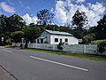
 | coordinates) Upper Brookfield is an outer western suburb in the City of Brisbane, Queensland, Australia. In the 2016 census, Upper Brookfield had a population... 15 KB (1,446 words) - 09:30, 30 December 2023 |
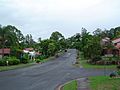
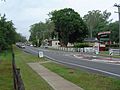 | (secondary coordinates) Brookfield is a rural residential suburb in the City of Brisbane, Queensland, Australia. In the 2021 census, Brookfield had a population... 25 KB (2,381 words) - 14:18, 7 January 2024 |
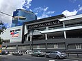
 | Kenmore today. In the 1890s the Queensland Parliament approved the construction of a rail line from Indooroopilly to Brookfield, running through the southern... 25 KB (2,379 words) - 11:39, 27 September 2023 |
 | metres (230 ft) above sea level. Kenmore Hills originally formed part of Brookfield, but in 1969 the name was changed to Kenmore Hills, based on the neighbouring... 10 KB (840 words) - 22:12, 12 July 2023 |
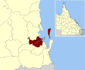 | City of Brisbane (redirect from City of Brisbane, Queensland) Toowong Upper Brookfield Upper Kedron Westlake Total: 43 Bulwer Cowan Cowan Kooringal Moreton Bay Moreton Island Total: 5 The Government of Queensland created... 50 KB (2,174 words) - 05:49, 4 May 2024 |
 | residents) is an inner suburb of the City of Brisbane, the state capital of Queensland, Australia. In the 2021 census, Fortitude Valley had a population of 9... 49 KB (5,073 words) - 20:52, 11 April 2024 |
 | (/ˌkuːpəˈruː/ KOO-pə-ROO) is a suburb in the inner City of Brisbane, Queensland, Australia. In the 2021 census, Coorparoo had a population of 18,132 people... 56 KB (5,740 words) - 00:50, 12 April 2024 |
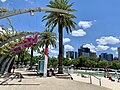 | coordinates) South Brisbane is an inner southern suburb in the City of Brisbane, Queensland, Australia. In the 2016 census, South Brisbane had a population of 7,196... 79 KB (7,902 words) - 21:04, 11 April 2024 |
Gold Creek rises in Brisbane Forest Park in the suburb of Upper Brookfield, Brisbane, Queensland, Australia; is dammed by Gold Creek Dam and on leaving the... 825 bytes (75 words) - 12:29, 16 December 2020 |
 | List of museums in Brisbane (category Lists of tourist attractions in Queensland) Retrieved 8 May 2021. "The Brookfield District Museum: Collecting, Preserving, and Sharing Brookfield and Upper Brookfield History". KenmoreNews. Archived... 14 KB (238 words) - 23:52, 11 February 2024 |
 | coordinates) West End is an inner southern suburb in the City of Brisbane, Queensland, Australia. In the 2016 census, West End had a population of 9,474 people... 52 KB (5,180 words) - 21:07, 11 April 2024 |
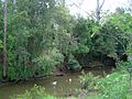 | Moggill Creek (redirect from Moggill Creek, Queensland) Brisbane Forest Park in Kholo and Pullenvale, flowing through Upper Brookfield, Brookfield and joining the Brisbane River at Kenmore. Before entering the... 6 KB (500 words) - 00:09, 20 March 2024 |
 | (secondary coordinates) Upper Mount Gravatt is a southern suburb in the City of Brisbane, Queensland, Australia. In the 2016 census, Upper Mount Gravatt had... 16 KB (1,531 words) - 10:21, 5 December 2023 |
Division of Ryan (category Federal politics in Queensland) part) Pinjarra Hills Pullenvale St Lucia Taringa The Gap Toowong Upper Brookfield Upper Kedron corporateName=Australian Electoral Commission; address=10... 11 KB (441 words) - 09:51, 27 April 2024 |
 | is a coastal northern suburb of the City of Brisbane, in the state of Queensland, in Australia. In the 2021 census, Brighton had a population of 9,664... 32 KB (3,282 words) - 22:56, 11 March 2024 |
 | coordinates) Mount Gravatt is a southern suburb of the City of Brisbane, Queensland, Australia and a prominent hill and lookout within this suburb (27°32′34″S... 18 KB (1,667 words) - 06:05, 18 April 2024 |
 | coordinates) Mount Coot-tha is a mountain and a suburb of the City of Brisbane, Queensland, Australia. Visible from much of the city, Mount Coot-tha is a popular... 36 KB (3,403 words) - 18:21, 17 September 2023 |
 | coordinates) Spring Hill is an inner northern suburb in the City of Brisbane, Queensland, Australia. In the 2016 census, Spring Hill had a population of 5,974... 26 KB (2,867 words) - 00:29, 25 April 2024 |
 | coordinates) Milton is a riverside inner suburb of the City of Brisbane, Queensland, Australia. In the 2021 census, Milton had a population of 3,144 people... 34 KB (3,489 words) - 07:43, 5 March 2024 |
 | coordinates) Darra is a south-western suburb in the City of Brisbane, Queensland, Australia. In the 2016 census, Darra had a population of 4,343 people... 18 KB (1,828 words) - 12:12, 13 March 2024 |
 | riverside suburb 7.8 kilometres (4.8 mi) south-west of the Brisbane CBD, Queensland, Australia. In the 2021 census, Indooroopilly had a population of 13,622... 47 KB (4,497 words) - 05:48, 11 February 2024 |
 | (secondary coordinates) Bulimba is a suburb in the City of Brisbane, Queensland, Australia. In the 2016 census, Bulimba had a population of 6,843 people... 54 KB (5,409 words) - 00:42, 12 April 2024 |
 | (secondary coordinates) Chermside is a suburb in the City of Brisbane, Queensland, Australia. In the 2021 census, Chermside had a population of 11,426 people... 45 KB (4,342 words) - 08:37, 7 April 2024 |
 | Toowong (redirect from Toowong, Queensland) Toowong (/təˈwɒŋ/ tə-WONG) is a riverside suburb in the City of Brisbane, Queensland, Australia. In the 2021 census, Toowong had a population of 12,556 people... 56 KB (6,011 words) - 00:13, 28 April 2024 |
 | Inala is a south-western suburb in the City of Brisbane, Queensland, Australia. In the 2021 census, Inala had a population of 15,273 people. Inala is 22... 34 KB (3,422 words) - 23:04, 18 February 2024 |
 | New Farm is an inner northern riverside suburb in the City of Brisbane, Queensland, Australia. In the 2021 census, New Farm had a population of 12,454 people... 29 KB (2,920 words) - 20:56, 11 April 2024 |
 | coordinates) Kangaroo Point is an inner southern suburb in the City of Brisbane, Queensland, Australia. In the 2016 census, Kangaroo Point had a population of 8,063... 42 KB (4,501 words) - 11:14, 30 April 2024 |
 | Forest Lake is an outer south-western suburb of the City of Brisbane, Queensland, Australia. In the 2016 census, Forest Lake had a population of 22,904... 20 KB (2,012 words) - 09:20, 7 March 2024 |
 | Department of Disability Services Queensland on the upper level.[citation needed] The Oxley branch of the Queensland Country Women's Association meets... 39 KB (3,806 words) - 07:06, 2 January 2024 |
 | Woolloongabba (redirect from One Mile Swamp, Queensland) (/wʊlənˈɡæbə/ wuu-lən-GAB-ə) is an inner southern suburb in the City of Brisbane, Queensland, Australia. In the 2021 census, Woolloongabba had a population of 8,687... 50 KB (5,151 words) - 15:12, 5 May 2024 |