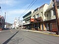
 | West Virginia Route 480 (WV 480) is a 5.64-mile-long (9.08 km) state highway in the U.S. state of West Virginia. Known for most of its length as Kearneysville... 13 KB (1,282 words) - 17:54, 23 December 2023 |
 | West Virginia Route 480 extends east to cross the Potomac River into Maryland, continuing as Maryland Route 34 towards Sharpsburg. Westward, WV 480 connects... 24 KB (2,349 words) - 20:10, 27 April 2024 |
 | of the route is at U.S. Route 340 west of Bolivar. The northern terminus of the route is at West Virginia Route 45 and West Virginia Route 480 in Shepherdstown... 2 KB (97 words) - 18:39, 16 February 2024 |
National Route 480 Interstate 480 Interstate 480N (unsigned) California State Route 480 (former) Maryland Route 480 Puerto Rico Highway 480 West Virginia Route 480... 1 KB (89 words) - 22:28, 4 April 2024 |
 | West Virginia Route 45 (WV 45) is a state highway in the U.S. state of West Virginia. The state highway runs 25.8 miles (41.5 km) from the Virginia state... 9 KB (591 words) - 18:38, 16 February 2024 |
 | Virginia State Route 311 (SR 311) and West Virginia Route 311 (WV 311) are adjoining state highways in the U.S. states of Virginia and West Virginia. The... 14 KB (936 words) - 01:34, 17 April 2024 |
 | the Potomac River, where it crosses into Shepherdstown, West Virginia, as West Virginia Route 480. MD 65 proceeds northward to a junction with Interstate... 20 KB (1,636 words) - 15:46, 6 April 2024 |
 | November 11, 2021, the final West Virginia portion of the highway has been expanded to four lanes, mostly along a completely new route. In Putnam County, the... 75 KB (5,763 words) - 11:22, 7 January 2024 |
 | West Virginia Route 9 (WV 9) is a major east–west state highway located in the eastern extents of West Virginia's Eastern Panhandle. The western terminus... 9 KB (558 words) - 11:29, 7 January 2024 |
 | U.S. Route 60 is a major east–west United States highway, traveling 2,655 miles (4,273 km) from southwestern Arizona to the Atlantic Ocean coast in Virginia... 50 KB (5,491 words) - 19:33, 6 April 2024 |
 | U.S. Route 60 in Virginia Beach, Virginia. Until 1996, when the Cumberland Gap Tunnel opened, US 58 ran only inside the commonwealth of Virginia (and... 47 KB (1,992 words) - 01:35, 21 April 2024 |
 | highway begins at the West Virginia state line at the Potomac River, where the highway continues south as West Virginia Route 480 (WV 480) through Shepherdstown... 14 KB (1,518 words) - 04:00, 18 May 2023 |
 | and 480 blackjacks – as well as large quantities of daggers, bayonets, and brass knuckles. On May 19, 1920, a shootout in Matewan, West Virginia, between... 22 KB (2,736 words) - 14:00, 19 February 2024 |
 | Piedmont is West Virginia Route 46. Route 46 continues west across the North Branch Potomac River into Westernport, Maryland. To the east, Route 46 heads... 16 KB (1,670 words) - 23:26, 14 April 2024 |
 | West Virginia Route 501 is a two-lane west–east connector route. It is known as Big Tyler Road, and starts at the unincorporated community of Tyler Mountain... 2 KB (111 words) - 18:39, 16 February 2024 |
 | Monongalia County, West Virginia, United States, situated along the Monongahela River. The most populous city in North Central West Virginia and the third-most... 60 KB (5,539 words) - 09:49, 2 April 2024 |
 | Interstate 77 (redirect from Interstate Route 77) mountainous state of West Virginia to the rolling farmlands of North Carolina and Ohio. It largely supplants the old U.S. Route 21 (US 21) between Cleveland... 18 KB (1,561 words) - 02:53, 30 January 2024 |
place (CDP) in northern Monongalia County, West Virginia, United States. It lies along West Virginia Route 7 northwest of the city of Morgantown, the... 5 KB (219 words) - 06:00, 13 July 2023 |
Route 1. USBR 76 runs from the Midwestern state of Kansas to the eastern seaboard state of Virginia. It is also known as the TransAmerica Bike Route and... 14 KB (1,207 words) - 12:37, 28 April 2023 |
 | West Virginia Route 115 (WV 115) is a state highway running north to south in West Virginia's Eastern Panhandle. The southern terminus of the route is... 6 KB (380 words) - 23:43, 18 May 2023 |
 | Interstate 66 (redirect from Interstate 266 (Virginia)) with U.S. Route 29 (US 29) in Washington, D.C., at the eastern terminus. Much of the route parallels US 29 or State Route 55 (SR 55) in Virginia. I-66 has... 60 KB (4,973 words) - 21:51, 2 April 2024 |
 | enters Virginia from Bristol, Tennessee, and leaves Virginia into Berkeley County, West Virginia. The route passes through the cities of Bristol, Roanoke,... 50 KB (3,737 words) - 16:18, 29 April 2024 |
 | Route 48 U.S. Route 50 U.S. Route 220 West Virginia Route 28 West Virginia Route 42 West Virginia Route 55 West Virginia Route 93 Mineral County (northeast)... 25 KB (1,980 words) - 03:15, 8 March 2024 |
nine bicycle routes designated by the North Carolina Department of Transportation. It runs along North Carolina's coast for 300 miles (480 km) from South... 12 KB (941 words) - 06:52, 25 February 2024 |
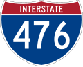 | Interstate 476 (redirect from Interstate 480 (Pennsylvania)) including I-76 (Schuylkill Expressway) in West Conshohocken, I-276 (Pennsylvania Turnpike) in Plymouth Meeting, U.S. Route 22 (US 22) near Allentown, and I-80... 71 KB (6,798 words) - 03:30, 26 April 2024 |
 | Mountains of West Virginia is a list of mountains in the U.S. state of West Virginia. This list includes mountains in the Appalachian range, which covers... 5 KB (72 words) - 05:50, 12 December 2023 |
 | Route 250 (US 250) and West Virginia Route 2 (WV 2) on the eastern banks of the Ohio River was thought to be the most complex interchange in West Virginia's... 27 KB (2,362 words) - 15:25, 7 January 2024 |
 | Area codes 304 and 681 (redirect from List of West Virginia area codes) number (681-990-TEST (8378)) for testing proper routing to the new area code from any West Virginia telephone number went into service on December 28... 136 KB (777 words) - 20:23, 25 November 2023 |
 | County, Virginia, United States. The lake flows into Isaacs Creek, an east-flowing tributary of Back Creek, which flows north through West Virginia to the... 4 KB (425 words) - 06:01, 11 July 2023 |
unincorporated community in Gilmer County, West Virginia, United States. Perkins is located along County Route 52, 11.4 miles (18.3 km) south-southwest... 3 KB (145 words) - 21:54, 27 July 2023 |