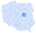
 | Masovian Voivodeship (redirect from Województwo mazowieckie) Masovian Voivodeship (Polish: województwo mazowieckie, pronounced [vɔjɛˈvut͡stfɔ mazɔˈvjɛt͡skʲɛ] ) is a voivodeship (province) in east-central Poland... 31 KB (1,343 words) - 03:13, 4 May 2024 |
Faustynowo, Masovian Voivodeship (redirect from Faustynowo (województwo mazowieckie)) Faustynowo [faustɨˈnɔvɔ] is a village in the administrative district of Gmina Glinojeck, within Ciechanów County, Masovian Voivodeship, in east-central... 1 KB (67 words) - 09:30, 5 July 2023 |
 | Masovian Voivodeship (Polish: Województwo Mazowieckie) was an administrative region of the Kingdom of Poland, and of the Polish–Lithuanian Commonwealth... 6 KB (522 words) - 11:35, 2 August 2022 |
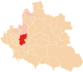
 | Gniewoszów, Masovian Voivodeship (redirect from Gniewoszów (województwo mazowieckie)) Gniewoszów [ɡɲɛˈvɔʂuf] is a village in Kozienice County, Masovian Voivodeship, in east-central Poland. It is the seat of the gmina (administrative district)... 6 KB (529 words) - 09:03, 7 July 2023 |
 | – Wybory 2006 "Wybory Samorządowe 2010 - Geografia wyborcza - Województwo mazowieckie". wybory2010.pkw.gov.pl. National Electoral Commission. Retrieved... 17 KB (450 words) - 01:42, 7 May 2024 |
 | Voivodeship (województwo płockie, Płock) Rawa Voivodeship (województwo rawskie, Rawa Mazowiecka) Masovian Voivodeship (województwo mazowieckie, Warszawa)... 51 KB (2,336 words) - 17:20, 15 April 2024 |
 | Voivodeship (województwo mazowieckie, of Mazowsze, Warsaw) Poznań Voivodeship (województwo poznańskie, Poznań) Płock Voivodeship (województwo płockie, Płock)... 39 KB (4,074 words) - 20:04, 2 May 2024 |
 | "Wybory do sejmików województw: wyniki głosowania i wyniki wyborów – Województwo mazowieckie". Państwowa Komisja Wyborcza. 2002. Retrieved 18 December 2019... 40 KB (4,083 words) - 09:38, 13 April 2024 |
 | PL114 Łódzki PL115 Piotrkowski PL116 Sieradzki PL117 Skierniewicki PL12 Mazowieckie PL121 Ciechanowsko-płocki PL122 Ostrołęcko-siedlecki PL127 Miasto Warszawa... 13 KB (560 words) - 13:25, 9 January 2024 |
 | 8 April 2024. "Wybory Samorządowe 2010 - Geografia wyborcza - Województwo mazowieckie - miasto st. Warszawa: Wyniki wyborów do rady". wybory2010.pkw... 25 KB (1,379 words) - 22:41, 6 May 2024 |
 | Immigrants of Mezritch Depodalsia. Accessed June 16, 2011. Przysucha, województwo Mazowieckie, Polska. Haapalah Index and Source Database. Accessed July 5, 2011... 93 KB (2,911 words) - 19:00, 25 October 2023 |
 | law in Poland "Wybory Samorządowe 2010 - Geografia wyborcza - Województwo mazowieckie - miasto st. Warszawa". wybory2010.pkw.gov.pl (in Polish). Retrieved... 7 KB (859 words) - 19:25, 22 April 2023 |
 | 2015. Państwowa Komisja Wyborcza. Retrieved 28 October 2023. "Województwo mazowieckie. Wybory samorządowe 2018". Wybory 2018. Państwowa Komisja Wyborcza... 9 KB (520 words) - 07:52, 4 May 2024 |
 | South Netherlands Netherlands 151,980 40,600 132,721 37,300 124 Województwo Mazowieckie Poland 33,500 112 Central Poland Poland 18,000 60 South Poland... 49 KB (414 words) - 04:21, 7 January 2024 |
 | Podlaskie Voivodeship (redirect from Województwo podlaskie) Podlaskie Voivodeship (Polish: Województwo podlaskie [vɔjɛˈvut͡stfɔ pɔˈdlaskʲɛ] ) is a voivodeship (province) in northeastern Poland. The name of the... 33 KB (2,799 words) - 12:32, 7 May 2024 |
(57 mi) north of Warsaw. https://www.polskawliczbach.pl/wies_Kolaki_mazowieckie "Central Statistical Office (GUS) - TERYT (National Register of Territorial... 2 KB (76 words) - 18:49, 15 April 2024 |
 | Dituel Sp. z. "Wybory Samorządowe 2010 - Geografia wyborcza - Województwo mazowieckie - Powiat pruszkowski - gm. Brwinów". wybory2010.pkw.gov.pl. Retrieved... 3 KB (282 words) - 21:40, 29 August 2023 |
 | pl. National Electoral Commission. Retrieved 22 October 2023. "Województwo mazowieckie". "Sejm: W podwarszawskim okręgu wygrywa KO zdobywając 35,23 proc... 8 KB (224 words) - 10:31, 13 April 2024 |
 | [[:pl:Złotopole (województwo mazowieckie)]]; see its history for attribution. You may also add the template {{Translated|pl|Złotopole (województwo mazowieckie)}} to... 1 KB (41 words) - 03:30, 29 July 2023 |
"Tabela klasyfikacji DEGURBA-województwo mazowieckie" [The degree of urbanisation (DEGURBA) classification table - Mazowieckie voivodship]. Podział Jednostek... 4 KB (223 words) - 15:01, 14 April 2020 |
(in Polish). 2008-06-01. "Cielechowizna, Mińsk Mazowiecki, Powiat miński, Województwo Mazowieckie, Poland". Mindat.org. Retrieved 10 March 2020. v t e... 2 KB (83 words) - 08:38, 4 July 2023 |
 | Retrieved 19 November 2023. "Posłowie: Lista wg okręgów wyborczych - Województwo mazowieckie" (in Polish). Warsaw, Poland: Sejm. Retrieved 19 November 2023... 118 KB (3,852 words) - 10:30, 13 April 2024 |
"Enom Status". "Enom Status". "Enom Status". "Enom Status". pl:Jednorożec (województwo mazowieckie) Polish Wikipedia[circular reference] Village website... 14 KB (1,602 words) - 05:00, 24 September 2023 |
 | Sochaczew, Żuromin, and Żyrardów, and the city county of Płock. "Województwo mazowieckie". 52°33′00″N 19°42′00″E / 52.550000°N 19.700000°E / 52.550000;... 4 KB (78 words) - 10:31, 13 April 2024 |
 | and Wyszków, and the city counties of Ostrołęka and Siedlce. "Województwo mazowieckie". 52°09′00″N 22°16′00″E / 52.150000°N 22.266667°E / 52.150000;... 4 KB (82 words) - 10:32, 13 April 2024 |
 | "Tabela klasyfikacji DEGURBA-województwo mazowieckie" [The Degree of urbanisation (DEGURBA) classification table - Mazowieckie voivodship]. Podział Jednostek... 6 KB (431 words) - 23:38, 17 July 2023 |
 | Gmina Sieciechów Polish: Public Information Bulletin for Gmina Sieciechów Wikimedia Commons has media related to Zajezierze (województwo mazowieckie).... 3 KB (173 words) - 07:41, 28 July 2023 |
of Territorial Land Apportionment Journal)" (in Polish). 2008-06-01. "Zakącie, Garwolin, Powiat garwoliński, Województwo Mazowieckie, Poland". v t e... 2 KB (80 words) - 07:49, 28 July 2023 |
 | Czersk County (seat: Czersk) Warsaw County (seat: Warsaw) Polish: Województwo mazowieckie Dziennik Praw Królestwa Polskiego, no 2. vol. 1. Warsaw. 1816.... 6 KB (247 words) - 16:09, 9 March 2024 |
Libicki, Marcin (2009). Dwory i pałace wiejskie na Mazowszu (obecne województwo mazowieckie). Dom Wydawniczy Rebis. ISBN 978-83-7301-826-6. 51°38′17.08″N 20°32′42... 3 KB (519 words) - 22:59, 16 December 2023 |