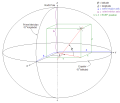
 | The World Geodetic System (WGS) is a standard used in cartography, geodesy, and satellite navigation including GPS. The current version, WGS 84, defines... 24 KB (2,809 words) - 05:56, 18 March 2024 |
 | December 25, 2018. National Geospatial Intelligence Agency. "World Geodetic System 1984 datasheet" (PDF). United Nations Office for Outer Space Affairs... 9 KB (904 words) - 13:39, 7 January 2024 |
 | Web Mercator projection (category Geographic coordinate systems) MEMBER["World Geodetic System 1984 (Transit)", ID["EPSG",1166]], MEMBER["World Geodetic System 1984 (G730)", ID["EPSG",1152]], MEMBER["World Geodetic System 1984... 15 KB (1,702 words) - 11:03, 26 January 2024 |
reference for the determining of locators should be based on the World Geodetic System 1984 (WGS-84). A Maidenhead locator compresses latitude and longitude... 16 KB (1,933 words) - 01:48, 16 April 2024 |
 | The European Terrestrial Reference System 1989 (ETRS89) is an ECEF (Earth-Centered, Earth-Fixed) geodetic Cartesian reference frame, in which the Eurasian... 6 KB (585 words) - 18:43, 20 March 2024 |
 | Earth ellipsoid (section Geodetic coordinates) TR8350.2, "Department of Defense World Geodetic System 1984, Its Definition and Relationships With Local Geodetic Systems", Third Edition, 4 July 1997 [1]... 19 KB (2,424 words) - 23:35, 14 April 2024 |
 | Geographical distance (redirect from Geodetic distance) Geographical distance or geodetic distance is the distance measured along the surface of the Earth, or the shortest arch length. The formulae in this article... 23 KB (3,278 words) - 08:57, 29 March 2024 |
 | Satellite geodesy (redirect from Space geodetic techniques) worldwide triangulation networks allowed for the establishment of the World Geodetic System. The development of GPS by the United States in the 1980s allowed... 21 KB (2,338 words) - 20:20, 13 April 2024 |
 | The Hellenic Geodetic Reference System 1987 or HGRS87 (Greek: Ελληνικό Γεωδαιτικό Σύστημα Αναφοράς 1987 or ΕΓΣΑ'87) is a geodetic system commonly used... 7 KB (827 words) - 10:07, 15 December 2023 |
 | Geo URI scheme (category Geographic information systems) make sense when a coordinate reference system (CRS) is specified. The default CRS is the World Geodetic System 1984 (WGS-84), and it is not recommended to... 14 KB (1,850 words) - 08:23, 8 December 2023 |
 | The National Spatial Reference System (NSRS), managed by the National Geodetic Survey (NGS), is a coordinate system that includes latitude, longitude,... 6 KB (555 words) - 16:13, 16 April 2024 |
Geographic coordinate conversion (category Geographic coordinate systems) 2017-01-10. "DEPARTMENT OF DEFENSE WORLD GEODETIC SYSTEM 1984 Its Definition and Relationships with Local Geodetic Systems" (PDF). National Imagery and Mapping... 34 KB (5,145 words) - 23:49, 2 December 2023 |
 | also known as MGRS-New, which is used for WGS84 and some other modern geodetic datums, the letter for the first row – just north of the equator – is A... 15 KB (2,133 words) - 06:55, 13 February 2024 |
 | map projection (with specific parameters), a choice of geodetic datum to bind the coordinate system to real locations on the earth, an origin point, and... 21 KB (2,802 words) - 02:18, 12 April 2024 |
g=g_{45}=} 9.80665 m/s2 (32.1740 ft/s2) based upon data from World Geodetic System 1984 (WGS-84), where g {\displaystyle g} is understood to be pointing... 20 KB (3,502 words) - 11:34, 9 April 2024 |
 | South American Datum (category Geodetic datums) of Geography and History. It uses as reference ellipsoid the Geodetic Reference System 1967 (GRS-67), recommended by the International Union of Geodesy... 2 KB (255 words) - 20:02, 13 August 2023 |
 | position, the height of the geoid (e.g., the EGM96 geoid) over the World Geodetic System (WGS) ellipsoid. They are then able to correct the height above... 26 KB (3,056 words) - 23:24, 18 April 2024 |
地形图非线性保密处理算法; lit. 'Topographic map non-linear confidentiality algorithm') is a geodetic datum used by the Chinese State Bureau of Surveying and Mapping (Chinese:... 28 KB (2,997 words) - 22:54, 4 March 2024 |
 | ED50 (category Geographic coordinate systems) a geodetic datum which was defined after World War II for the international connection of geodetic networks. Some of the important battles of World War... 8 KB (928 words) - 18:08, 2 August 2023 |


