
 French
 Deutsch
Adolph, West Virginia
Adolph, West Virginia | |
|---|---|
 Adolph  Adolph | |
| Coordinates: 38°44′40″N 80°2′44″W / 38.74444°N 80.04556°W | |
| Country | United States |
| State | West Virginia |
| County | Randolph |
| Elevation | 2,313 ft (705 m) |
| Time zone | UTC-5 (Eastern (EST)) |
| • Summer (DST) | UTC-4 (EDT) |
| GNIS feature ID | 1553697[1] |
Adolph is an unincorporated community in Randolph County, West Virginia, United States. Originally known as West Huttonsville, Adolph was named by the Board on Geographic Names in 1977.[1] The first settlement at Adolph was made in the early 1880s.[2] Adolph is located on Helvetia-Adolph Road, at the confluence where Kittle Creek and Birch Fork join to form the Middle Fork River.[1][3]
References
[edit]- ^ a b c d U.S. Geological Survey Geographic Names Information System: Adolph, West Virginia
- ^ Kenny, Hamill (1945). West Virginia Place Names: Their Origin and Meaning, Including the Nomenclature of the Streams and Mountains. Piedmont, WV: The Place Name Press. p. 73.
- ^ Adolph Quadrangle, West Virginia (Map). 1 : 24,000. 7.5 Minute Series (Topographic). United States Geological Survey. 2023. Retrieved April 5, 2025.
Municipalities and communities of Randolph County, West Virginia, United States | ||
|---|---|---|
| City | 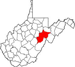 | |
| Towns | ||
| CDPs | ||
| Other communities |
| |
| Ghost towns | ||
| Footnotes | ‡This populated place also has portions in an adjacent county or counties | |
This article about a location in Randolph County, West Virginia is a stub. You can help Wikipedia by expanding it. |