
 French
 Deutsch
Concord (CDP), Vermont
Concord, Vermont | |
|---|---|
_highlighted.svg) Location in Essex County and the state of Vermont. | |
| Coordinates: 44°25′43″N 71°53′18″W / 44.42861°N 71.88833°W | |
| Country | United States |
| State | Vermont |
| County | Essex |
| Town | Concord |
| Area | |
• Total | 1.13 sq mi (2.92 km2) |
| • Land | 1.10 sq mi (2.85 km2) |
| • Water | 0.03 sq mi (0.07 km2) |
| Elevation | 880 ft (270 m) |
| Population | |
• Total | 271 |
| • Density | 247/sq mi (95.2/km2) |
| Time zone | UTC-5 (Eastern (EST)) |
| • Summer (DST) | UTC-4 (EDT) |
| ZIP code | 05824[2] |
| Area code | 802 |
| GNIS feature ID | 1456992[3] |
| FIPS code | 50-15175 |
Concord is a census-designated place comprising the main settlement in the town of Concord, Essex County, Vermont, United States. As of the 2010 census, it had a population of 271,[1] out of a total town population of 1,235. It was an incorporated village for much of the 20th century, disincorporating in 1969.
The Concord CDP is in the western part of the town of Concord, along the Moose River, a west-flowing tributary of the Passumpsic River and part of the Connecticut River basin. U.S. Route 2 passes through the center of the CDP, leading west 8 miles (13 km) to St. Johnsbury and east 20 miles (32 km) to Lancaster, New Hampshire.
The Concord CDP has a total area of 1.1 square miles (2.9 km2), of which 0.027 square miles (0.07 km2), or 2.50%, is water.[1]
References
[edit]- ^ a b c d "Geographic Identifiers: 2010 Census Summary File 1 (G001): Concord CDP, Vermont". American Factfinder. U.S. Census Bureau. Archived from the original on February 13, 2020. Retrieved April 8, 2016.
- ^ United States Postal Service (2016). "USPS - Look Up a ZIP Code". Retrieved April 8, 2016.
- ^ "Canaan". Geographic Names Information System. United States Geological Survey, United States Department of the Interior.
Municipalities and communities of Essex County, Vermont, United States | ||
|---|---|---|
| Towns | 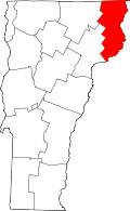 | |
| CDPs | ||
| Grants and gores | ||
| Other community | ||
| Footnotes | ‡ Unorganized | |
This article about a location in Vermont is a stub. You can help Wikipedia by expanding it. |