
 French
 Deutsch
File:Atlantic Ocean laea location map.svg

Size of this PNG preview of this SVG file: 491 × 599 pixels. Other resolutions: 197 × 240 pixels | 393 × 480 pixels | 629 × 768 pixels | 839 × 1,024 pixels | 1,679 × 2,048 pixels | 709 × 865 pixels.
Original file (SVG file, nominally 709 × 865 pixels, file size: 274 KB)
| This is a file from the Wikimedia Commons. Information from its description page there is shown below. Commons is a freely licensed media file repository. You can help. |
Summary
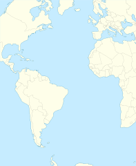
| Description | English: Relief location map of Atlantic_Ocean.
|
| Date | |
| Source | Own work |
| Author | Tentotwo |
Shell script for generating the map using GMT archive copy at the Wayback Machine
#!/bin/sh # Set common options PROJECTION=A-35.0/0.0/180/19.998266666666666c REGION=-147.58842045747764/-48.58942183011819/77.58842045747762/48.589421830118205r FILENAME=Atlantic_Ocean_laea_location_map.ps # Get Natural Earth datafiles echo "Downloading datafiles from naturalearthdata.com" wget -nv -nc \ http://www.naturalearthdata.com/http//www.naturalearthdata.com/download/110m/physical/110m-coastline.zip\ http://www.naturalearthdata.com/http//www.naturalearthdata.com/download/110m/physical/110m-land.zip\ http://www.naturalearthdata.com/http//www.naturalearthdata.com/download/110m/cultural/110m-admin-0-boundary-lines.zip echo "...done\n" echo "Inflating archives" unzip 110m\*.zip echo "...done\n" echo "Converting shapefiles to GMT" ogr2ogr -F GMT 110m_land.gmt 110m_land.shp ogr2ogr -F GMT 110m_coastline.gmt 110m_coastline.shp ogr2ogr -F GMT 110m_borders.gmt ne_110m_admin_0_boundary_lines_land.shp echo "...done\n" echo "Creating maps" GMT psxy -m -J$PROJECTION -R$REGION -Bg15 -P --PAGE_COLOR=198/236/255 --POLAR_CAP=none --BASEMAP_TYPE=plain --BASEMAP_AXES=NESW --FRAME_PEN=0.15p,black 110m_land.gmt -K -G254/254/233 > $FILENAME GMT psxy -m -J$PROJECTION -R$REGION 110m_coastline.gmt -O -K -W0.535p,9/120/171 >> $FILENAME GMT psxy -m -J$PROJECTION -R$REGION 110m_borders.gmt -O -W100/100/100 >> $FILENAME echo "...done\n" echo "You can now open $FILENAME in Inkscape to clean up the file and save it as SVG. You should add an ocean coloured background and simplify the graticules using CTRL+L." gv $FILENAME Licensing
I, the copyright holder of this work, hereby publish it under the following license:
This file is licensed under the Creative Commons Attribution-Share Alike 3.0 Unported license.
- You are free:
- to share – to copy, distribute and transmit the work
- to remix – to adapt the work
- Under the following conditions:
- attribution – You must give appropriate credit, provide a link to the license, and indicate if changes were made. You may do so in any reasonable manner, but not in any way that suggests the licensor endorses you or your use.
- share alike – If you remix, transform, or build upon the material, you must distribute your contributions under the same or compatible license as the original.
File history
Click on a date/time to view the file as it appeared at that time.
| Date/Time | Thumbnail | Dimensions | User | Comment | |
|---|---|---|---|---|---|
| current | 21:19, 31 January 2012 | | 709 × 865 (274 KB) | Tentotwo | Corrected colour of black sea |
| 21:17, 31 January 2012 |  | 709 × 865 (298 KB) | Tentotwo | Included border of South Sudan | |
| 13:38, 31 January 2012 |  | 709 × 865 (248 KB) | Tentotwo | Removed grid line | |
| 13:36, 31 January 2012 |  | 709 × 865 (239 KB) | Tentotwo |
File usage
The following pages on the English Wikipedia use this file (pages on other projects are not listed):
- 2017 Basketball Champions League Final Four
- Abrolhos Archipelago
- Annobón
- Bird Island, South Georgia
- Bugio Island
- Caryn Seamount
- Cheeki Rafiki
- Deserta Grande Island
- Desertas Islands
- Dom João de Castro Bank
- Eltanin impact
- Faure Islands
- Frankfurt Seamount
- HX convoys
- Hibernia oil field
- Ilhabela
- Ilhéu Chão
- Laconia incident
- Middle Island, Tristan da Cunha
- Muir Seamount
- Newfoundland Seamounts
- Nightingale Islands
- Pilancones
- Puerto de las Nieves
- RAF Ascension Island
- Roca Islands
- Roncador Bank
- Saxemberg Island
- Sedlo Seamount
- South Shetland Trough
- St. Matthew Island (phantom island)
- Stoltenhoff Island
- Terra Nova oil field
- Thompson Island (South Atlantic)
- Vila Baleira
- Zavodovski Island
- Module:Location map/data/Atlantic Ocean
- Module:Location map/data/Atlantic Ocean/doc
Global file usage
The following other wikis use this file:
- Usage on af.wikipedia.org
- Usage on als.wikipedia.org
- Usage on ar.wikipedia.org
- Usage on ast.wikipedia.org
- Usage on azb.wikipedia.org
- Usage on be-tarask.wikipedia.org
- Usage on be.wikipedia.org
- Usage on ceb.wikipedia.org
- Plantilya:Location map Atlantic Ocean
- South Point
- Scotts Hill
- Saddle Hill
- The Ridge
- Pillar Rock
- James Bay
- Castle Hill
- Bird Island
- North Point
- West Point
- Sandy Point
- Black Point
- Powell Point
- Black Rock
- Egg Island
- East Point
- White Rock
- White Point
- Whale Point
- Long Point
- The Bluff
- Middle Point
- Crown Point
- Channel Rock
- Cave Point
- Blue Hill
- South West Point
- White Bluff
- Sandy Bay
- George Island
View more global usage of this file.