
 French
 Deutsch
File:Blank Map World Secondary Political Divisions.svg

Size of this PNG preview of this SVG file: 512 × 260 pixels. Other resolutions: 320 × 163 pixels | 640 × 325 pixels | 1,024 × 520 pixels | 1,280 × 650 pixels | 2,560 × 1,300 pixels.
Original file (SVG file, nominally 512 × 260 pixels, file size: 3.18 MB)
| This is a file from the Wikimedia Commons. Information from its description page there is shown below. Commons is a freely licensed media file repository. You can help. |
| This file may be updated to reflect new information. If you wish to use a specific version of the file without it being overwritten, please upload the required version as a separate file. |
Summary
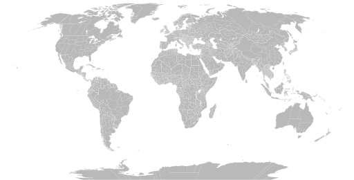
| Description | English: A detailed Robinson projection SVG map of the world with secondary political units grouped for easy coloring. |
| Date | |
| Source | |
| Author |
|
Licensing
I, the copyright holder of this work, hereby publish it under the following license:
| This file is made available under the Creative Commons CC0 1.0 Universal Public Domain Dedication. | |
| The person who associated a work with this deed has dedicated the work to the public domain by waiving all of their rights to the work worldwide under copyright law, including all related and neighboring rights, to the extent allowed by law. You can copy, modify, distribute and perform the work, even for commercial purposes, all without asking permission.
|
Any autoconfirmed user can overwrite this file from the same source. Please ensure that overwrites comply with the guideline.
File history
Click on a date/time to view the file as it appeared at that time.
| Date/Time | Thumbnail | Dimensions | User | Comment | |
|---|---|---|---|---|---|
| current | 03:39, 15 May 2025 | | 512 × 260 (3.18 MB) | ClaveScottPH | Major changes |
| 07:41, 6 May 2025 |  | 512 × 260 (3.19 MB) | Gengeros | antarctica fixed | |
| 10:36, 5 May 2025 |  | 512 × 260 (3.12 MB) | ClaveScottPH | Fixed Bahamas and Turks and Caicos Islands' position. | |
| 10:31, 5 May 2025 |  | 512 × 260 (3.12 MB) | ClaveScottPH | Major changes; updated subdivisions for Bahamas and Botswana. | |
| 10:05, 29 April 2025 |  | 512 × 260 (3.1 MB) | ClaveScottPH | Major changes. | |
| 08:59, 28 April 2025 |  | 512 × 260 (2.79 MB) | ClaveScottPH | Updated Bhutan. | |
| 13:10, 24 April 2025 |  | 512 × 260 (2.77 MB) | ClaveScottPH | Updated Bangladesh. | |
| 06:57, 23 April 2025 |  | 512 × 260 (2.69 MB) | ClaveScottPH | Fixed subdivisions for Finland, Mexico, and Panama. Recolored everything. | |
| 20:02, 3 April 2025 |  | 512 × 260 (2.38 MB) | Golden | Reverted to version as of 18:31, 10 August 2024 (UTC) outdated version | |
| 12:42, 3 April 2025 |  | 2,560 × 1,314 (4.59 MB) | BlueEagleNumber101 | Reverted to version as of 19:10, 28 May 2022 (UTC) |
File usage
The following 8 pages use this file:
- Administrative division
- Government
- User:Naqsh-e hJahan/List of provinces
- User talk:Naqsh-e hJahan/List of provinces
- Wikipedia:Blank maps
- Wikipedia:Graphics Lab/Illustration workshop/Archive/Jun 2023
- Wikipedia:Graphics Lab/Map workshop/Archive/Jul 2023
- Wikipedia:Graphics Lab/Map workshop/Archive/May 2011
Global file usage
The following other wikis use this file:
- Usage on bn.wikipedia.org
- Usage on bs.wikipedia.org
- Usage on ja.wikipedia.org
- Usage on ne.wikipedia.org
- Usage on sq.wikipedia.org
- Usage on sr.wikipedia.org
- Usage on te.wikipedia.org
- Usage on tr.wikipedia.org
- Usage on zh-yue.wikipedia.org
- Usage on zh.wikipedia.org