
 French
 Deutsch
File:Boston1692.jpg
Size of this preview: 483 × 600 pixels. Other resolutions: 193 × 240 pixels | 387 × 480 pixels | 619 × 768 pixels | 1,024 × 1,271 pixels.
Original file (1,024 × 1,271 pixels, file size: 487 KB, MIME type: image/jpeg)
| This is a file from the Wikimedia Commons. Information from its description page there is shown below. Commons is a freely licensed media file repository. You can help. |
Summary
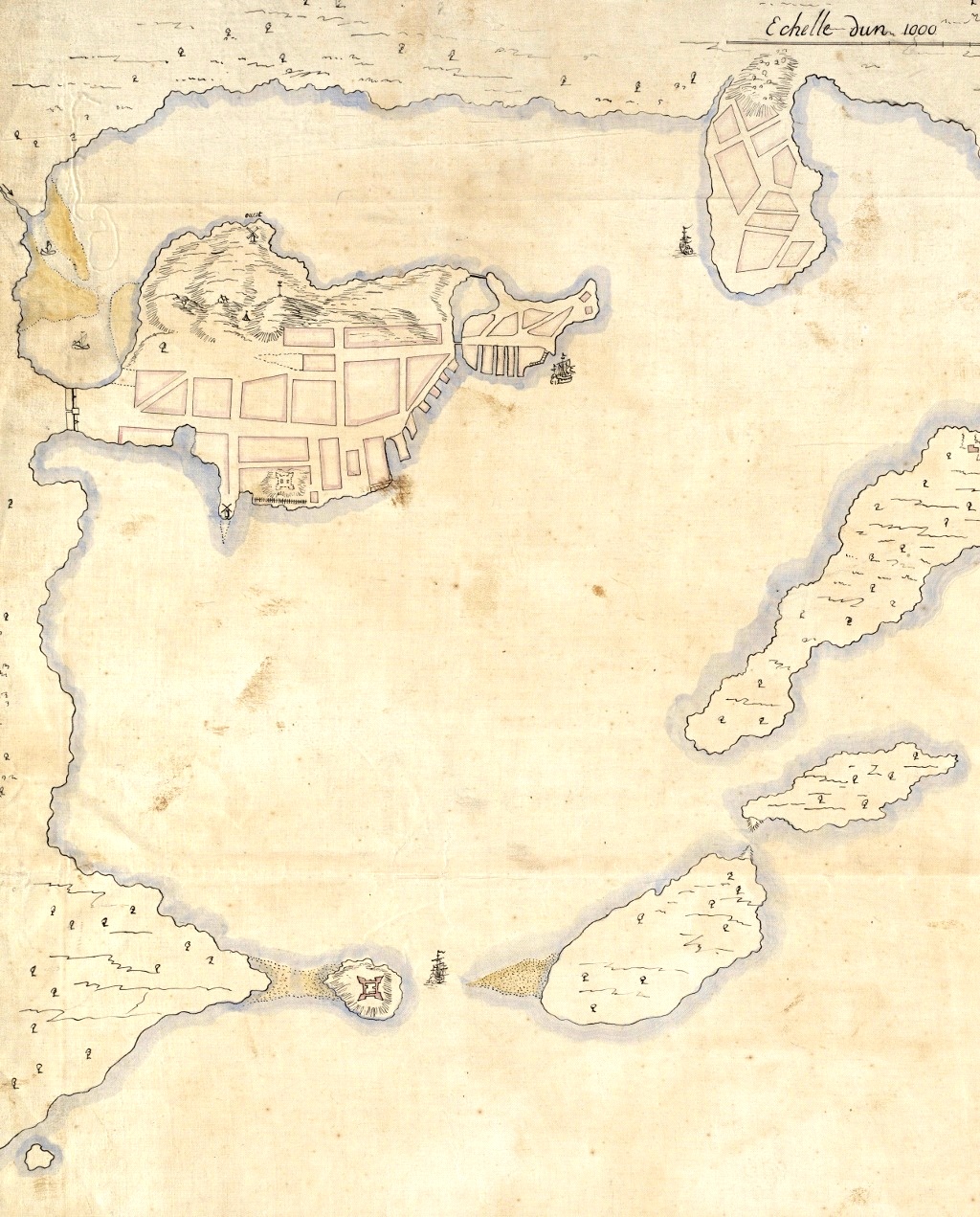
| Description | Detail from a 1692 French map of Boston harbor. The Shawmut Peninsula, site of Boston is in the upper left, with Charlestown top center. Castle Island is visible to the lower left. |
| Date | |
| Source | Boston Public Library digital map collection: http://maps.bpl.org/details_10927/ |
| Author | Pierre d'Au de Jolliet |
| Other versions |
|
.jpg)
Licensing
| This is a faithful photographic reproduction of a two-dimensional, public domain work of art. The work of art itself is in the public domain for the following reason:
The official position taken by the Wikimedia Foundation is that "faithful reproductions of two-dimensional public domain works of art are public domain". This photographic reproduction is therefore also considered to be in the public domain in the United States. In other jurisdictions, re-use of this content may be restricted; see Reuse of PD-Art photographs for details. | ||||
File history
Click on a date/time to view the file as it appeared at that time.
| Date/Time | Thumbnail | Dimensions | User | Comment | |
|---|---|---|---|---|---|
| current | 03:34, 14 April 2011 | | 1,024 × 1,271 (487 KB) | Magicpiano | Contrast, brightness, level adjustments. |
| 21:00, 13 April 2011 |  | 1,024 × 1,271 (422 KB) | Magicpiano | {{Information |Description=Detail from a 1692 French map of Boston harbor. The Shawmut Peninsula, site of Boston is in the upper left, with Charlestown top center. Castle Island is visible to the lower left. |Source=Boston Public Library digital map col |
File usage
The following pages on the English Wikipedia use this file (pages on other projects are not listed):
Global file usage
The following other wikis use this file:
- Usage on ar.wikipedia.org
- Usage on ca.wikipedia.org
- Usage on de.wikipedia.org
- Usage on es.wikipedia.org
- Usage on fr.wikipedia.org
- Usage on it.wikipedia.org
- Usage on ja.wikipedia.org
- Usage on la.wikipedia.org
- Usage on pl.wikipedia.org
- Usage on pt.wikipedia.org
- Usage on sr.wikipedia.org
- Usage on zh.wikipedia.org