
 French
 Deutsch
File:NIShape.gif
No higher resolution available.
NIShape.gif (532 × 405 pixels, file size: 10 KB, MIME type: image/gif)
| This is a file from the Wikimedia Commons. Information from its description page there is shown below. Commons is a freely licensed media file repository. You can help. |
Summary
 | File:NIShape.svg is a vector version of this file. It should be used in place of this GIF file when not inferior. File:NIShape.gif → File:NIShape.svg For more information, see Help:SVG. |  |
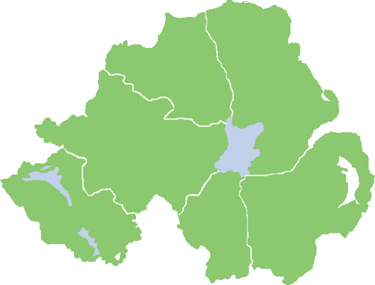
| Description | English: Northern Ireland shape (with county boundaries). |
| Date | 28 February 2006 (original upload date) |
| Source | Created by Mal 14:43, 28 February 2006 (UTC) (Feb 2006). |
| Author | Setanta747 (locked) at English Wikipedia |
 | This file has been superseded by NIShape.png. It is recommended to use the other file. Please note that deleting superseded images requires consent. |  |
Licensing
| This work has been released into the public domain by its author, Setanta747 (locked) at English Wikipedia. This applies worldwide. In some countries this may not be legally possible; if so: Setanta747 (locked) grants anyone the right to use this work for any purpose, without any conditions, unless such conditions are required by law. |
Original upload log
Transferred from en.wikipedia to Commons by Sfan00_IMG using CommonsHelper.
The original description page was here. All following user names refer to en.wikipedia.
- 2007-04-18 05:41 Padraig 532×405× (9774 bytes)
- 2006-02-28 14:43 Setanta747 (locked) 800×659× (7464 bytes) Northern Ireland shape (with county boundaries). Created by ~~~~ (Feb 2006).
File history
Click on a date/time to view the file as it appeared at that time.
| Date/Time | Thumbnail | Dimensions | User | Comment | |
|---|---|---|---|---|---|
| current | 09:37, 23 July 2013 | | 532 × 405 (10 KB) | File Upload Bot (Magnus Manske) | Transfered from en.wikipedia by User:Sfan00_IMG using CommonsHelper |
File usage
More than 100 pages use this file. The following list shows the first 100 pages that use this file only. A full list is available.
- Armagh rail disaster
- BBC Northern Ireland
- Belfast International Airport
- Bernadette Devlin McAliskey
- Billy Wright (loyalist)
- Bloody Sunday (1972)
- Carrickfergus
- Charles Haughey
- Charles III
- Cookstown
- County Antrim
- Democratic Unionist Party
- Derry
- Downpatrick
- Drum Manor Forest Park
- Enniskillen
- Flag of Northern Ireland
- Garret FitzGerald
- George Best Belfast City Airport
- Giant's Causeway
- Ian Paisley
- Lightvessels in Ireland
- Limavady
- Lisburn
- List of lighthouses in Ireland
- List of towns and villages in Northern Ireland
- Loyalist Volunteer Force
- Loyalist feud
- Lurgan
- Margaret Thatcher
- Newry
- Newtownards
- Northern Ireland
- Omagh
- Paddy Ashdown
- Police Service of Northern Ireland
- Queen Camilla
- Rathlin Island
- Royal Irish Constabulary
- Royal Ulster Constabulary
- Strabane
- The Troubles
- Ulster
- United Kingdom
- William, Prince of Wales
- Talk:Bard
- Talk:Battle of the Somme
- Talk:Bloody Sunday (1972)
- Talk:Bonar Law
- Talk:Book of Armagh
- Talk:Brian Boru
- Talk:Brian Friel
- Talk:C. S. Lewis
- Talk:Celtic languages
- Talk:Celts
- Talk:Chris Barrie
- Talk:Continuity Irish Republican Army
- Talk:County Antrim
- Talk:County Down
- Talk:County Fermanagh
- Talk:Dana Rosemary Scallon
- Talk:F. S. L. Lyons
- Talk:Flag of the United Kingdom
- Talk:Force Research Unit
- Talk:Giant's Causeway
- Talk:HMHS Britannic
- Talk:History of Ireland
- Talk:Ian Paisley
- Talk:Irish National Liberation Army
- Talk:Irish dance
- Talk:Irish language
- Talk:Josef Locke
- Talk:List of airports in the United Kingdom and the British Crown Dependencies
- Talk:List of kings of Dál Riata
- Talk:Lord Kelvin
- Talk:Loyalism
- Talk:Loyalist feud
- Talk:Mary Mallon
- Talk:Mary McAleese
- Talk:Michael Ancram
- Talk:Michael Collins (Irish leader)
- Talk:Mischa Barton
- Talk:Monarchy of Ireland
- Talk:Monarchy of the United Kingdom
- Talk:National Trust
- Talk:Northern Ireland
- Talk:Northern Ireland Environment Agency
- Talk:Provinces of Ireland
- Talk:Provisional Irish Republican Army
- Talk:RMS Olympic
- Talk:Robert Stewart, Viscount Castlereagh
- Talk:Royal Ulster Constabulary
- Talk:Scotch-Irish
- Talk:Scots language
- Talk:Shankill Butchers
- Talk:Short Brothers
- Talk:Terrorism Act 2000
- Talk:The Crying Game
- Talk:The Troubles
- Talk:Ulster Volunteer Force
View more links to this file.
Global file usage
The following other wikis use this file:
- Usage on ar.wikipedia.org
- Usage on ast.wikipedia.org
- Usage on fa.wikipedia.org
- بحث:ایرلند شمالی
- کاربر:محک
- بحث:جرج بست
- کاربر:محک/علایقم
- بحث:آرما (شهر)
- الگو:ویکیپروژه ایرلند شمالی
- بحث:شیموس هینی
- بحث:سی. اس. لوئیس
- بحث:دری (شهر)
- بحث رده:ایرلند شمالی
- بحث:نیوری
- بحث:بلفاست
- بحث:لیام نیسون
- بحث:اسنو پاترول
- بحث:توماس اندروز
- بحث:لیسبورن
- بحث رده:ارتش جمهوریخواه ایرلند
- بحث رده:ورزش در ایرلند شمالی
- بحث:لالا وارد
- بحث:درن گیبسون
- بحث:دنی بلنچفلوور
- بحث:رصدخانه آرما
- بحث:کوین ویلسون
- بحث رده:اهالی ایرلند شمالی
- بحث رده:بازیکنان فوتبال اهل ایرلند شمالی
- بحث رده:بازیکنان تیم ملی فوتبال ایرلند شمالی
- بحث رده:فوتبال در ایرلند شمالی
- بحث رده:مربیان فوتبال اهل ایرلند شمالی
- بحث رده:اهالی ایرلند شمالی بر پایه پیشه
- بحث:سم نیل
- بحث رده:دانشگاههای ایرلند شمالی
- ویکیپدیا:ویکیپروژه ایرلند شمالی
- ویکیپدیا:ویکیپروژه ایرلند شمالی/مقدمه
- ویکیپدیا:ویکیپروژه ایرلند شمالی/انجامدادنیها
- ویکیپدیا:ویکیپروژه ایرلند شمالی/مشارکتکنندگان
- ویکیپدیا:ویکیپروژه ایرلند شمالی/محتواهای باکیفیت
- ویکیپدیا:ویکیپروژه ایرلند شمالی/فهرست الگوها
- ویکیپدیا:ویکیپروژه ایرلند شمالی/گشتن
- ویکیپدیا:ویکیپروژه ایرلند شمالی/گسترش
- ویکیپدیا:ویکیپروژه ایرلند شمالی/مقالههای درخواستی
- الگو:ویکیپروژه ایرلند شمالی-خوشامد
- الگو:ویکیپروژه ایرلند شمالی-دعوت
- کاربر:جعبه کاربر/ویکیپروژه ایرلند شمالی
- بحث:ون موریسون
- بحث:استانهای ایرلند
- بحث:اسکاتس
- بحث رده:تاریخ ایرلند شمالی
- بحث رده:جغرافیای ایرلند شمالی
View more global usage of this file.