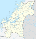
File:Norway Trøndelag adm location map.svg

Size of this PNG preview of this SVG file: 554 × 600 pixels. Other resolutions: 222 × 240 pixels | 443 × 480 pixels | 709 × 768 pixels | 946 × 1,024 pixels | 1,892 × 2,048 pixels | 836 × 905 pixels.
Original file (SVG file, nominally 836 × 905 pixels, file size: 237 KB)
File history
Click on a date/time to view the file as it appeared at that time.
| Date/Time | Thumbnail | Dimensions | User | Comment | |
|---|---|---|---|---|---|
| current | 02:01, 8 June 2020 |  | 836 × 905 (237 KB) | Jay1279 | update after Nærøysund/Namsos and Indre Fosen/Steinkjer border adjustments in 2020 |
| 13:42, 2 January 2020 |  | 836 × 905 (229 KB) | NordNordWest | upd 2020 | |
| 18:19, 18 March 2019 |  | 836 × 905 (232 KB) | NordNordWest | upd 2019 | |
| 16:48, 7 January 2018 |  | 836 × 905 (232 KB) | NordNordWest | == {{int:filedesc}} == {{Information |description= {{de|1=Positionskarte von {{Wd|Trøndelag}}, {{Wd|Norwegen}}}} {{en|1=Location map of {{W|Trøndelag}}, {{W|Norway}}}} {{Location map series N (conic)|top=65.25|longitude=11.25|latitude1=64.25|latitude... |
File usage
More than 100 pages use this file. The following list shows the first 100 pages that use this file only. A full list is available.
- Agle
- Bangsund
- Beitstad
- Bergsmoen
- Berkåk
- Bessaker
- Binde, Norway
- Bjugn (village)
- Bjørnli
- By, Norway
- Børsa
- Eggkleiva
- Fagerhaugen
- Falstad concentration camp
- Fannrem
- Fannrem concentration camp
- Foldereid
- Follafoss
- Forbregd/Lein
- Forsnes
- Gangstadhaugen
- Glåmos
- Haltdalen
- Harran, Norway
- Hegra, Norway
- Hell, Norway
- Hell Station
- Hessdalen
- Hovin, Trøndelag
- Hunn, Norway
- Husbysjøen
- Hylla
- Jøssund, Ørland
- Kolvereid
- Kongsmoen
- Kopperå
- Korsvegen
- Kvithammer
- Kvål, Trøndelag
- Kyrksæterøra
- Langørjan
- Lauvsnes
- Lensvik
- Ler, Norway
- Lerkehaug
- Lundamo
- Lysøysundet
- Malm
- Markabygda
- Mebonden
- Momarka
- Mule, Norway
- Muruvika
- Mære
- Nes, Ørland
- Nesset, Levanger
- Opphaug
- Orkanger
- Osen (village)
- Ottersbo
- Prestmoen
- Ranemsletta
- Ringvål
- Råbygda
- Råkvåg
- Røra
- Rørvik
- Sandvika, Lierne
- Selbekken
- Singsås
- Sistranda
- Skatval
- Skogmo
- Smiskaret
- Småland, Inderøy
- Soknedal
- Stadsbygd
- Stiklestad
- Stjørdalen
- Storås
- Straumen, Trøndelag
- Sunnan
- Svalia, Norway
- Sverkmoen
- Svorkmo
- Tanem
- Titran
- Trondheim
- Trondheim Fjord
- Trones, Verdal
- Uthaug
- Valsøyfjord
- Vanvikan
- Vassaunet
- Velle, Trøndelag
- Vinjeøra
- Vormstad
- Vuku
- Å, Orkland
- Åfjorden
View more links to this file.
Global file usage
The following other wikis use this file:
- Usage on azb.wikipedia.org
- Usage on da.wikipedia.org
- Usage on de.wikipedia.org
- Kjeungskjær fyr
- Lerkendal-Stadion
- Trøndelag
- Grinna fyr
- Nordøyan fyr
- Buholmråsa fyr
- Wikipedia:Kartenwerkstatt/Positionskarten/Europa
- Skansenbrua
- Leangen Ishall
- Kråkmo (Trøndelag)
- Flughafen Rørvik, Ryum
- Flughafen Røros
- Vorlage:Positionskarte Norwegen Trøndelag
- Bautasteine von Børsa
- Trondheim Spektrum
- Steinkjerbrücke
- Agdenes fyr
- Benutzer:Evolyzer/Gamle Bybrua
- Kya fyr
- Kolstad Arena
- Usage on eo.wikipedia.org
View more global usage of this file.


 French
 Deutsch


