
 French
 Deutsch
File:Ohio Bicentennial Barn, Dorset Township, Ashtabula County, Ohio.jpg
Size of this preview: 800 × 533 pixels. Other resolutions: 320 × 213 pixels | 640 × 427 pixels | 1,024 × 683 pixels | 1,280 × 853 pixels | 2,560 × 1,707 pixels | 4,096 × 2,731 pixels.
Original file (4,096 × 2,731 pixels, file size: 4 MB, MIME type: image/jpeg)
| This is a file from the Wikimedia Commons. Information from its description page there is shown below. Commons is a freely licensed media file repository. You can help. |
Summary
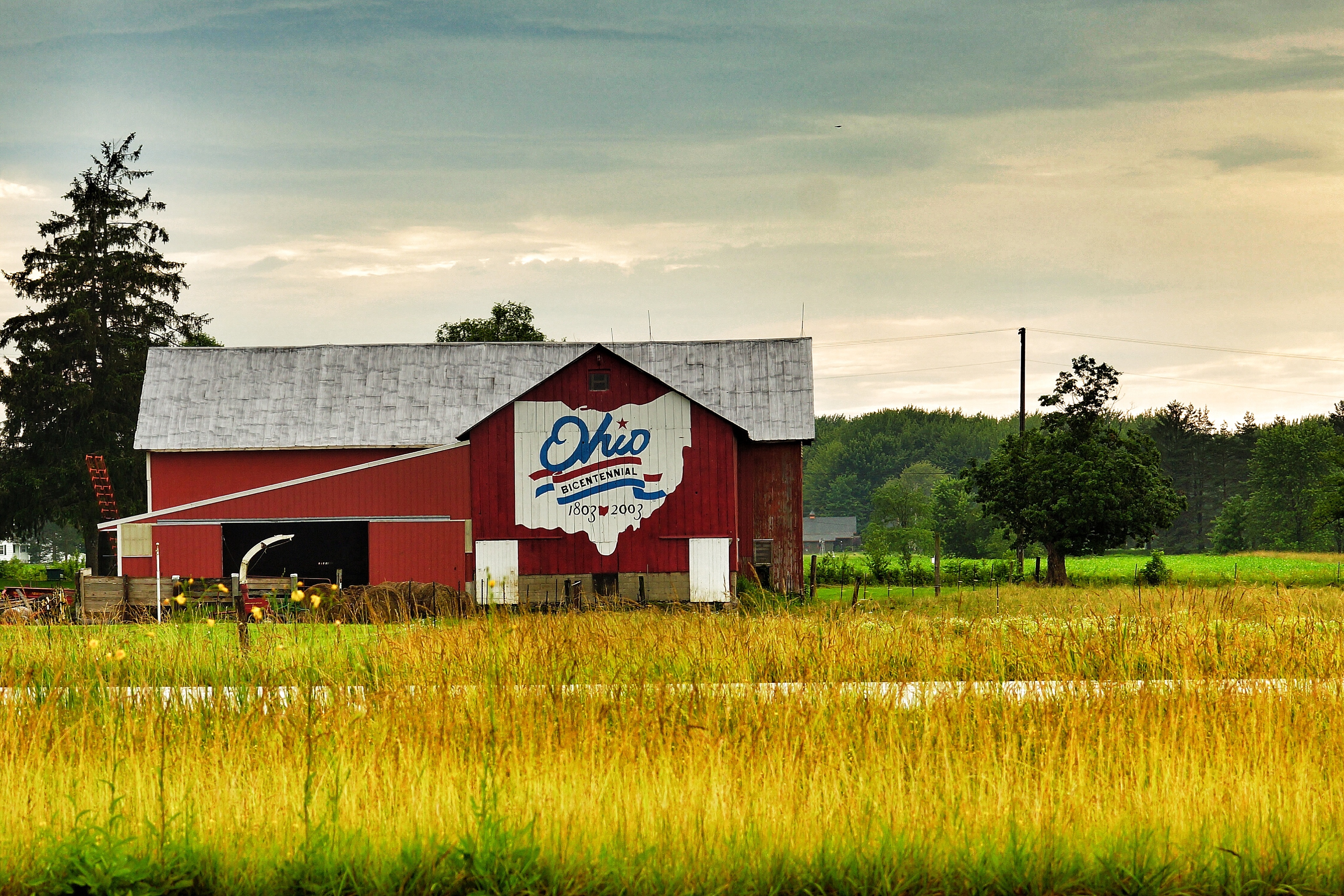
| Description | English: An Ohio Bicentennial Barn in Dorset Township, Ashtabula County, Ohio. [1] The Ohio Bicentennial Commission commissioned Scott Hagan to paint about 100 barns from 1997 to 2002 to commemorate Ohio's 200th anniversary in 2003. See Barn advertisement. Tiếng Việt: Chuồng Kỷ niệm 200 Năm Ohio tại Xã Dorset, Quận Ashtabula, Ohio. [2] Ủy ban Kỷ niệm 200 Năm Ohio mướn Scott Hagan để sơn vào khoảng 100 chuồng ngựa từ 1997 đến 2002 để kỷ niệm 200 năm của tiểu bang vào năm 2003. |
| Date | |
| Source | Flickr |
| Author | Photograph by Jason Miklacic; barn painted by Scott Hagan |
| Object location | | View this and other nearby images on: OpenStreetMap |
|---|
| Camera location | | View this and other nearby images on: OpenStreetMap |
|---|
Licensing
This file is licensed under the Creative Commons Attribution-Share Alike 2.0 Generic license.
- You are free:
- to share – to copy, distribute and transmit the work
- to remix – to adapt the work
- Under the following conditions:
- attribution – You must give appropriate credit, provide a link to the license, and indicate if changes were made. You may do so in any reasonable manner, but not in any way that suggests the licensor endorses you or your use.
- share alike – If you remix, transform, or build upon the material, you must distribute your contributions under the same or compatible license as the original.
| This image was originally posted to Flickr by Jason Miklacic at https://www.flickr.com/photos/52934799@N03/9252750648. It was reviewed on 13 January 2015 by FlickreviewR and was confirmed to be licensed under the terms of the cc-by-sa-2.0. |
File history
Click on a date/time to view the file as it appeared at that time.
| Date/Time | Thumbnail | Dimensions | User | Comment | |
|---|---|---|---|---|---|
| current | 07:40, 31 December 2014 | | 4,096 × 2,731 (4 MB) | Mxn | User created page with UploadWizard |
File usage
The following pages on the English Wikipedia use this file (pages on other projects are not listed):
Global file usage
The following other wikis use this file:
- Usage on es.wikipedia.org
- Usage on eu.wikipedia.org
- Usage on fa.wikipedia.org
- Usage on pt.wikipedia.org
- Usage on vi.wikipedia.org
- Usage on www.wikidata.org