
 French
 Deutsch
File:Outline Map of Amur Oblast.svg

Size of this PNG preview of this SVG file: 558 × 512 pixels. Other resolutions: 262 × 240 pixels | 523 × 480 pixels | 837 × 768 pixels | 1,116 × 1,024 pixels | 2,232 × 2,048 pixels.
Original file (SVG file, nominally 558 × 512 pixels, file size: 595 KB)
| This is a file from the Wikimedia Commons. Information from its description page there is shown below. Commons is a freely licensed media file repository. You can help. |
Summary
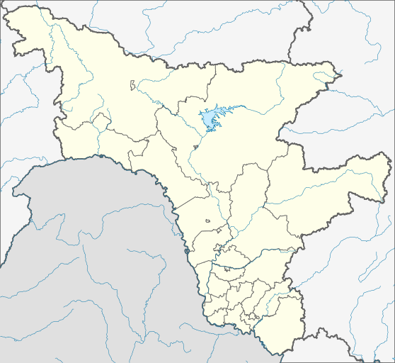
| Description | Русский: Административная карта Амурской области, Россия.
|
| Date | |
| Source |
This W3C-unspecified vector image was created with Inkscape . |
| Author | Nzeemin |
| Other versions | |

Licensing
| Description | This map was created from OpenStreetMap project data, collected by the community. This map may be incomplete, and may contain errors. Don't rely solely on it for navigation. |
| Date | (see file history) |
| Source | openstreetmap.org |
| Creator | OpenStreetMap contributors |
| Permission (Reusing this file) | OpenStreetMap data and maps are licensed under the Creative Commons Attribution-ShareAlike 2.0 license (CC-BY-SA 2.0). This file is licensed under the Creative Commons Attribution-Share Alike 2.0 Generic license.
|
| Georeferencing | If inappropriate please set warp_status = skip to hide. |
File history
Click on a date/time to view the file as it appeared at that time.
| Date/Time | Thumbnail | Dimensions | User | Comment | |
|---|---|---|---|---|---|
| current | 08:20, 10 March 2012 | | 558 × 512 (595 KB) | Nzeemin | more accurate lake from Vmap0 dataset |
| 21:29, 9 March 2012 |  | 558 × 512 (592 KB) | Nzeemin | ||
| 18:53, 8 March 2012 |  | 558 × 512 (592 KB) | Nzeemin |
File usage
More than 100 pages use this file. The following list shows the first 100 pages that use this file only. A full list is available.
- 2014 Winter Olympics torch relay
- Abaykan
- Albazino
- Alexandrovka, Russia
- Amurskoye
- Antonovka, Arkharinsky District, Amur Oblast
- Arkadyevka
- Arkhara
- Belogorsk, Amur Oblast
- Belotserkovka
- Blagoveshchensk
- Boguchan
- Bomnak
- Bon, Amur Oblast
- Bureya, Russia
- Chernigovka, Arkharinsky District, Amur Oblast
- Chernoberyozovka
- Domikan (station)
- Domikan (village)
- Dubrovka, Amur Oblast
- Ekimchan
- Far Eastern Federal District
- Fevralsk
- Gribovka
- Gulikovka
- Ignatyevo Airport
- Innokentyevka, Arkharinsky District, Amur Oblast
- Kamenka, Arkharinsky District, Amur Oblast
- Kamenny Karyer
- Kamyshevka, Amur Oblast
- Kasatkino
- Kazachy
- Kazanovka
- Kiseleozyorka
- Klyuchi, Amur Oblast
- Komissarovka
- Krasnaya Gorka, Amur Oblast
- Krasny Istok
- Krasny Luch, Amur Oblast
- Krugloye
- Kulustay
- Kundur, Russia
- Kustanayevka
- Leninskoye, Amur Oblast
- Levy Bereg
- Lokhvitsy, Amur Oblast
- Lozovoye, Belogorsky District, Amur Oblast
- Lugovoye, Belogorsky District, Amur Oblast
- Magdagachi
- Mikhaylovka, Arkharinsky District, Amur Oblast
- Mogilyovka
- Norsk (rural locality)
- Novobureysky
- Novodomikan
- Novopokrovka, Amur Oblast
- Novoraychikhinsk
- Novosergeyevka, Arkharinsky District, Amur Oblast
- Novospassk
- Orlovka, Arkharinsky District, Amur Oblast
- Orlovka (air base)
- Otvazhnoye
- Petropavlovka, Arkharinsky District, Amur Oblast
- Progress, Amur Oblast
- Rachi, Russia
- Raychikhinsk
- Razdolny, Russia
- Sagibovo
- Semyonovka, Russia
- Seryshevo
- Severnoye, Amur Oblast
- Shimanovsk
- Sivaki, Russia
- Skovorodino, Amur Oblast
- Svobodnoye, Amur Oblast
- Svobodny, Amur Oblast
- Talakan
- Tatakan
- Tsiolkovsky, Amur Oblast
- Tynda
- Ukrainka (air base)
- Uril, Russia
- Ushumun
- Ust'-Nyukzha
- Vasilyevka, Amur Oblast
- Velikoknyazevka
- Volnoye, Arkharinsky District, Amur Oblast
- Vozzhayevka (air base)
- Vozzhayevka (village)
- Yadrino
- Yerakhta
- Yerofey Pavlovich
- Yesaulovka
- Zakharyevka
- Zarechnoye, Arkharinsky District, Amur Oblast
- Zarechnoye, Belogorsky District, Amur Oblast
- Zavitinsk
- Zavitinsk (air base)
- Zeya, Russia
- Zhuravli, Russia
- Zhuravlyovka, Amur Oblast
View more links to this file.
Global file usage
The following other wikis use this file:
- Usage on af.wikipedia.org
- Usage on ar.wikipedia.org
- Usage on azb.wikipedia.org
- اوتواژنوی
- بلوسووکا
- اودارنوی، آمور اوبلاستی
- بلوقورکا، آمور اوبلاستی
- بلوقوری ، آمور اوبلاستی
- بلوقوری، آمور اوبلاستی
- اودوبنوی
- بلونوقووو
- بلویارووو
- زلاتوتووسک
- بلی یار، آمور اوبلاستی
- بلیاکووکا
- اورالووکا
- زلوینو، روسیه
- کیسلی کلیوچ
- کیسلئوزیورکا
- بلیژنی ساخالین
- زلیونی بور، آمور اوبلاستی
- زنکووکا، روسیه
- زنئیمنکا، آمور اوبلاستی
- اورکان، روسیه
- اورلتسکوی
- اورلووکا، آمور اوبلاستی
- کیودو-تیوکان
- کیودینایسکای
- بوچکاریووکا
- زوزرنی، آمور اوبلاستی
- زولوتایا قورا
- زولوتونوژکا
- کئیمنکا، آمور اوبلاستی
- کئیمنی کاریر
- اوروچنایسکای
- اوروژاینوی
- لاپری، روسیه
- اوریل، آمور اوبلاستی
- لاربا، روسیه
- زیقووکا، روسیه
- اوزرنوی، آمور اوبلاستی
- لازئیروکا، آمور اوبلاستی
- اوزریئین
- زئیرچنایا سلوبودا
- زئیرچنوی، آمور اوبلاستی
- زئیرچنی، آمور اوبلاستی
- لبیاژی، آمور اوبلاستی
- بوریسپول، آمور اوبلاستی
- اوسپنووکا، آمور اوبلاستی
- لرمونتووکا
View more global usage of this file.