
 French
 Deutsch
File:Qld region map 2.PNG
Size of this preview: 548 × 599 pixels. Other resolutions: 220 × 240 pixels | 439 × 480 pixels | 703 × 768 pixels | 937 × 1,024 pixels | 1,302 × 1,423 pixels.
Original file (1,302 × 1,423 pixels, file size: 88 KB, MIME type: image/png)
| This is a file from the Wikimedia Commons. Information from its description page there is shown below. Commons is a freely licensed media file repository. You can help. |
 | This locator map image could be re-created using vector graphics as an SVG file. This has several advantages; see Commons:Media for cleanup for more information. If an SVG form of this image is available, please upload it and afterwards replace this template with {{vector version available|new image name}}.It is recommended to name the SVG file “Qld region map 2.svg”—then the template Vector version available (or Vva) does not need the new image name parameter. |
Summary
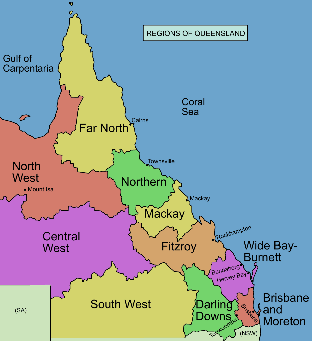
Map of regions of Queensland. I made the image, based on information from this map archive copy at the Wayback Machine
Licensing
 | Permission is granted to copy, distribute and/or modify this document under the terms of the GNU Free Documentation License, Version 1.2 or any later version published by the Free Software Foundation; with no Invariant Sections, no Front-Cover Texts, and no Back-Cover Texts. A copy of the license is included in the section entitled GNU Free Documentation License. |
| This file is licensed under the Creative Commons Attribution-Share Alike 3.0 Unported license. | ||
| ||
| This licensing tag was added to this file as part of the GFDL licensing update. |
File history
Click on a date/time to view the file as it appeared at that time.
| Date/Time | Thumbnail | Dimensions | User | Comment | |
|---|---|---|---|---|---|
| current | 14:03, 8 January 2006 | | 1,302 × 1,423 (88 KB) | Roke~commonswiki | added cities |
| 12:10, 6 January 2006 |  | 1,202 × 1,426 (75 KB) | Roke~commonswiki | fixed nsw/sa | |
| 11:14, 6 January 2006 |  | 1,202 × 1,426 (75 KB) | Roke~commonswiki | Map of regions of Queensland. I made the image, based on information from [http://www.premiers.qld.gov.au/library/images/QueenslandRegion_Map.gif this map] Category:Maps of Queensland |
File usage
The following 12 pages use this file:
Global file usage
The following other wikis use this file:
- Usage on ceb.wikipedia.org
- Usage on cs.wikipedia.org
- Usage on de.wikipedia.org
- Usage on en.wikinews.org
- Usage on es.wikipedia.org
- Usage on fa.wikipedia.org
- Usage on fr.wikipedia.org
- Usage on hu.wikipedia.org
- Usage on ja.wikipedia.org
- Usage on ky.wikipedia.org
- Usage on ml.wikipedia.org
- Usage on pt.wikipedia.org
- Usage on sd.wikipedia.org
- Usage on sq.wikipedia.org
- Usage on to.wikipedia.org
- Usage on zh.wikinews.org