File:SMOS.jpg
SMOS.jpg (376 × 266 pixels, file size: 100 KB, MIME type: image/jpeg)
Summary[edit]
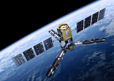
| Description | The SMOS (Soil Moisture and Ocean Salinity satellite) mission makes global observations of soil moisture over Earth’s landmasses and salinity over the oceans. Variations in soil moisture and ocean salinity are a consequence of the continuous exchange of water between the oceans, the atmosphere and the land – Earth’s water cycle. | ||||||
|---|---|---|---|---|---|---|---|
| Author or copyright owner | ESA - AOES Medialab | ||||||
| Source (WP:NFCC#4) | Original publication: http://spaceinimages.esa.int/Images/2009/09/SMOS Immediate source: http://spaceinimages.esa.int/var/esa/storage/images/esa_multimedia/images/2009/09/smos/10241463-3-eng-GB/SMOS.jpg | ||||||
| Use in article (WP:NFCC#7) | Soil Moisture and Ocean Salinity satellite | ||||||
| Purpose of use in article (WP:NFCC#8) | This image show the aspect of the vehicle in the infobox | ||||||
| Not replaceable with free media because (WP:NFCC#1) | No other pictures released about the SMOS | ||||||
| Minimal use (WP:NFCC#3) | Only for showing the aspect of the vehicle | ||||||
| Respect for commercial opportunities (WP:NFCC#2) | ESA explicitly allow the use of its images or videos for educational or informational purposes. | ||||||
| Other information |
| ||||||
| Fair useFair use of copyrighted material in the context of Soil Moisture and Ocean Salinity satellite//en.wikipedia.org/wiki/File:SMOS.jpgtrue | |||||||
Licensing[edit]
 | This work is copyrighted or licensed by the European Space Agency and released via the ESA Multimedia Gallery or the ESA Portal. According to the ESA Multimedia Gallery copyright notice it is provided free of charge for educational or informational purposes. It is believed that low-resolution copies of this image:
|
 | Aside from the claim that this file qualifies for use without permission under fair use, this file is also available under a license that permits educational, personal, or otherwise non-commercial use only. Files available under such terms do not meet the definition of Free Cultural Works as adopted by the Wikimedia Foundation, and are therefore considered non-free on Wikipedia and may only be used under Wikipedia's non-free content policy. This tag must only be used with a non-free license tag and a valid fair use rationale as required by policy. |
File history
Click on a date/time to view the file as it appeared at that time.
| Date/Time | Thumbnail | Dimensions | User | Comment | |
|---|---|---|---|---|---|
| current | 09:43, 18 October 2013 |  | 376 × 266 (100 KB) | Pippo skaio (talk | contribs) | ==Summary== {{Non-free use rationale 2 |Description = The SMOS (Soil Moisture and Ocean Salinity satellite) mission makes global observations of soil moisture over Earth’s landmasses and salinity over the oceans. Variations in soil moisture and ocean... |
You cannot overwrite this file.
File usage
The following pages on the English Wikipedia use this file (pages on other projects are not listed):


 French
 Deutsch