
 French
 Deutsch
File:Srinagar city 1959.jpg

Size of this preview: 470 × 599 pixels. Other resolutions: 188 × 240 pixels | 377 × 480 pixels | 909 × 1,158 pixels.
Original file (909 × 1,158 pixels, file size: 142 KB, MIME type: image/jpeg)
| This is a file from the Wikimedia Commons. Information from its description page there is shown below. Commons is a freely licensed media file repository. You can help. |
Summary
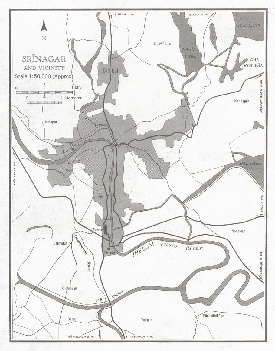
| Description | Srinagar, India: city and its vicinity in 1959. Original description at http://www.lib.utexas.edu/maps/kashmir.html: "Portion of sheet NI 43-6 Srinagar. Edition May 1959. Original scale 1:50,000 Compiled in 1954 from Survey of India. Published by the U.S. Army Map Service, July 1959 (146K) Not for navigational use." |
| Date | |
| Source | |
| Author | U.S. Army Map Service |
Licensing
This work is in the public domain in the United States because it is a work prepared by an officer or employee of the United States Government as part of that person’s official duties under the terms of Title 17, Chapter 1, Section 105 of the US Code. Note: This only applies to original works of the Federal Government and not to the work of any individual U.S. state, territory, commonwealth, county, municipality, or any other subdivision. This template also does not apply to postage stamp designs published by the United States Postal Service since 1978. (See § 313.6(C)(1) of Compendium of U.S. Copyright Office Practices). It also does not apply to certain US coins; see The US Mint Terms of Use. |  | |
| This file has been identified as being free of known restrictions under copyright law, including all related and neighboring rights. | ||
File history
Click on a date/time to view the file as it appeared at that time.
| Date/Time | Thumbnail | Dimensions | User | Comment | |
|---|---|---|---|---|---|
| current | 14:52, 15 November 2005 | | 909 × 1,158 (142 KB) | Vyzasatya | Srinagar,India city and its vicinity in 1959. This map is taken from http://www.lib.utexas.edu/maps/historical/srinagar_city_1959.jpg |
File usage
The following pages on the English Wikipedia use this file (pages on other projects are not listed):
Global file usage
The following other wikis use this file:
- Usage on ms.wikipedia.org
- Usage on ru.wikipedia.org
- Usage on te.wikipedia.org