
 French
 Deutsch
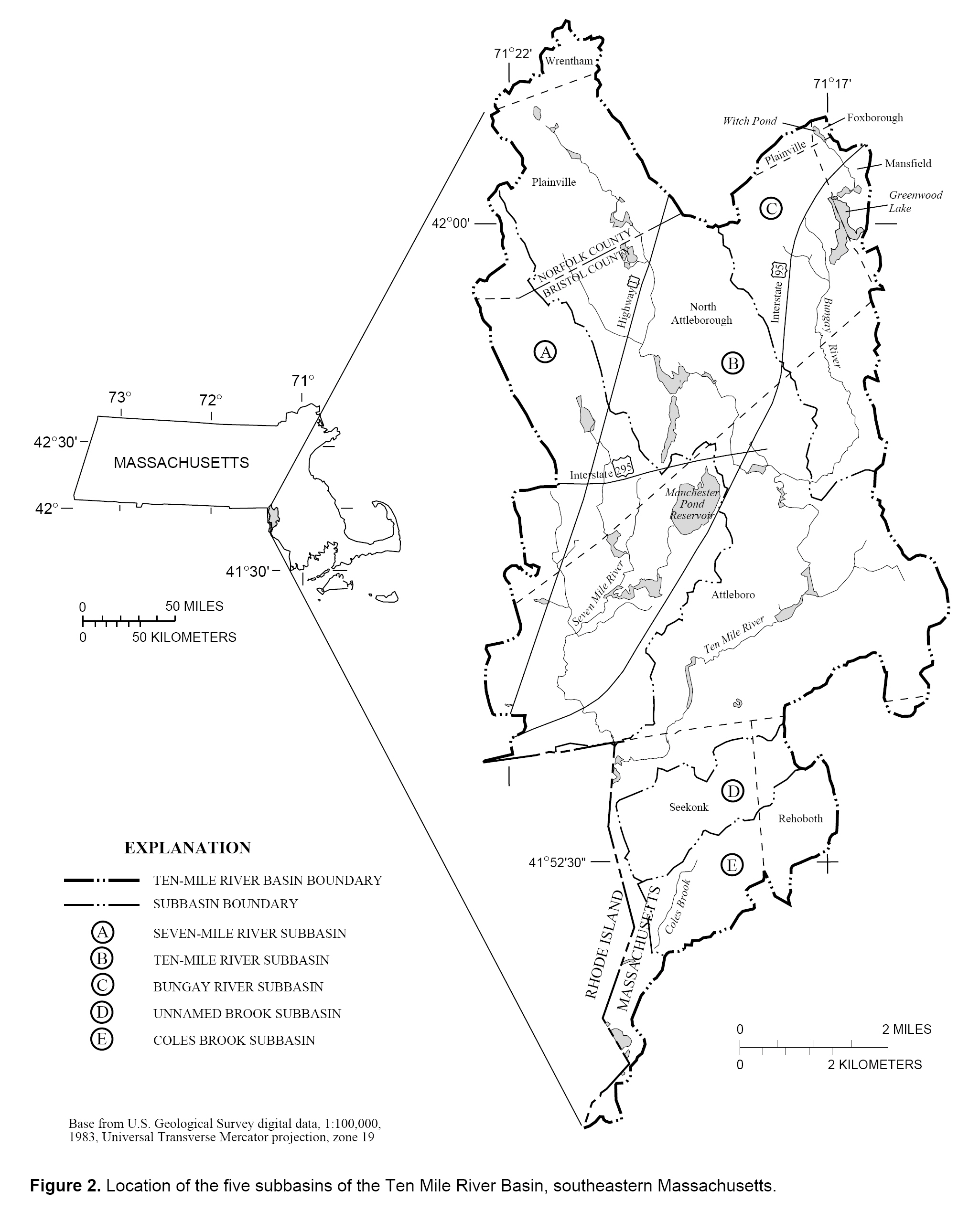
File:Ten Mile River Basin, Massachusetts (USGS).jpg
Size of this preview: 485 × 600 pixels. Other resolutions: 194 × 240 pixels | 388 × 480 pixels | 621 × 768 pixels | 828 × 1,024 pixels | 2,051 × 2,536 pixels.
Original file (2,051 × 2,536 pixels, file size: 776 KB, MIME type: image/jpeg)
| This is a file from the Wikimedia Commons. Information from its description page there is shown below. Commons is a freely licensed media file repository. You can help. |
.jpg)
Summary
| Description | Diagram of the Ten Mile River water basin, southeastern Massachusetts, USA. |
| Date | |
| Source | M.A. Horn, "Method for Estimating Water Use and Interbasin Transfers of Freshwater and Wastewater in an Urbanized Basin", United States Geological Survey WRIR-99-4287. Figure 2. Online version at: http://pubs.usgs.gov/wri/wri994287/pdf/text2.pdf. |
| Author | M.A. Horn. |
| Permission (Reusing this file) | Public domain, as original work of the US Federal Government. |
Licensing
This image is in the public domain in the United States because it only contains materials that originally came from the United States Geological Survey, an agency of the United States Department of the Interior. For more information, see the official USGS copyright policy.
|
File history
Click on a date/time to view the file as it appeared at that time.
| Date/Time | Thumbnail | Dimensions | User | Comment | |
|---|---|---|---|---|---|
| current | 10:55, 6 December 2006 | | 2,051 × 2,536 (776 KB) | Daderot | {{Information |Description=Diagram of the Ten Mile River water basin, southeastern Massachusetts, USA. |Source=M.A. Horn, "Method for Estimating Water Use and Interbasin Transfers of Freshwater and Wastewater in an Urbanized Basin", United States Geograph |
File usage
The following pages on the English Wikipedia use this file (pages on other projects are not listed):
Global file usage
The following other wikis use this file:
- Usage on ru.wikipedia.org
.jpg)