
 French
 Deutsch
File:USACE Depoe Bay Oregon.jpg

Size of this preview: 800 × 528 pixels. Other resolutions: 320 × 211 pixels | 640 × 422 pixels | 1,024 × 676 pixels | 1,500 × 990 pixels.
Original file (1,500 × 990 pixels, file size: 959 KB, MIME type: image/jpeg)
| This is a file from the Wikimedia Commons. Information from its description page there is shown below. Commons is a freely licensed media file repository. You can help. |
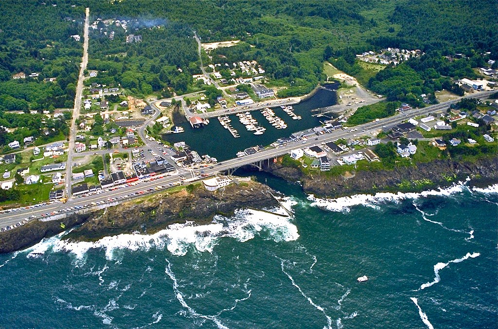
| Description | English: Aerial view of the harbor and center of Depoe Bay, Oregon, USA. | |||
| Location | Depoe Bay, Oregon, USA 44°48′33.61″N 124°3′38.08″W / 44.8093361°N 124.0605778°W | |||
| Date | ||||
| Source | U.S. Army Corp of Engineers Digital Visual Library Digital Visual Library home page Image page Image description page | |||
| Author | Bob Heims, U.S. Army Corps of Engineers | |||
| Permission (Reusing this file) |
|
File history
Click on a date/time to view the file as it appeared at that time.
| Date/Time | Thumbnail | Dimensions | User | Comment | |
|---|---|---|---|---|---|
| current | 01:18, 24 May 2012 | | 1,500 × 990 (959 KB) | Ian Page | Colour-enhanced version of original file |
| 02:54, 16 April 2007 |  | 1,500 × 990 (478 KB) | DanMS | {{Information2 | Description = {{en|Aerial view of the harbor and center of Depoe Bay, Oregon, USA.}} | Source = U.S. Army Corp of Engineers Digital Visual Library<br />[http://images.usace.army.mil/Main.html Digital Visual Library home page]<br />[h |
File usage
The following pages on the English Wikipedia use this file (pages on other projects are not listed):
Global file usage
The following other wikis use this file:
- Usage on ar.wikipedia.org
- Usage on azb.wikipedia.org
- Usage on bg.wikipedia.org
- Usage on ca.wikipedia.org
- Usage on ceb.wikipedia.org
- Usage on ce.wikipedia.org
- Usage on cs.wikipedia.org
- Usage on cy.wikipedia.org
- Usage on de.wikipedia.org
- Usage on en.wikivoyage.org
- Usage on es.wikipedia.org
- Usage on eu.wikipedia.org
- Usage on fa.wikipedia.org
- Usage on fi.wikipedia.org
- Usage on fr.wikipedia.org
- Usage on ht.wikipedia.org
- Usage on hu.wikipedia.org
- Usage on it.wikipedia.org
- Usage on ky.wikipedia.org
- Usage on lld.wikipedia.org
- Usage on pl.wikipedia.org
- Usage on pt.wikipedia.org
- Usage on sh.wikipedia.org
- Usage on sr.wikipedia.org
- Usage on tt.wikipedia.org
- Usage on uk.wikipedia.org
- Usage on uz.wikipedia.org
- Usage on www.wikidata.org
- Usage on zh-min-nan.wikipedia.org