
 French
 Deutsch
File:USA Virginia Northern location map.svg

Size of this PNG preview of this SVG file: 234 × 297 pixels. Other resolutions: 189 × 240 pixels | 378 × 480 pixels | 605 × 768 pixels | 807 × 1,024 pixels | 1,613 × 2,048 pixels.
Original file (SVG file, nominally 234 × 297 pixels, file size: 51 KB)
| This is a file from the Wikimedia Commons. Information from its description page there is shown below. Commons is a freely licensed media file repository. You can help. |
Summary
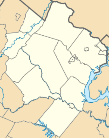
| Description | English: Equirectangular projection, N/S stretching 130.0 %. Geographic limits of the map: top=39.324960, bottom=37.990552, left=-78.391863, right=-77.038670. Northern Virginia as defined by the Washington metropolitan area (Alexandria, Arlington County, Clarke County, Culpeper County, Fairfax County, Fairfax, Falls Church, Fauquier County, Loudoun County, Manassas, Manassas Park, Prince William County, Rappahannock County, Spotsylvania County, Stafford County, Fredericksburg, Warren County). |
| Date | |
| Source | Own work |
| Author | Id4abel |
| SVG development |

Licensing
I, the copyright holder of this work, hereby publish it under the following license:
This file is licensed under the Creative Commons Attribution-Share Alike 4.0 International license.
- You are free:
- to share – to copy, distribute and transmit the work
- to remix – to adapt the work
- Under the following conditions:
- attribution – You must give appropriate credit, provide a link to the license, and indicate if changes were made. You may do so in any reasonable manner, but not in any way that suggests the licensor endorses you or your use.
- share alike – If you remix, transform, or build upon the material, you must distribute your contributions under the same or compatible license as the original.
File history
Click on a date/time to view the file as it appeared at that time.
| Date/Time | Thumbnail | Dimensions | User | Comment | |
|---|---|---|---|---|---|
| current | 16:27, 26 June 2016 | | 234 × 297 (51 KB) | Id4abel | Can't seem to get version with all counties as the current version. |
| 16:24, 26 June 2016 |  | 234 × 297 (51 KB) | Id4abel | Reverted to version as of 06:12, 26 June 2016 (UTC) | |
| 16:23, 26 June 2016 |  | 234 × 297 (51 KB) | Id4abel | Reverted to version as of 06:11, 26 June 2016 (UTC) | |
| 06:12, 26 June 2016 |  | 234 × 297 (51 KB) | Id4abel | Reverted to version as of 06:08, 26 June 2016 (UTC) | |
| 06:11, 26 June 2016 |  | 234 × 297 (51 KB) | Id4abel | This version includes Culpeper County and Rappahannock County. | |
| 06:08, 26 June 2016 |  | 234 × 297 (51 KB) | Id4abel | This version includes Culpeper County and Rappahannock County. | |
| 22:49, 15 May 2016 |  | 234 × 297 (51 KB) | Id4abel | User created page with UploadWizard |
File usage
More than 100 pages use this file. The following list shows the first 100 pages that use this file only. A full list is available.
- Airmont, Virginia
- Aldie, Virginia
- Annandale, Virginia
- Ashburn, Virginia
- Bailey's Crossroads, Virginia
- Ballston, Virginia
- Bealeton, Virginia
- Belle Haven, Fairfax County, Virginia
- Bluemont, Virginia
- Brambleton, Virginia
- Brentsville, Virginia
- Burke, Virginia
- Catlett, Virginia
- Centreville, Virginia
- Chancellorsville, Virginia
- Chantilly, Virginia
- Chatham Manor
- Christendom College
- Clarendon, Virginia
- Clifton, Virginia
- Colchester, Virginia
- Culpeper Regional Airport
- Dulles, Virginia
- Dunn Loring, Virginia
- Fairfax, Virginia
- Fairfax Station, Virginia
- Fairlington, Virginia
- Falls Church, Virginia
- Ferry Farm
- Fort Belvoir
- Fort Hunt, Virginia
- Franconia, Virginia
- Fredericksburg, Virginia
- Gadsby's Tavern
- Garrisonville, Virginia
- George Mason University
- George Washington Masonic National Memorial
- Germanna Community College
- Germantown, Virginia
- Great Falls, Virginia
- Groveton, Virginia
- Gunston Hall
- Hamilton, Virginia
- Haymarket, Virginia
- Herndon, Virginia
- Hillsboro, Loudoun County, Virginia
- Hollin Hills
- Huntington, Virginia
- Hybla Valley, Virginia
- Idylwood, Virginia
- Lake Barcroft, Virginia
- Langley, Virginia
- Laurel Ridge Community College
- Leesburg, Virginia
- Lincoln, Virginia
- Lincolnia, Virginia
- Little Washington, Virginia
- Lorton, Virginia
- Loudoun Heights, Virginia
- Lovettsville, Virginia
- Lucketts, Virginia
- Manassas, Virginia
- Manassas Park, Virginia
- Mantua, Virginia
- Marine Corps Base Quantico
- Marshall, Virginia
- McLean, Virginia
- Merrifield, Virginia
- Middleburg, Virginia
- Millwood, Virginia
- Mount Vernon, Virginia
- Newington, Virginia
- North Springfield, Virginia
- Northern Virginia Community College
- Oak Hill (James Monroe house)
- Oakton, Virginia
- Philomont, Virginia
- Pimmit Hills, Virginia
- Potomac, Virginia
- Purcellville, Virginia
- Reston, Virginia
- Rose Hill, Fairfax County, Virginia
- Round Hill, Loudoun County, Virginia
- Seven Corners, Virginia
- South Riding, Virginia
- Southbridge, Virginia
- Springfield, Virginia
- Sterling, Virginia
- Sumerduck, Virginia
- Taylorstown, Virginia
- Tysons, Virginia
- Unison, Virginia
- University of Mary Washington
- Vienna, Virginia
- Virginia State Route 193
- Virginia Theological Seminary
- Waterford, Virginia
- Weems–Botts Museum
- West Falls Church, Virginia
- West Springfield, Virginia
View more links to this file.
Global file usage
The following other wikis use this file:
- Usage on ar.wikipedia.org
- Usage on fa.wikipedia.org
- فورت بلوار، ویرجینیا
- کمپ ارلی
- لانگلی (ویرجینیا)
- لیسبورگ، ویرجینیا
- لورتون، ویرجینیا
- فرت هانت، ویرجینیا
- لیک برکرافت، ویرجینیا
- نوینگتن، ویرجینیا
- دانلرینگ، ویرجینیا
- چنتیلی، ویرجینیا
- مریفیلد (ویرجینیا)
- ماونت ورنن، ویرجینیا
- گریت فالز، ویرجینیا
- پایگاه نیروی دریایی کوانتیکو
- ولف تراپ، ویرجینیا
- رز هیل، شهرستان فرفکس، ویرجینیا
- ادیلوود، ویرجینیا
- بیلیز کراسرودز، ویرجینیا
- منتوا، ویرجینیا
- سون کرنرز، ویرجینیا
- هایبلا ولی، ویرجینیا
- گرووتون، ویرجینیا
- فرانکونیا، ویرجینیا
- آناندیل، ویرجینیا
- استرلینگ، ویرجینیا
- وست فالز چرچ، ویرجینا
- پیمیت هیلز، ویرجینیا
- شنندوا فارمز، ویرجینیا
- شنندوا شورز، ویرجینیا
- اسکایلند استیتز، ویرجینیا
- کاتلت، ویرجینیا
- بلمونت، ویرجینیا
- برامبلتون، ویرجینیا
- درانزویل، ویرجینیا
- ساوت رایدینگ، ویرجینیا
- آرکولا، ویرجینیا
- مارشال، ویرجینیا
- میدلند، ویرجینیا
- براودلندز، ویرجینیا
- مکنیر، ویرجینیا
- گرینبرایر، ویرجینیا
- لیک آو د وودز، ویرجینیا
- ریونزورث، ویرجینیا
- ویکفیلد شهرستان فرفکس، ویرجینیا
- فیرفکس استیشن، ویرجینیا
- بل هیون، شهرستان فرفکس، ویرجینیا
- میسن نک، ویرجینیا
- فیر لیکس، ویرجینیا
View more global usage of this file.