
 French
 Deutsch
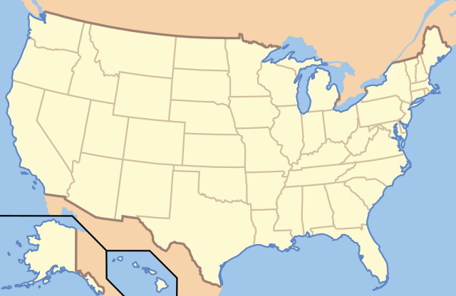
File:US Locator Blank.svg

Size of this PNG preview of this SVG file: 286 × 186 pixels. Other resolutions: 320 × 208 pixels | 640 × 416 pixels | 1,024 × 666 pixels | 1,280 × 832 pixels | 2,560 × 1,665 pixels.
Original file (SVG file, nominally 286 × 186 pixels, file size: 137 KB)
| This is a file from the Wikimedia Commons. Information from its description page there is shown below. Commons is a freely licensed media file repository. You can help. |
Clickable version
| Description | This image is abstracted from Image:Map_of_USA_with_state_names.svg (GFDL). | ||||||||
| Date | |||||||||
| Source | based on Image:Map of USA without state names.svg | ||||||||
| Author | Originally uploaded English Wikipedia by en:User:Papayoung and en:User:Ilmari Karonen. Base versions this one is derived from: originally created by en:User:Wapcaplet | ||||||||
| Permission (Reusing this file) |
|

| Object location | | View this and other nearby images on: OpenStreetMap |
|---|
| Annotations | This image is annotated: View the annotations at Commons |
File history
Click on a date/time to view the file as it appeared at that time.
| Date/Time | Thumbnail | Dimensions | User | Comment | |
|---|---|---|---|---|---|
| current | 00:57, 21 June 2010 | | 286 × 186 (137 KB) | Ras67 | frame removed |
| 13:14, 5 January 2007 |  | 286 × 186 (167 KB) | EDUCA33E | Rétablissement de la version précédente | |
| 13:07, 5 January 2007 |  | 286 × 186 (97 KB) | EDUCA33E | (same but 98 ko) | |
| 07:58, 6 March 2006 |  | 286 × 186 (167 KB) | Itsmine | == Summary == This image is abstracted from Image:Map_of_USA_with_state_names.svg (GFDL). Originally uploaded English Wikipedia by en:User:Papayoung and en:User:Ilmari Karonen. <div style="border: 1px solid #F66; padding: 1em;">'''Please |
File usage
More than 100 pages use this file. The following list shows the first 100 pages that use this file only. A full list is available.
- Abraham Lincoln Birthplace National Historical Park
- Acadia National Park
- Adams National Historical Park
- Appomattox Court House National Historical Park
- Badlands National Park
- Big Bend National Park
- Biscayne National Park
- Black Canyon of the Gunnison National Park
- Boston National Historical Park
- Bryce Canyon National Park
- Cane River Creole National Historical Park
- Canyonlands National Park
- Capitol Reef National Park
- Chaco Culture National Historical Park
- Channel Islands National Park
- Chesapeake and Ohio Canal National Historical Park
- Colonial National Historical Park
- Congaree National Park
- Crater Lake National Park
- Cumberland Gap National Historical Park
- Cuyahoga Valley National Park
- Death Valley National Park
- Denali National Park and Preserve
- Dry Tortugas National Park
- Everglades National Park
- Fort Sumter and Fort Moultrie National Historical Park
- Gates of the Arctic National Park and Preserve
- Gateway Arch National Park
- George Rogers Clark National Historical Park
- Glacier Bay National Park and Preserve
- Glacier National Park (U.S.)
- Golden Spike National Historical Park
- Grand Canyon National Park
- Grand Teton National Park
- Great Basin National Park
- Great Falls (Passaic River)
- Great Sand Dunes National Park and Preserve
- Great Smoky Mountains National Park
- Guadalupe Mountains National Park
- Haleakalā National Park
- Harpers Ferry National Historical Park
- Hawaiʻi Volcanoes National Park
- Hopewell Culture National Historical Park
- Hot Springs National Park
- Independence National Historical Park
- Indiana Dunes National Park
- Isle Royale National Park
- Jean Lafitte National Historical Park and Preserve
- Kalaupapa National Historical Park
- Kaloko-Honokōhau National Historical Park
- Katmai National Park and Preserve
- Kenai Fjords National Park
- Kings Canyon National Park
- Klondike Gold Rush National Historical Park
- Kobuk Valley National Park
- Lake Clark National Park and Preserve
- Lassen Volcanic National Park
- Lewis and Clark National Historical Park
- Lowell National Historical Park
- Mammoth Cave National Park
- Martin Luther King Jr. National Historical Park
- Mesa Verde National Park
- Minute Man National Historical Park
- Morristown National Historical Park
- Mount Rainier National Park
- National Historic Site (United States)
- National Park Service
- National Park of American Samoa
- New Bedford Whaling National Historical Park
- New River Gorge National Park and Preserve
- Nez Perce National Historical Park
- North Cascades National Park
- Ocmulgee Mounds National Historical Park
- Olympic National Park
- Palo Alto Battlefield National Historical Park
- Pecos National Historical Park
- Petrified Forest National Park
- Pinnacles National Park
- Puʻuhonua o Hōnaunau National Historical Park
- Redwood National and State Parks
- Rocky Mountain National Park
- Rosie the Riveter World War II Home Front National Historical Park
- San Antonio Missions National Historical Park
- San Francisco Maritime National Historical Park
- San Juan Island National Historical Park
- Saratoga National Historical Park
- Sequoia National Park
- Sitka National Historical Park
- Theodore Roosevelt National Park
- Thomas Edison National Historical Park
- Tumacácori National Historical Park
- Valley Forge National Historical Park
- Virgin Islands National Park
- Voyageurs National Park
- Waterton-Glacier International Peace Park
- White Sands National Park
- Wind Cave National Park
- Wrangell–St. Elias National Park and Preserve
- Yellowstone National Park
- Yosemite National Park
View more links to this file.
Global file usage
The following other wikis use this file:
- Usage on ab.wikipedia.org
- Usage on af.wikipedia.org
- Usage on ar.wikipedia.org
- متنزه يلوستون الوطني
- متنزه يوسيميتي الوطني
- متنزه صهيون الوطني
- قالب:Superimpose
- قالب:Superimpose/شرح
- كهف الماموث
- حديقة جبل رينييه
- متنزه وادي الموت الوطني
- قالب:صندوق معلومات منطقة محمية/شرح
- قالب:صندوق معلومات منطقة محمية
- قائمة حدائق الولايات المتحدة الوطنية
- حديقة أكاديا الوطنية
- حديقة الأقواس الوطنية
- حديقة أمريكان ساموا الوطنية
- حديقة بادلاندز الوطنية
- الحديقة الوطنية الجليدية
- محمية ومتنزه بوابات القطب الشمالي الوطنية
- متنزه ومحمية رانجيل-سانت إلياس الطبيعية الوطنية
- برايس كانيون
- محمية ميسا فيردي الوطنية
- متنزه الأخدود العظيم الوطني
- حديقة إيفرغلاديس الوطنية
- حدائق ريدوود الوطنية والحكومية
- حديقة جبال غريت سموكي الوطنية
- حديقة كهوف كارلسباد الوطنية
- حديقة براكين هاواي الوطنية
- متنزه غراند تيتون الوطني
- المتنزه الأولمبي الوطني
- حديقة هاليكالا الوطنية
- حديقة شجرة جوشوا الوطنية
- قالب:المتنزهات الوطنية في خريطة الولايات المتحدة الأمريكية
- قالب:الحدائق الوطنية في الولايات المتحدة
- قالب:صندوق معلومات منطقة محمية/ملعب
- حديقة بيغ بند الوطنية
- منتزه ساغوارو الوطني
- حديقة بيسكين الوطنية
- حديقة غنيسون الأسود
- منتزه شمال كاسكيدز الوطني
- حديقة كهف الرياح الوطنية
- متنزه جزر القناة الوطني
- متنزه غريت باسين الوطني
- متنزه كانيونلاندز الوطني
- حديقة شيناندوا الوطنية
- خليج ومحمية غليسر الوطنية
- حديقة فوياجرز الوطنية
- حديقة هوت سبرينغس الوطنية
View more global usage of this file.