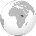
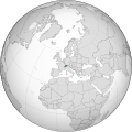
File:Uganda (orthographic projection).svg

Size of this PNG preview of this SVG file: 600 × 600 pixels. Other resolutions: 240 × 240 pixels | 480 × 480 pixels | 768 × 768 pixels | 1,024 × 1,024 pixels | 2,048 × 2,048 pixels.
Original file (SVG file, nominally 600 × 600 pixels, file size: 559 KB)
| This is a file from the Wikimedia Commons. Information from its description page there is shown below. Commons is a freely licensed media file repository. You can help. |
Summary
 | English: Editor's note:
|
| DescriptionUganda (orthographic projection).svg | English: Uganda (orthographic projection) Português: Uganda (projeção ortográfica) Español: Uganda (proyección ortográfica) Polski: Uganda (rzutowanie ortogonalne) | |||
| Date | ||||
| Source | File:African Union (orthographic projection).svg | |||
| Author | Marcos Elias de Oliveira Júnior | |||
| Permission (Reusing this file) |
| |||
| Other versions | العربية: الرجاء، قراءة الميثاق. বাংলা: দয়া করে, রীতিনীতিটি পড়ুন। Deutsch: Bitte lies die Konventionen. English: Please, read the conventions. Español: Por favor, lea las convenciones. Filipino: Paki-basa ang mga kumbensyon. Français : S'il vous plaît, lisez les conventions. हिन्दी: कृपया सभागमों को पढ़ लें. Bahasa Indonesia: Silakan, baca konvensi. Italiano: Si prega di leggere le convenzioni. 日本語: 規約をご確認ください。 ქართული: გთხოვთ, გაეცნოთ კონვენციებს. Македонски: Ве молиме, прочитајте ги општоприфатените правила. Português: Por favor, leia as convenções. Русский: Пожалуйста, прочитайте соглашения. Tagalog: Paki-basa ang mga kumbensyon. Українська: Будь ласка, прочитайте конвенції. Tiếng Việt: Hãy đọc công văn trước khi đăng. 中文(繁體):請檢視常規 中文(简体):请查看常规
| |||
| SVG development InfoField | This vector image was created with a text editor. |
العربية: الرجاء، قراءة الميثاق.
বাংলা: দয়া করে, রীতিনীতিটি পড়ুন।
Deutsch: Bitte lies die Konventionen.
English: Please, read the conventions.
Español: Por favor, lea las convenciones.
Filipino: Paki-basa ang mga kumbensyon.
Français : S'il vous plaît, lisez les conventions.
हिन्दी: कृपया सभागमों को पढ़ लें.
Bahasa Indonesia: Silakan, baca konvensi.
Italiano: Si prega di leggere le convenzioni.
日本語: 規約をご確認ください。
ქართული: გთხოვთ, გაეცნოთ კონვენციებს.
Македонски: Ве молиме, прочитајте ги општоприфатените правила.
Português: Por favor, leia as convenções.
Русский: Пожалуйста, прочитайте соглашения.
Tagalog: Paki-basa ang mga kumbensyon.
Українська: Будь ласка, прочитайте конвенції.
Tiếng Việt: Hãy đọc công văn trước khi đăng.
中文(繁體):請檢視常規
中文(简体):请查看常规
| World maps |
|---|
Africaहिन्दी: अफ्रीका ქართული: აფრიკა.
Eastern Africaहिन्दी: पूर्वी अफ्रीका
Southern Africa
Central Africa
Northern Africa
Western Africa
Americasქართული: ამერიკა. हिन्दी: अमेरिका
North Americaहिन्दी: उत्तरी अमेरिका
Central America
Caribbean
South Americaहिन्दी: दक्षिण अमेरिका
Asiaहिन्दी: एशिया (जम्भूद्वीप) ქართული: აზია. Português: Ásia. Українська: Азія.
Eastहिन्दी: पूर्वी एशिया ქართული: აღმოსავლეთი აზია. Português: Ásia Oriental. Українська: Східна Азія.
Centralहिन्दी: मध्य एशिया ქართული: ცენტრალური აზია. Português: Ásia Central. Українська: Центральна Азія.
SoutheastFilipino: Timog-silangang Asya. हिन्दी: दक्षिण-पूर्वी एशिया Bahasa Indonesia: Asia tenggara ქართული: სამხრეთ-აღმოსავლეთი აზია. Português: Sudeste Asiático. Tagalog: Timog-silangang Asya. Українська: Південно-Східна Азія.
Southहिन्दी: दक्षिण एशिया (भारतीय उपमहाद्वीप) ქართული: სამხრეთი აზია. Português: Sul da Ásia. Українська: Південна Азія.
Westernहिन्दी: पश्चिमी एशिया ქართული: დასავლეთ აზია. Português: Sudoeste da Ásia. Українська: Передня Азія.
Europeहिन्दी: यूरोप ქართული: ევროპა. Português: Europa. Română: Europa. Русский: Европа. Українська: Європа.
Countries
Oceaniaहिन्दी: ओशिआनिया ქართული: ოკეანეთი. Português: Oceania. Українська: Океанія.
Intercontinentalहिन्दी: अंतर्महाद्वीपिय ქართული: კონტინენთშორისი. Português: Intercontinental. Українська: Міжконтинентальні.
HistoricalEnglish: Unions, Organizations, Kingdoms, Empires Español: Uniones, Organizaciones, Reinos, Imperios Filipino: Mga Unyon, Organisasyon, Kaharian, Imperyo Français : Unions, Organisations, Royaumes, Empires हिन्दी: संघ, संगठन, राज्य, साम्राज्य व ऐतिहासिक देश ქართული: გაერთიანებები, ორგანიზაციები, სამეფოები, იმპერიები Português: Estados extintos. Tagalog: Mga Unyon, Organisasyon, Kaharian, Imperyo Українська: Союзи, Організації, Королівства, Імперії 中文(繁體):聯盟、組織、王國和帝國 中文(简体):联盟、组织、王国和帝国
Subnationalsहिन्दी: उपराष्ट्रीय इकाईयाँ ქართული: სუბეროვნული ერთეულები. Português: Entidades subnacionais. Українська: Субнаціональні утворення.
|
| Annotations InfoField | This image is annotated: View the annotations at Commons |
363
192
31
32
550
550
Eritrea? Seconded, where is Eritrea, which has been independent since 1990
345
113
8
15
550
550
Lebanon?
390
201
23
15
550
550
North Yemen and South Yemen have already merged into a single country in 1990.
384
134
12
13
550
550
Neutral zone abolished in 1991.
310
72
11
10
550
550
Moldova is landlocked; Odessa area to Ukraine.
347
124
8
12
550
550
Clearly separate West Bank from Jordan.
-390
-10
-23
15
550
550
Walvis Bay was transfered to Namibia in 1994.
Captions
Add a one-line explanation of what this file represents
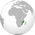
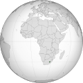
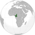
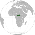
Globe terrestre avec l'Ouganda en vert.
Items portrayed in this file
depicts
some value
19 June 2011
image/svg+xml
572,536 byte
3049f27787945472ff2123586bed0ce043a2c5f8
File history
Click on a date/time to view the file as it appeared at that time.
| Date/Time | Thumbnail | Dimensions | User | Comment | |
|---|---|---|---|---|---|
| current | 15:41, 30 March 2025 | 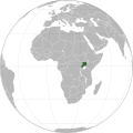 | 600 × 600 (559 KB) | M.Bitton | + title |
| 15:06, 30 March 2025 |  | 600 × 600 (559 KB) | M.Bitton | Cleaner version of the stable map | |
| 14:21, 30 March 2025 |  | 550 × 550 (283 KB) | M.Bitton | Reverted to version as of 14:18, 15 July 2011 (UTC): per COM:OVERWRITE | |
| 23:14, 29 March 2025 |  | 550 × 550 (3.05 MB) | Remsense | algorithmically generated locator map via https://observablehq.com/@mikima/wikipedia-grey-green-orthographic-projections-maps-gener/2, resolving glaring longstanding border glitches | |
| 14:18, 15 July 2011 |  | 550 × 550 (283 KB) | Mixx321 | South Sudan | |
| 16:23, 19 June 2011 |  | 550 × 550 (281 KB) | Marquinhos | {{Information |Description ={{en|1=Uganda (orthographic projection)}} {{pt|1=Uganda (projeção ortográfica)}} {{es|1=Uganda (proyección ortográfica)}} |Source ={{own}}{{inkscape}} |Author =[[User:Marcos Elias de Oliveira Júnior|Mar |
File usage
The following 7 pages use this file:
Global file usage
The following other wikis use this file:
- Usage on ami.wikipedia.org
- Usage on ann.wikipedia.org
- Usage on arc.wikipedia.org
- Usage on ar.wikipedia.org
- أوغندا
- بوابة:العالم الإسلامي/دولة مختارة/63
- مستخدم:جار الله/قائمة صور مقالات العلاقات الثنائية
- العلاقات الأوغندية الأمريكية
- العلاقات الأنغولية الأوغندية
- العلاقات الأوغندية الكورية الجنوبية
- العلاقات الأوغندية الإريترية
- العلاقات الأوغندية السويسرية
- العلاقات الألمانية الأوغندية
- العلاقات الأوغندية الليختنشتانية
- العلاقات الأوغندية البوليفية
- العلاقات الأوغندية الموزمبيقية
- العلاقات الألبانية الأوغندية
- العلاقات الأوغندية البلجيكية
- العلاقات الأوغندية الإثيوبية
- العلاقات الأوغندية البيلاروسية
- العلاقات الأوغندية الطاجيكستانية
- العلاقات الأوغندية الروسية
- العلاقات الأوغندية الرومانية
- العلاقات الأوغندية الأرجنتينية
- العلاقات الأوغندية الغامبية
- العلاقات الأوغندية القبرصية
- العلاقات الأوغندية السيراليونية
- العلاقات الأوغندية النيبالية
- العلاقات الأوغندية الليبيرية
- العلاقات الأوغندية التشيكية
- العلاقات الأوغندية الميانمارية
- العلاقات الأوغندية السعودية
- العلاقات الأوغندية الكندية
- العلاقات الأوغندية الزيمبابوية
- العلاقات الأوغندية الإسرائيلية


 French
 Deutsch


