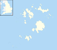
Giant's Castle, Isles of Scilly
 Viewed from the west. The defensive banks can be seen on the slope linking the fort to the mainland. | |
| Location | St Mary's, Isles of Scilly |
|---|---|
| Coordinates | 49°54′42″N 6°17′7″W / 49.91167°N 6.28528°W |
| OS grid reference | SV 925 101 |
| Type | Promontory fort |
| Area | 0.4 hectares (1 acre) |
| History | |
| Periods | Iron Age |
| Designated | 7 October 1976 |
| Reference no. | 1011935 |
The Giant's Castle is a promontory fort of the Iron Age, on St Mary's, Isles of Scilly, England. It is a scheduled monument.[1]
Description[edit]
The fort is situated in the south-east of St Mary's, near St Mary's Airport and on the edge of Salakee Down. The rocky promontory, area 0.4 hectares (1 acre), is defended by sea cliffs, 15 to 25 metres (49 to 82 ft) high, on the east, south and south-west sides. To the north there are three banks and ditches, 8 to 12 metres (26 to 39 ft) apart; these occupy most of the steep northern slope linking the promontory to the mainland. The castle, on almost level ground within the promontory, has an internal area of about 25 by 20 metres (82 by 66 ft).[1][2]
During the Second World War, a practice firing target for military aircraft was made in the western end of the outermost rampart. This survives as an unroofed rectangular structure up to 1 metre (3 ft 3 in) high. Fragments of early Iron Age pottery were recovered from cuttings made by the army.[1][2]
See also[edit]
References[edit]
- ^ a b c Historic England. "The Giant's Castle cliff castle, St Mary's (1011935)". National Heritage List for England. Retrieved 21 October 2021.
- ^ a b Wainwright, Richard (1978). A Guide to the Prehistoric Remains in Britain. Vol. 1: South and East. Constable and Robinson. p. 65. ISBN 978-0094603202.


 French
 Deutsch