Muisca Confederation
Muisca Confederation Muysc Muyquyguamox (Chibcha) | |||||||||
|---|---|---|---|---|---|---|---|---|---|
| c. 800[1]–1540 | |||||||||
| Flag of the Muisca Confederation | |||||||||
 | |||||||||
| Capital | Bacatá (Bogotá), Hunza, and Suamox, Tundama (800–1540) | ||||||||
| Common languages | Muysccubun | ||||||||
| Religion | Muisca religion | ||||||||
| Zaque and zipa | |||||||||
• ~1450–1470 | zaque Hunzahúa zipa Meicuchuca | ||||||||
• 1470–1490 | zaque Saguamanchica zipa Michuá | ||||||||
• 1490–1537 1490–1514 | zaque Quemuenchatocha zipa Nemequene | ||||||||
• 1514–1537 | zipa Tisquesusa | ||||||||
• 1537–1540 1537–1539 | zaque Aquiminzaque zipa Sagipa | ||||||||
| Historical era | Pre-Columbian | ||||||||
• Established | c. 800[1] | ||||||||
| March 1537 | |||||||||
| 20 April 1537 | |||||||||
• Conquest of Hunza | 20 August 1537 | ||||||||
• Destruction of the Sun Temple | September 1537 | ||||||||
| 6 August 1538 20 August 1538 | |||||||||
| 6 August 1539 December 1539 | |||||||||
• Execution of Aquiminzaque | 1540 | ||||||||
| Area | |||||||||
| 1537 | 46,972 km2 (18,136 sq mi) | ||||||||
| Population | |||||||||
• Early 16th century[2] | 2 million | ||||||||
• Density | 42.58/km2 (110.3/sq mi) | ||||||||
| |||||||||
| Today part of | Colombia - Cundinamarca - Boyacá - Santander | ||||||||
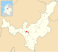
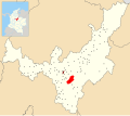
The Muisca Confederation was a loose confederation of different Muisca rulers (zaques, zipas, iraca, and tundama) in the central Andean highlands of what is today Colombia before the Spanish conquest of northern South America. The area, presently called Altiplano Cundiboyacense, comprised the current departments of Boyacá, Cundinamarca and minor parts of Santander.
According to some Muisca scholars the Muisca Confederation was one of the best-organized confederations of tribes on the South American continent.[3] Other historians and anthropologists, however, such as Jorge Gamboa Mendoza, attribute the present-day knowledge about the confederation and its organization more to a reflection by Spanish chroniclers who predominantly wrote about it a century or more after the Muisca were conquered and proposed the idea of a loose collection of different people with slightly different languages and backgrounds.[4]
Geography
[edit]
Climate
[edit]| Climate charts for the extremes and four most important settlements of the Muisca Confederation | |||||||||||||||||||||||||||||||||||||||||||||||||||||||||||||||||||||||||||||||||||||||||||||||||||||||||||||||||||||||||||||||||||||||||||||||||||||||||||||||||||||||||||||||||||||||||||||||||||||||||||||||||||||||||||||||||||||||||||||||||||||||||||||||||||||||||||||||||||||||||||||||||||||||||||||||||||||||||||||||||||||||||||||||||||||||||||||||||||||||||||||||||||||||||||||||||||||||||||||||||||||||||||||||||||||||||||||||||||||||||||||||||||||||||||||||||||||||||||||||||||||||||||||||||||
|
|
|
| ||||||||||||||||||||||||||||||||||||||||||||||||||||||||||||||||||||||||||||||||||||||||||||||||||||||||||||||||||||||||||||||||||||||||||||||||||||||||||||||||||||||||||||||||||||||||||||||||||||||||||||||||||||||||||||||||||||||||||||||||||||||||||||||||||||||||||||||||||||||||||||||||||||||||||||||||||||||||||||||||||||||||||||||||||||||||||||||||||||||||||||||||||||||||||||||||||||||||||||||||||||||||||||||||||||||||||||||||||||||||||||||||||||||||||||||||||||||||||||||||||||||||||||||||
|  |  |
| ||||||||||||||||||||||||||||||||||||||||||||||||||||||||||||||||||||||||||||||||||||||||||||||||||||||||||||||||||||||||||||||||||||||||||||||||||||||||||||||||||||||||||||||||||||||||||||||||||||||||||||||||||||||||||||||||||||||||||||||||||||||||||||||||||||||||||||||||||||||||||||||||||||||||||||||||||||||||||||||||||||||||||||||||||||||||||||||||||||||||||||||||||||||||||||||||||||||||||||||||||||||||||||||||||||||||||||||||||||||||||||||||||||||||||||||||||||||||||||||||||||||||||||||||
|
|
|
| ||||||||||||||||||||||||||||||||||||||||||||||||||||||||||||||||||||||||||||||||||||||||||||||||||||||||||||||||||||||||||||||||||||||||||||||||||||||||||||||||||||||||||||||||||||||||||||||||||||||||||||||||||||||||||||||||||||||||||||||||||||||||||||||||||||||||||||||||||||||||||||||||||||||||||||||||||||||||||||||||||||||||||||||||||||||||||||||||||||||||||||||||||||||||||||||||||||||||||||||||||||||||||||||||||||||||||||||||||||||||||||||||||||||||||||||||||||||||||||||||||||||||||||||||
| The climates (Af-Cfb-Cwb) of the geographic (NW, NE, SW and SE) and topographic extremes and for the four main settlements of the Muisca Confederation situated on the Altiplano, from SW to NE; Bacatá, Hunza, Suamox and Tundama are rather constant over the year with wetter periods in April–May and October–November | |||||||||||||||||||||||||||||||||||||||||||||||||||||||||||||||||||||||||||||||||||||||||||||||||||||||||||||||||||||||||||||||||||||||||||||||||||||||||||||||||||||||||||||||||||||||||||||||||||||||||||||||||||||||||||||||||||||||||||||||||||||||||||||||||||||||||||||||||||||||||||||||||||||||||||||||||||||||||||||||||||||||||||||||||||||||||||||||||||||||||||||||||||||||||||||||||||||||||||||||||||||||||||||||||||||||||||||||||||||||||||||||||||||||||||||||||||||||||||||||||||||||||||||||||||
Muisca Confederation
[edit]
In the times before the Spanish conquest of the Muisca, the central part of present-day Colombia; the Eastern Ranges of the Colombian Andes was inhabited by the Muisca people who were organised in a loose confederation of rulers. The central authorities of Bacatá in the south and Hunza in the north were called zipa and zaque respectively. Other rulers were the iraca priest in sacred City of the Sun Sugamuxi, the Tundama of Tundama and various other caciques (chiefs). The Muisca spoke Chibcha, in their own language called Muysccubun; "language of the people".
The Muisca people, different from the other three great civilisations of the Americas; the Maya, Aztec and Inca, did not build grand stone architecture. Their settlements were relatively small and consisted of bohíos; circular houses of wood and clay, organised around a central market square with the house of the cacique in the centre. Roads were present to connect the settlements with each other and with the surrounding indigenous groups, of which the Guane and Lache to the north, the Panche and Muzo to the west and Guayupe, Achagua and Tegua to the east were the most important.
History
[edit]Prehistory
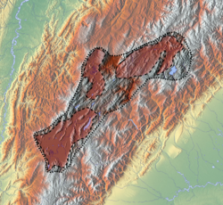
[edit]Early Amerindian settlers led a hunter-gatherer life among still extant megafauna living in cool habitats around Pleistocene lakes, of which the humedales in Bogotá, Lake Suesca, Lake Fúquene and Lake Herrera are notable examples. Multiple evidences of late Pleistocene to middle Holocene population of the Bogotá savanna, the high plateau in the Colombian Andes, have been found to date. As is common with caves and rock shelters, Tequendama was inhabited from around 11,000 years BP, and continuing into the prehistorical, Herrera and Muisca periods, making it the oldest site of Colombia, together with El Abra (12,500 BP), located north of Zipaquirá and Tibitó, located within the boundaries of Tocancipá (11,740 BP).[5][6] The oldest human remains and the oldest complete skeleton were discovered at Tequendama and has been named "Hombre del Tequendama" or Homo Tequendama. Other artefacts have been found in Gachalá (9100 BP), Sueva (Junín) and Zipacón.[7] Just west of the Altiplano, the oldest archaeological remains were found; in Pubenza, part of Tocaima and have been dated at 16,000 years Before Present.[8]
Pre-Columbian era
[edit]| Timeline of inhabitation of the Altiplano Cundiboyacense, Colombia | |
 |    |
Herrera Period
[edit]| Period name | Start age | End age |
|---|---|---|
| Herrera | 800 BCE | 800 |
| Early Muisca | 800 | 1200 |
| Late Muisca | 1200 | 1537 |
| Kruschek, 2003[1] | ||
The Herrera Period is a phase in the history of Colombia. It is part of the Andean preceramic and ceramic, time equivalent of the North American pre-Columbian formative and classic stages and age dated by various archaeologists.[9] The Herrera Period predates the age of the Muisca people, who inhabited the Altiplano Cundiboyacense before the Spanish conquest of the Muisca and postdates the lithic formative stage and prehistory of the eastern Andean region in Colombia. The Herrera Period is usually defined as ranging from 800 BCE to 800 AD,[10] although some scholars date it as early as 1500 BCE, considered as the "Early Herrera Period".[11]
Ample evidence of the Herrera Period has been uncovered on the Altiplano Cundiboyacense and main archaeologists contributing to the present knowledge about the Herrera Period are scholars Ana María Groot, Gonzalo Correal Urrego, Thomas van der Hammen, Carl Henrik Langebaek Rueda, Sylvia M. Broadbent, Marianne Cardale de Schrimpff and others.
Muisca
[edit] |
| Part of a series on |
| Muisca culture |
|---|
| Topics |
| Geography |
| The Salt People |
| Main neighbours |
| History and timeline |
The Muisca were polytheistic and their religion and mythology was closely connected with the natural area they were inhabiting. They had a thorough understanding of astronomical parameters and developed a complex luni-solar calendar; the Muisca calendar. According to the calendar they had specific times for sowing, harvest and the organisation of festivals where they sang, danced and played music and drank their national drink chicha in great quantities.
The most respected members of the community were mummified and the mummies were not buried, yet displayed in their temples, in natural locations such as caves and even carried on their backs during warfare to impress their enemies.
Their art is the most famous remnant of their culture, as living spaces, temples and other existing structures have been destroyed by the Spanish who colonised the Muisca territories. A primary example of their fine goldworking is the Muisca raft, together with more objects made of gold, tumbaga, ceramics and cotton displayed in the Museo del Oro in Bogotá, the ancient capital of the southern Muisca.
The Muisca were a predominantly agricultural society with small-scale farmfields, part of more extensive terrains. To diversify their diet, they traded mantles, gold, emeralds and salt for fruits, vegetables, coca, yopo and cotton cultivated in lower altitude warmer terrains populated by their neighbours, the Muzo, Panche, Yarigui, Guane, Guayupe, Achagua, Tegua, Lache, Sutagao and U'wa. Trade of products grown farther away happened with the Calima, Pijao and Caribbean coastal communities around the Sierra Nevada de Santa Marta.
The Muisca economy was self-sufficient regarding the basic supplies,[clarification needed] thanks to the use of raised terraces in agriculture. The system of trade was well established providing both the higher social classes and the general population abundances of gold, feathers, marine snails, coca, yopo and other luxury goods. Markets were held every four to eight days in various settlements throughout the Muisca Confederation and special markets were organised around festivities where merchants from far outside the Andes were trading their goods with the Muisca.
Apart from agriculture, the Muisca were well developed in the production of different crafts, using the raw materials traded with surrounding indigenous peoples. Famous are the golden and tumbaga objects made by the Muisca people. Cotton mantles, cloths and nets were made by the Muisca women and traded for valuable goods, tropical fruits and small cotton cloths were used as money. The Muisca were unique in South America for having real coins of gold, called tejuelos.
Mining was an important source of income for the Muisca, who were called "Salt People" because of their salt mines in Zipaquirá, Nemocón and Tausa. Like their western neighbours, the Muzo—who were called "The Emerald People"—they mined emeralds in their territories, mainly in Somondoco. Carbon was found throughout the region of the Muisca in Eocene sediments and used for the fires for cooking and the production of salt and golden ornaments.
The people used a decimal counting system, based on the digits of the hand. Their system went from 1 to 10 and for higher numerations they used the prefix quihicha or qhicha, which means "foot" in their Chibcha language Muysccubun. Eleven became thus "foot one", twelve "foot two", etc. As in the other pre-Columbian civilizations, the number 20 was special. It was the total number of all body extremities; fingers and toes. The Muisca used two forms to express twenty: "foot ten"; quihícha ubchihica or their exclusive word gueta, derived from gue, which means "house". Numbers between 20 and 30 were counted gueta asaqui ata ("twenty plus one"; 21), gueta asaqui ubchihica ("twenty plus ten"; 30). Larger numbers were counted as multiples of twenty; gue-bosa ("20 times 2"; 40), gue-hisca ("20 times 5"; 100). The Muisca script consisted of hieroglyphs, only used for numerals.[12]
Territorial organization
[edit]| History of the Muisca | |||||||||
 | |||||||||
 Altiplano |  Muisca |  Art |  Architecture |  Astronomy |  Cuisine |  El Dorado |  Subsistence |  Women |  Conquest |
Bacatá
[edit]
- Capital – Bacatá
- Area – 5,430 square kilometres (2,100 sq mi)
- Average elevation – 2,470 metres (8,100 ft)
- Last rulers – zipas Tisquesusa, Sagipa
- Date of conquest – 20 April 1537 (Funza) – Jiménez & Pérez de Quesada
- First city – 6 August 1538 (Bogotá) – Gonzalo Jiménez de Quesada
| Municipality | Department bold is capital | Ruler(s) bold is seat | Altitude urban centre (m) | Surface area (km2) | Remarks | Map |
|---|---|---|---|---|---|---|
| Bacatá | Cundinamarca | zipa | 2640 | 1587 | Muisca mummy found Important market town Petrographs found |  |
| Bojacá | Cundinamarca | zipa | 2598 | 109 | Lake Herrera Petrographs found |  |
| Cajicá | Cundinamarca | zipa | 2558 | 50.4 |  | |
| La Calera | Cundinamarca | zipa | 2718 | 317 | Petrographs found |  |
| Cáqueza | Cundinamarca | zipa | 1746 | 38 |  | |
| Chía | Cundinamarca | zipa | 2564 | 80 | Moon Temple Herrera site Petrographs found |  |
| Choachí | Cundinamarca | zipa | 1923 | 223 | Choachí Stone found |  |
| Chocontá | Cundinamarca | zipa | 2655 | 301.1 | Important market town Battle of Chocontá (~1490) Fortification between zipa & zaque |  |
| Cogua | Cundinamarca | zipa | 2600 | 113 | Muisca ceramics production Petrographs found |  |
| Cota | Cundinamarca | zipa | 2566 | 55 | Petrographs found Still Muisca people living | 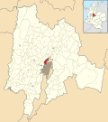 |
| Cucunubá | Cundinamarca | zipa | 2590 | 112 | Petrographs found |  |
| Facatativá | Cundinamarca | zipa | 2586 | 158 | Piedras del Tunjo |  |
| Funza | Cundinamarca | zipa | 2548 | 70 | Important market town |  |
| Gachancipá | Cundinamarca | zipa | 2568 | 44 | Muisca mummy found Muisca ceramics production |  |
| Guasca | Cundinamarca | zipa | 2710 | 346 | Siecha Lakes Muisca ceramics production Petrographs found |  |
| Madrid | Cundinamarca | zipa | 2554 | 120.5 | Lake Herrera Petrographs found |  |
| Mosquera | Cundinamarca | zipa | 2516 | 107 | Lake Herrera Petrographs found |  |
| Nemocón | Cundinamarca | zipa | 2585 | 98.1 | Muisca salt mines Preceramic site Checua Petrographs found |  |
| Pacho | Cundinamarca | zipa | 2136 | 403.3 | Important market town |  |
| Pasca | Cundinamarca | zipa | 2180 | 246.24 | Battle of Pasca (~1470) Muisca raft found |  |
| El Rosal | Cundinamarca | zipa | 2685 | 86.48 |  | |
| San Antonio del Tequendama | Cundinamarca | zipa | 1540 | 82 | Tequendama Falls Fortification against Panche Petrographs found |  |
| Sesquilé | Cundinamarca | zipa | 2595 | 141 | Lake Guatavita Minor Muisca salt mines |  |
| Sibaté | Cundinamarca | zipa | 2700 | 125.6 | Petrographs found |  |
| Soacha | Cundinamarca | zipa | 2565 | 184.45 | Preceramic site Tequendama Herrera site Muisca ceramics production Petrographs found |  |
| Sopó | Cundinamarca | zipa | 2650 | 111.5 | Herrera site |  |
| Subachoque | Cundinamarca | zipa | 2663 | 211.53 | Petrographs found |  |
| Suesca | Cundinamarca | zipa | 2584 | 177 | 150 Muisca mummies found Lake Suesca Muisca ceramics production Important market town Petrographs found |  |
| Sutatausa | Cundinamarca | zipa | 2550 | 67 | Petrographs found |  |
| Tabio | Cundinamarca | zipa | 2569 | 74.5 | Hot springs used by the Muisca |  |
| Tausa | Cundinamarca | zipa | 2931 | 204 | Muisca salt mines Petrographs found |  |
| Tena | Cundinamarca | zipa | 1384 | 55 | Fortification against Panche Petrographs found |  |
| Tenjo | Cundinamarca | zipa | 2587 | 108 | Petrographs found |  |
| Tibacuy | Cundinamarca | zipa & Panche | 1647 | 84.4 | Border with Panche Fortification against Panche & Sutagao Petrographs found |  |
| Tocancipá | Cundinamarca | zipa | 2605 | 73.51 | Preceramic site Tibitó Muisca ceramics production Important market town Petrographs found |  |
| Zipaquirá | Cundinamarca | zipa | 2650 | 197 | El Abra Muisca salt mines Important market town Petrographs and petroglyphs found |  |
| Fúquene | Cundinamarca | zipa zaque | 2750 | 90 | Lake Fúquene |  |
| Simijaca | Cundinamarca | zipa (1490–1537) | 2559 | 107 | Conquered by zipa Saguamanchica upon zaque Michuá (~1490) |  |
| Susa | Cundinamarca | zipa (1490–1537) | 2655 | 86 | Conquered by zipa Saguamanchica upon zaque Michuá (~1490) Lake Fúquene |  |
| Ubaté | Cundinamarca | zipa (1490–1537) | 2556 | 102 | Conquered by zipa Saguamanchica upon zaque Michuá (~1490) Muisca mummy found |  |
| Zipacón | Cundinamarca | zipa | 2550 | 70 | Agriculture Place of meditation for the zipa Petrographs found |  |
Chipazaque
[edit]
| Municipality | Department | Ruler(s) | Altitude (m) | Surface area (km2) | Remarks | Map |
|---|---|---|---|---|---|---|
| Junín | Cundinamarca | chipazaque | 2300 | 337 | Shared between zipa and zaque Petrographs found |  |
Hunza
[edit]
- Capital – Hunza
- Area – 4,700 square kilometres (1,800 sq mi)
- Average elevation – 2,270 metres (7,450 ft)
- Last rulers – zaques Quemuenchatocha, Aquiminzaque
- Date of conquest – 20 August 1537 (Hunza) – Jiménez & Pérez de Quesada
- First city – 6 August 1539 (Tunja) – Gonzalo Suárez Rendón
Iraca
[edit]
- Capital – Suamox
- Area – 4,163 square kilometres (1,607 sq mi)
- Average elevation – 2,630 metres (8,630 ft)
- Last ruler – iraca Sugamuxi
- Date of conquest – Early September 1537 (Sogamoso) – Jiménez & Pérez de Quesada
- Important settlements – Suamox, Busbanzá, Firavitoba, Gámeza and Tota
- Archaeological remains – mummies, Sun Temple reconstruction, Lake Tota
| Municipality | Department | Ruler(s) bold is seat | Altitude (m) | Surface area (km2) | Remarks | Map |
|---|---|---|---|---|---|---|
| Suamox | Boyacá | iraca Nompanim Sugamuxi | 2569 | 208.54 | Sun Temple Muisca mummy found Muisca carbon mines |  |
| Aquitania | Boyacá | iraca | 3030 | 943 | Lake Tota |  |
| Busbanzá | Boyacá | iraca | 2472 | 22.5 | Elector of new iraca |  |
| Cuítiva | Boyacá | iraca | 2750 | 43 | Lake Tota Statue of Bochica |  |
| Firavitoba | Boyacá | iraca | 2500 | 109.9 | Elector of new iraca | 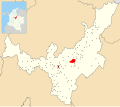 |
| Gámeza | Boyacá | iraca | 2750 | 88 | Herrera site Muisca mummy found Minor Muisca salt mines Muisca carbon mines Petrographs found |  |
| Iza | Boyacá | iraca | 2560 | 34 | Herrera site Lake Tota Petrographs found |  |
| Mongua | Boyacá | iraca | 2975 | 365.5 | Petrographs found |  |
| Monguí | Boyacá | iraca | 2900 | 81 | Petroglyphs Birthplaces (Tortolitas) |  |
| Pesca | Boyacá | iraca | 2858 | 282 |  | |
| Tasco | Boyacá | iraca | 2530 | 167 | Muisca mummy found |  |
| Toca | Boyacá | iraca | 2810 | 165 |  | |
| Tota | Boyacá | iraca | 2870 | 314 | Lake Tota |  |
| Socotá | Boyacá | iraca Tundama | 2443 | 600.11 | Muisca mummy found |  |
| Tibasosa | Boyacá | Tundama iraca | 2538 | 94.3 |  |
Tundama
[edit]
- Capital – Tundama
- Area – 2,920 square kilometres (1,130 sq mi)
- Average elevation – 2,470 metres (8,100 ft)
- Last ruler – Tundama
- Date of conquest – Late December 1539 (Duitama) – Baltasar Maldonado
- Important settlements – Tundama, Onzaga, Soatá, Chitagoto (now Paz de Río)
| Municipality | Department | Ruler(s) bold is seat | Altitude (m) | Surface area (km2) | Remarks | Map |
|---|---|---|---|---|---|---|
| Tundama | Boyacá | Tundama | 2590 | 266.93 | Seat of Tundama In ancient lake |  |
| Onzaga | Santander | Tundama | 1960 | 486.76 | Important for wool and cotton production |  |
| Cerinza | Boyacá | Tundama | 2750 | 61.63 | Monument to the Muisca |  |
| Paz de Río | Boyacá | Tundama | 2200 | 116 | Coca market town | 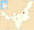 |
| Paipa | Boyacá | Tundama | 2525 | 305.924 | Thermal springs |  |
| Sativanorte | Boyacá | Tundama | 2600 | 184 | Herrera site |  |
| Sativasur | Boyacá | Tundama | 2600 | 81 | Muisca mummy SO10-IX found Herrera site |  |
| Soatá | Boyacá | Tundama | 1950 | 136 | Herrera site Coca market town |  |
| Belén | Boyacá | Tundama | 2650 | 83.6 | Petrographs found | 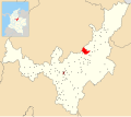 |
| Corrales | Boyacá | Tundama | 2470 | 60.85 |  | |
| Floresta | Boyacá | Tundama | 2506 | 86 |  | |
| Nobsa | Boyacá | Tundama | 2510 | 55.39 |  | |
| Santa Rosa de Viterbo | Boyacá | Tundama | 2753 | 107 |  | |
| Susacón | Boyacá | Tundama | 2480 | 191 |  | |
| Tibasosa | Boyacá | Tundama iraca | 2538 | 94.3 |  | |
| Socotá | Boyacá | iraca Tundama | 2443 | 600.11 | Muisca mummy found |  |
Independent caciques
[edit]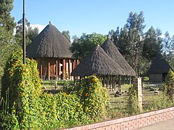
- Capital – none
- Area – 3,080 square kilometres (1,190 sq mi)
- Average elevation – 2,140 metres (7,020 ft)
- Important caciques – Guatavita, Ubaté, Chiquinquirá, Ubaque, Tenza, Vélez
| Municipality bold is major cacique | Department | Ruler(s) | Altitude (m) | Surface area (km2) | Remarks | Map |
|---|---|---|---|---|---|---|
| Vélez | Santander | cacique | 2050 | 271.34 |  | |
| Chipatá | Santander | cacique | 1820 | 94.17 | First town conquered by the Spanish |  |
| Güepsa | Santander | cacique | 1540 | 33.08 | Border with Guane Border with Yarigui |  |
| Charalá | Santander | cacique | 1290 | 411 | Border with Guane |  |
| Arcabuco | Boyacá | cacique | 2739 | 155 | Statue honouring the Muisca warriors |  |
| Betéitiva | Boyacá | cacique | 2575 | 123 | 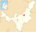 | |
| Boavita | Boyacá | cacique | 2114 | 159 | Muisca mummy found |  |
| Chiquinquirá | Boyacá | cacique | 2556 | 133 | 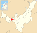 | |
| Cómbita | Boyacá | cacique | 2825 | 149 |  | |
| Covarachía | Boyacá | cacique | 2320 | 103 | Herrera site |  |
| Guateque | Boyacá | cacique | 1815 | 36.04 | Religious rituals at Guatoc hill | 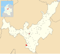 |
| Guayatá | Boyacá | cacique | 1767 | 112 | Muisca money (tejuelo) found |  |
| Moniquirá | Boyacá | cacique | 1669 | 220 | Muisca mummy found Muisca copper mines |  |
| Pisba | Boyacá | cacique | 2400 | 469.12 | Muisca mummy found |  |
| Ráquira | Boyacá | cacique | 2150 | 233 | Muisca ceramics production |  |
| Saboyá | Boyacá | cacique | 2600 | 246.9 | Petrographs found |  |
| Tópaga | Boyacá | cacique | 2900 | 37 | Muisca mummy found Muisca carbon mines |  |
| Tutazá | Boyacá | cacique | 1890 | 135 | Muisca ceramics production |  |
| Tenza | Boyacá | cacique | 1600 | 51 | Tenza Valley |  |
| Chivor | Boyacá | cacique | 1800 | 108.36 | Muisca emerald mines | 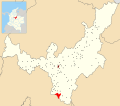 |
| Úmbita | Boyacá | cacique | 2480 | 148.17 | 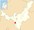 | |
| Carmen de Carupa | Cundinamarca | cacique | 2600 | 228 | Tunjo found |  |
| Guatavita | Cundinamarca | cacique | 2680 | 247.3 | Muisca ceramics production Main goldworking town Petrographs found |  |
| Gachetá | Cundinamarca | cacique Guatavita | 1745 | 262.2 |  | |
| Guachetá | Cundinamarca | cacique | 2688 | 177.45 | Minor Muisca salt mines Petrographs found |  |
| Manta | Cundinamarca | cacique | 1924 | 105 |  | |
| Ubaque | Cundinamarca | cacique | 1867 | 104.96 | Last public religious ritual (1563) Lake Ubaque |  |
| Ubalá | Cundinamarca | cacique | 1949 | 505 | Muisca emerald mines |  |
| Chipaque | Cundinamarca | cacique | 2400 | 139.45 | Petrographs found |  |
| Fómeque | Cundinamarca | cacique | 1895 | 555.7 |  | |
| Quetame | Cundinamarca | cacique | 1496 | 138.47 |  | |
| Une | Cundinamarca | cacique | 2376 | 221 |  | |
| Fosca | Cundinamarca | cacique | 2080 | 126.02 | Fortification against Guayupe |  |
Neighbouring indigenous groups
[edit]| Yarigui | Guane | Lache | U'wa | ||
| Muzo | |||||


 French
 Deutsch


