
 French
 Deutsch
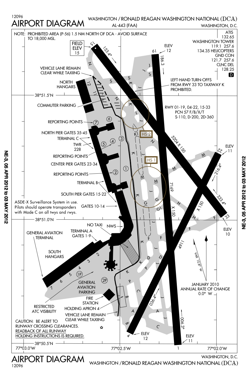
ファイル:DCA airport map.PNG
このプレビューのサイズ: 391 × 600 ピクセル。 その他の解像度: 156 × 240 ピクセル | 313 × 480 ピクセル | 807 × 1,238 ピクセル。
元のファイル (807 × 1,238 ピクセル、ファイルサイズ: 269キロバイト、MIME タイプ: image/png)
ウィキメディア・コモンズのファイルページにある説明を、以下に表示します。 |
Airport diagram for Ronald Reagan Washington National Airport (Washington, D.C.)
This image or file is a work of a Federal Aviation Administration employee, taken or made as part of that person's official duties. As a work of the U.S. federal government, the image is in the public domain in the United States.
|  |
ファイルの履歴
過去の版のファイルを表示するには、その版の日時をクリックしてください。
| 日付と時刻 | サムネイル | 寸法 | 利用者 | コメント | |
|---|---|---|---|---|---|
| 現在の版 | 2012年4月12日 (木) 19:37 | | 807 × 1,238 (269キロバイト) | Phongn | Updated to April-May 2012 map (shows longer runway) |
| 2006年1月6日 (金) 22:39 |  | 791 × 1,136 (143キロバイト) | Cmprince | Aiport diagram for Ronald Reagan Washington National Airport (Washington, D.C.) {{PD-USGov-FAA}} |
ファイルの使用状況
以下のページがこのファイルを使用しています:
グローバルなファイル使用状況
以下に挙げる他のウィキがこの画像を使っています:
- de.wikipedia.org での使用状況
- en.wikipedia.org での使用状況
- id.wikipedia.org での使用状況
- sco.wikipedia.org での使用状況