
 French
 Deutsch
中露国境
中露国境(ちゅうろこっきょう)は、中華人民共和国とロシア連邦との間の国境である。国境線の総延長は約4,209.3kmである。モンゴル国を挟んで東西に不連続な国境を有する。
概要[編集]

2ヶ所の国境線のうち、東部国境が全長4,195kmを占める[1]。中蒙露の三国国境(北緯49度50分42.3秒 東経116度42分46.8秒 / 北緯49.845083度 東経116.713000度)には境界碑が設置されている[2][3]。この境界碑から北東方向に向かい、アルグン川に到達する。国境線はアルグン川、アムール川、ウスリー川に沿って形成されている。東部国境の終点は中露朝三国の三国国境(北緯42度25分 東経130度36分 / 北緯42.417度 東経130.600度)であり、露朝国境の終点でもある。
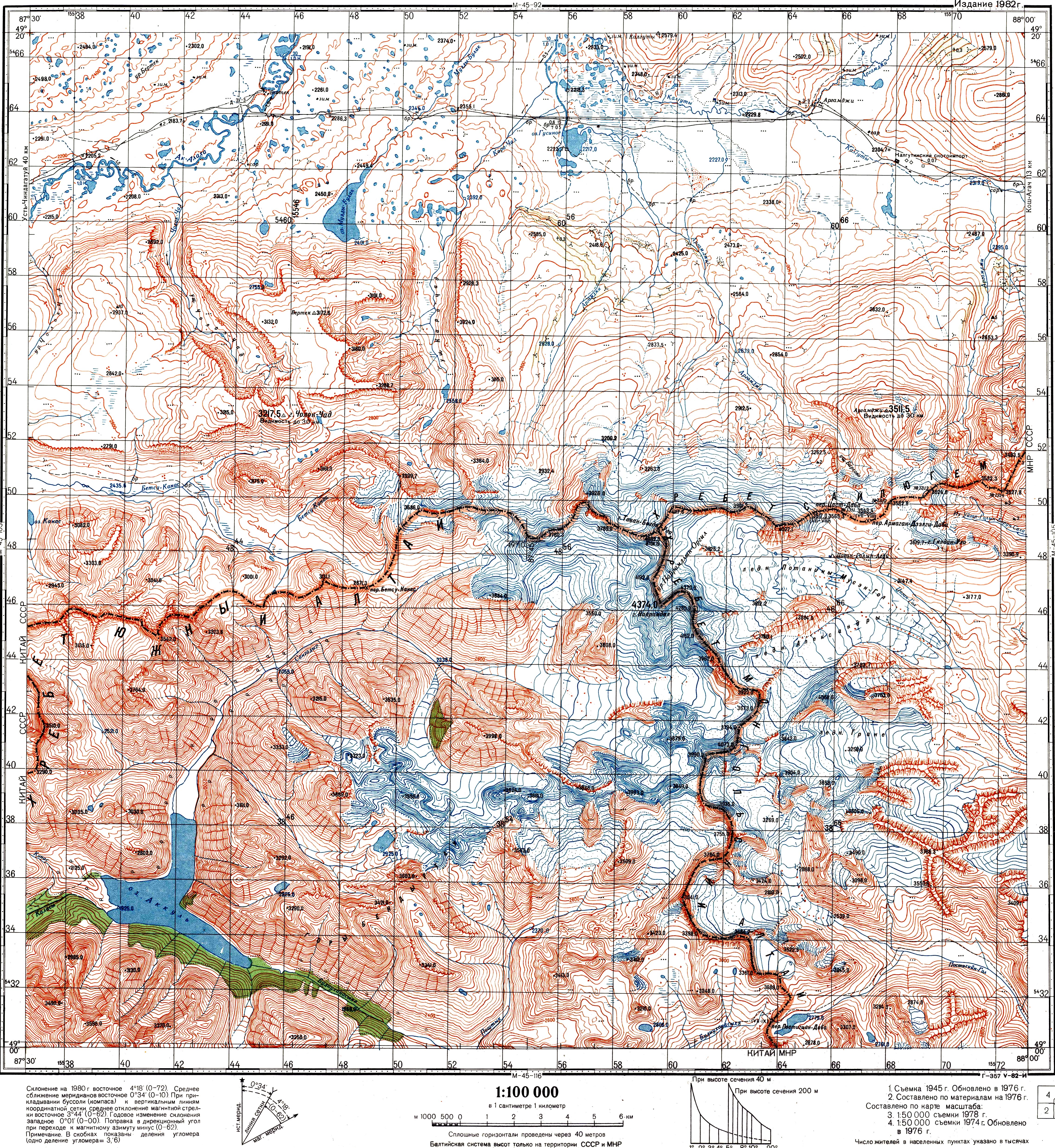
西部国境は全長100km未満であり、ロシアのアルタイ共和国と中国の新疆ウイグル自治区の境界を構成している。西部国境の大部分アルタイ山脈から構成される。西端は中国・カザフスタン・ロシアの三国国境(北緯49度06分54秒 東経87度17分12秒 / 北緯49.11500度 東経87.28667度、標高3327m)[4]、東端は中蒙露の三国国境[5][6](北緯49度10分13.5秒 東経87度48分56.3秒 / 北緯49.170417度 東経87.815639度)である[3][6][7]。
脚注[編集]
- ^ Sébastien Colin, Le développement des relations frontalières entre la Chine et la Russie, études du CERI n°96, July 2003. (Note: this publication preceded the 2004 final settlement, and thus the estimate may slightly differ from the current number).
- ^ ПРОТОКОЛ-ОПИСАНИЕ ТОЧКИ ВОСТОЧНОГО СТЫКА ГОСУДАРСТВЕННЫХ ГРАНИЦ ТРЕХ ГОСУДАРСТВ МЕЖДУ ПРАВИТЕЛЬСТВОМ Российской Федерации, ПРАВИТЕЛЬСТВОМ МОНГОЛИИ и ПРАВИТЕЛЬСТВОМ КИТАЙСКОЙ НАРОДНОЙ РЕСПУБЛИКИ (Protocol between the Government of the Russian Federation, the Government of Mongolia, and the Government of the People's Republic of China, describing the eastern junction point of the borders of the trees states) (ロシア語)
- ^ a b Соглашением между Правительством Российской Федерации, Правительством Китайской Народной Республики и Правительством Монголии об определении точек стыков государственных границ трех государств (Заключено в г. Улан-Баторе 27 января 1994 года) (The Agreement between the Government of the Russian Federation, the Government of the People's Republic of China, and the Government of Mongolia on the determination of the points of junction of the national borders of the three states) (ロシア語)
- ^ Соглашение между Российской Федерацией, Республикой Казахстан и Китайской Народной Республикой об определении точки стыка государственных границ трех государств, от 5 мая 1999 года (The agreement between the Russian Federation, Republic of Kazakhstan, and the People's Republic of China on determining the junction point of the international borders of the three states. May 5, 1999)
- ^ 中华人民共和国和俄罗斯联邦关于中俄国界西段的协定 (Agreement between the PRC and RF in regard to the western section of the China-Russia border), 1994-09-03 (中国語)
- ^ a b ПРОТОКОЛ-ОПИСАНИЕ ТОЧКИ ЗАПАДНОГО СТЫКА ГОСУДАРСТВЕННЫХ ГРАНИЦ ТРЕХ ГОСУДАРСТВ МЕЖДУ ПРАВИТЕЛЬСТВОМ Российской Федерации, ПРАВИТЕЛЬСТВОМ МОНГОЛИИ и ПРАВИТЕЛЬСТВОМ КИТАЙСКОЙ НАРОДНОЙ РЕСПУБЛИКИ (ПОДПИСАН в г. ПЕКИНЕ 24.06.1996) (Protocol between the Government of the Russian Federation, the Government of Mongolia, and the Government of the People's Republic of China, describing the western junction point of the borders of the three states. Signed in Beijing, June 24, 1996) (ロシア語)
- ^ Soviet Topo map M45-104, scale 1:100,000, (ロシア語)
関連項目[編集]
この項目は、中国に関連した書きかけの項目です。この項目を加筆・訂正などしてくださる協力者を求めています(P:中国/PJ:中国)。 |
この項目は、ロシアに関連した書きかけの項目です。この項目を加筆・訂正などしてくださる協力者を求めています(P:ロシア/PJ:ロシア)。 |
| 典拠管理データベース: 国立図書館 |
|---|