
 French
 Deutsch
Файл:Karta över de europeiska delarna av Sovjetunionen på 1920-talet.jpg — Вікіпедія

Розмір при попередньому перегляді: 439 × 600 пікселів. Інші роздільності: 176 × 240 пікселів | 351 × 480 пікселів | 562 × 768 пікселів | 750 × 1024 пікселів | 2548 × 3480 пікселів.
Повна роздільність (2548 × 3480 пікселів, розмір файлу: 1,81 МБ, MIME-тип: image/jpeg)
| Відомості про цей файл містяться на Вікісховищі — централізованому сховищі вільних файлів мультимедіа для використання у проектах Фонду Вікімедіа. |
Опис файлу
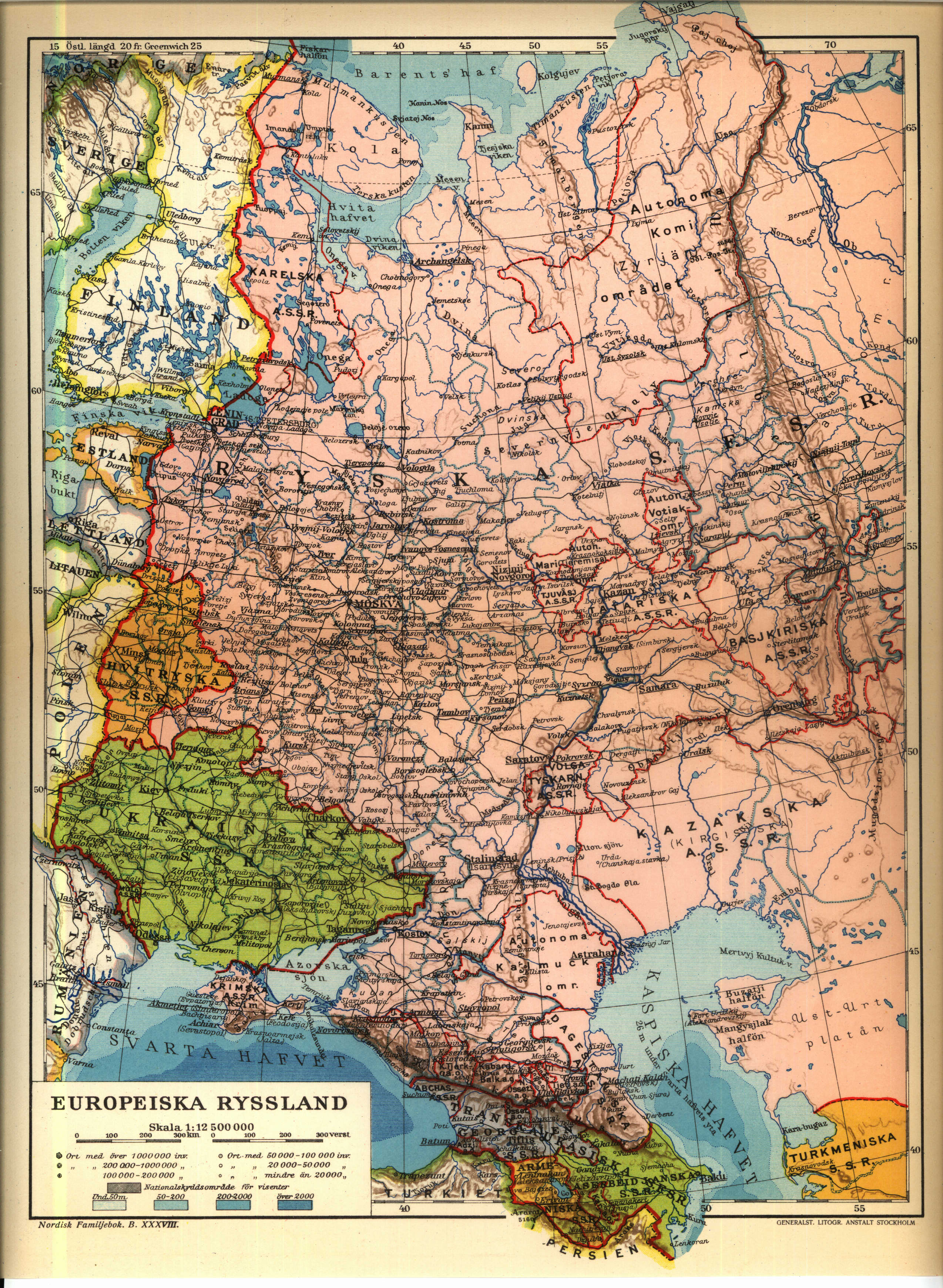
| Опис | English: 1926 Map of the western Soviet Union region. Norsk bokmål: från Nordisk familjebok | ||||||||
| Джерело | https://runeberg.org/nfcr/ryssland.jpg | ||||||||
| Автор | User Den fjättrade ankan on sv.wikipedia | ||||||||
| Ліцензія (Повторне використання цього файлу) |
| ||||||||
| Інші версії | Похідні роботи від цього файлу: Karta över de europeiska delarna av Sovjetunionen på 1920-talet Georgiska SSR.jpg, Похідні роботи від цього файлу: Kaninhalvön.jpg Originally from sv.wikipedia; description page is (was) here * 25 juni 2004 kl.01.54 [[:sv:User:Den fjättrade ankan|Den fjättrade ankan]] 2548x3480 (1 899 294 bytes) <span class="comment">(från Nordisk familjebok)</span> |


(Uploaded using CommonsHelper or PushForCommons)
sv:Kategori:Kartor från Nordisk familjebok
Історія файлу
Клацніть на дату/час, щоб переглянути, як тоді виглядав файл.
| Дата/час | Мініатюра | Розмір об'єкта | Користувач | Коментар | |
|---|---|---|---|---|---|
| поточний | 22:24, 6 липня 2006 | | 2548 × 3480 (1,81 МБ) | Nicke L | {{Information| |Description= från Nordisk familjebok sv:Kategori:Kartor från Nordisk familjebok |Source= |Date= |Author=User Den fjättrade ankan on [http://sv.wikipedia.org sv.wikipedia] |Permission={{Ugglanbild} |
Використання файлу
Такі сторінки використовують цей файл:
Глобальне використання файлу
Цей файл використовують такі інші вікі:
- Використання в be-tarask.wikipedia.org
- Використання в be.wikipedia.org
- Використання в ca.wikipedia.org
- Використання в cs.wikipedia.org
- Використання в de.wikipedia.org
- Використання в en.wikipedia.org
- Використання в fi.wikipedia.org
- Використання в fr.wikipedia.org
- Використання в ru.wikipedia.org
- Використання в sk.wikipedia.org
- Використання в sq.wikipedia.org
- Використання в sr.wikipedia.org
- Використання в tg.wikipedia.org