
 French
 Deutsch
Broad Creek (Susquehanna River tributary)
| Broad Creek | |
|---|---|
| Location | |
| Country | United States |
| State | Maryland |
| Region | Harford County |
| Physical characteristics | |
| Source | near Pennsylvania state line |
| • coordinates | 39°43′11″N 76°25′12″W / 39.719827°N 76.419962°W |
| • elevation | 650 ft (200 m) |
| Mouth | Conowingo Reservoir (Susquehanna River) |
• coordinates | 39°41′56″N 76°14′14″W / 39.698994°N 76.237178°W |
• elevation | 108 ft (33 m) |
| Length | 17 mi (27 km) |
| Basin size | 40.6 sq mi (105 km2) |
| Basin features | |
| Tributaries | |
| • left | Carr Run, Deep Run |
| • right | Jacks Hole |
Broad Creek is a tributary of the lower Susquehanna River located in Harford County, Maryland.
Broad Creek originates on the west side of Constitution Road about 500 feet south of the Pennsylvania state line. It runs generally southeast through Pylesville, Maryland for the first half, then northeast for the second half of its 17 miles (27 km)[1] to the Conowingo Reservoir portion of the Susquehanna.
It flows through just two properties in its lower five miles, that of the Baltimore Area Council, B.S.A. and then the Exelon power company. In its three-mile course through Broad Creek Memorial Scout Reservation, it was dammed to create Lake Aaron Straus and passes close to the Late Archaic Period Broad Creek Soapstone Quarries archaeological site.[2] Downstream from the 1948 Boy Scout dam, the creek forms a noteworthy gorge through the largest and oldest eastern hemlock grove in the state east of the Allegheny Front.[3] At the east edge of the reservation, about two miles from its mouth, the creek meets the headwaters of the reservoir.
The watershed is 40.6 square miles (105 km2), all in Harford County except for three small areas in York County, Pennsylvania about two miles east of Fawn Grove, 1.5 miles northwest of Whiteford, Maryland, and the southeast part of Delta. Principal land uses in the watershed are agriculture and forest.[4]
-
 Looking west and upstream from the Route 623 bridge (Flintville Road)
 -
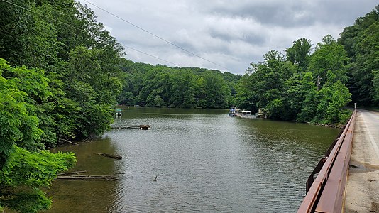 Looking east and downstream from same bridge


References[edit]
- ^ U.S. Geological Survey. National Hydrography Dataset high-resolution flowline data. The National Map Archived 2012-03-29 at the Wayback Machine, accessed August 8, 2011
- ^ Lake Straus: "Baltimore Speeds Scout Camp Work". The Washington Post. Jul 22, 1947.: B1Healey, David (Sep 18, 2012). Great Storms of the Chesapeake. Arcadia. p. 160.
- ^ U.S. Department of Agriculture U.S. National Forest Service. Northeast Area. [1], accessed March 1, 2013
- ^ Maryland Department of Natural Resources. Annapolis, MD. "Broad Creek." Archived June 16, 2011, at the Wayback Machine Maryland's Surf Your Watershed--Watershed Profile. August 2000.
- United States Geological Survey. Reston, VA. "Broad Creek." Geographic Names Information System (GNIS). Accessed 2010-08-30.


